


ที่เที่ยวหน้าหนาว ยอดฮิตทั่วไทย
 16690
16690
หลังจากเข้าหน้าหนาวอย่างเต็มตัว วันนี้เลยรวบรวมที่เที่ยวหน้าหนาวสุดฮิต มาให้ได้ชมกัน ซึ่งแต่ละที่มีความสวยงาม และเอกลักษณ์ต่างๆกันไป ไม่ว่าจะเป็นการชมทะเลหมอก การรับลมหนาวบนดอย การนอนดูดาว การผจญภัยต่างๆ แต่ที่เหมือนกันๆ ก็คือ อากาศที่เย็นสบาย ใครชอบหนาวขนาดไหน ก็ลองเลือกที่เที่ยวในสไตล์ของคุณกัน

 Doi Luang / Chiang Dao is a limestone mountain in the Chiang Dao Wildlife Reserve area, Amphoe Chiang Dao. This cone-shaped mountain is 2,195 metres from sea level, which makes it the third highest mountain in Thailand after Doi Inthanon and Doi Pha Hom Pok. Narrow plains on top of the mountain overlook spectacular views that include a sea of fog on the Amphoe Chiang Dao side, Doi Sam Phi Nong, th...
read more
Doi Luang / Chiang Dao is a limestone mountain in the Chiang Dao Wildlife Reserve area, Amphoe Chiang Dao. This cone-shaped mountain is 2,195 metres from sea level, which makes it the third highest mountain in Thailand after Doi Inthanon and Doi Pha Hom Pok. Narrow plains on top of the mountain overlook spectacular views that include a sea of fog on the Amphoe Chiang Dao side, Doi Sam Phi Nong, th...
read more


 Phu Tubberk The highest peak in Phetchabun. Just opened for tourists to explore the area soon. But it can be amazing to those who visit so much that they become one in UNSEEN THAILAND you should not miss visiting. At an elevation of 1,768 meters above sea level Cold temperatures all year on the peak. And cabbage farm The vast eye. Eat at the top of the mountain. Phu Kradueng is considered one...
read more
Phu Tubberk The highest peak in Phetchabun. Just opened for tourists to explore the area soon. But it can be amazing to those who visit so much that they become one in UNSEEN THAILAND you should not miss visiting. At an elevation of 1,768 meters above sea level Cold temperatures all year on the peak. And cabbage farm The vast eye. Eat at the top of the mountain. Phu Kradueng is considered one...
read more


 Pha Hua Sing and Doi Samoe Dao These places are situated at Km. 16, the Na Noi – Pang Hai route. Pha Hua Sing, meaning a cliff with a strange shape similar to the head of a lion, is a viewpoint spot on the summit of the high cliff. It has 360° of beautiful mountainous scenery. At the spot, Doi Samor Dao also contains a wide terrace suitable for relaxation, star observation and sunset vie...
read more
Pha Hua Sing and Doi Samoe Dao These places are situated at Km. 16, the Na Noi – Pang Hai route. Pha Hua Sing, meaning a cliff with a strange shape similar to the head of a lion, is a viewpoint spot on the summit of the high cliff. It has 360° of beautiful mountainous scenery. At the spot, Doi Samor Dao also contains a wide terrace suitable for relaxation, star observation and sunset vie...
read more

 Phu Kradueng is unquestionably one of the most popular tourist spots in Thailand, thanks to its unspoiled environment, diverse ecological systems and geographical features, incorporating grasslands, coniferous woodlands, evergreen forests, waterfalls and viewpoints. In the winter, especially during New Year holidays, Phu Kradueng has become crowded with the thousands of tourists. Phu Kradueng is a...
read more
Phu Kradueng is unquestionably one of the most popular tourist spots in Thailand, thanks to its unspoiled environment, diverse ecological systems and geographical features, incorporating grasslands, coniferous woodlands, evergreen forests, waterfalls and viewpoints. In the winter, especially during New Year holidays, Phu Kradueng has become crowded with the thousands of tourists. Phu Kradueng is a...
read more
 Phu Soi Dao National Park is located in both Chat Trakan district of Phitsanulok Province and Nam Pard District of Uttaradit Province. Occupying a total area of 48,962.5 rai of land (equivalent to 58,750 acres), the park stretches along the Thai-Laos border with the highest peak measured at 2,102 meters above sea level. The climate park is cool throughout the year and visitors are able to see seve...
read more
Phu Soi Dao National Park is located in both Chat Trakan district of Phitsanulok Province and Nam Pard District of Uttaradit Province. Occupying a total area of 48,962.5 rai of land (equivalent to 58,750 acres), the park stretches along the Thai-Laos border with the highest peak measured at 2,102 meters above sea level. The climate park is cool throughout the year and visitors are able to see seve...
read more

 Ban Ruam Thai is away from Maehongson about 44 kms. Takes the route to Pha Seau waterfall untill reach Ban Na Pa Paek and then turn left and keep go on for another 6 kms. Tourists will see variety of hill-tribes people. Try fresh coffee from the field. Behind the village is a beautiful lake and evergreen forest area....
read more
Ban Ruam Thai is away from Maehongson about 44 kms. Takes the route to Pha Seau waterfall untill reach Ban Na Pa Paek and then turn left and keep go on for another 6 kms. Tourists will see variety of hill-tribes people. Try fresh coffee from the field. Behind the village is a beautiful lake and evergreen forest area....
read more
 Amphoe Pai is a small district in the northeast of Mae Hong Son. Pai is getting hip and famous among visitors as a cute little town where you can find things from local charms of daily life to adrenaline rush sports such as rafting.
Huai Nam Dang National Park, Moo 5, Kuet Chang, Mae Taeng, Chiang Mai 50150 Thailand (25km East of Pai),. Huai Nam Dang National Park is positioned on top of the crest... read more
 Khao Kho is made up of mountain ranges to northwest of town about 1,174 metres above mean sea level covered in the main by deciduous plants. Very cold during November-February, it once was the base room which communist insurgents conducted their struggles against the authorities during 1968-1982. Today it is accessible via two routes; off Highway No. 12 (Phitsanulok - Lom Sak) at Ban Camp Son with...
read more
Khao Kho is made up of mountain ranges to northwest of town about 1,174 metres above mean sea level covered in the main by deciduous plants. Very cold during November-February, it once was the base room which communist insurgents conducted their struggles against the authorities during 1968-1982. Today it is accessible via two routes; off Highway No. 12 (Phitsanulok - Lom Sak) at Ban Camp Son with...
read more


 Chiangkhan is a small and lovely town located in Loei Province where the Khong river is the border line. The town is quiet with simple life style of people. It is a very nice place for relaxation and let your mind fly with local life. Chiangkhan has been influenced by French colonial as evidenced by old wooden houses and inn.
Old town area 're along the Khong river which you can see som... read more

 With spectacular views over the surrounding mountains, it is one of the famous tourist attractions of the Thai highlands near Chiang Rai town.
Tourists visit the mountain especially at dawn in order to catch a glimpse of the "sea of mist", the view of the fog-surrounded hills, with heights ranging between 1,200 and 1,600 m to the east of the mountain.
... read more


 Phu Rua, literally meaning mountain of ship, is s peak in the mountain range in Amphoe Phu Ruea. As its name in Thai indicates, Phu Ruea resembles a big junk and the plateau atop the peak looks like the junk’s belly. Phu Ruea National Park covers an area of about 75,525 rai in the districts of Phu Ruea and Tha Li. Its highest peak reaches the altitude of about 1,365 meters above...
read more
Phu Rua, literally meaning mountain of ship, is s peak in the mountain range in Amphoe Phu Ruea. As its name in Thai indicates, Phu Ruea resembles a big junk and the plateau atop the peak looks like the junk’s belly. Phu Ruea National Park covers an area of about 75,525 rai in the districts of Phu Ruea and Tha Li. Its highest peak reaches the altitude of about 1,365 meters above...
read more

 Pha Taem or Paiting Cliff. 'Taem' means 'paintings' while Pha means 'Cliff'. Pha Taem is a large-size national park in the Ubon Ratchathani, covering Amphur Khong Jiam, Sri Muang Mai and Pho Sai. The 340-sq.km park is a wide variety of interesting scenery and activities.
It covers the Dipterocarp forest with Shorea obtusa, Shorea siamensis, Dipterocarpus obtusifollus are dominant specie... read more
 A mountaintop settlement known as Santi Khiri is home to descendants of Chinese Nationalist soldiers who fled to, and settled in Thailand, in 1940.The area is particularly picturesque in December and January when Thai cherry trees are in blossom. Accommodation, restuarants and opportunities for horse riding and trekking number among major attractions.During December, the area is dotted with yellow...
read more
A mountaintop settlement known as Santi Khiri is home to descendants of Chinese Nationalist soldiers who fled to, and settled in Thailand, in 1940.The area is particularly picturesque in December and January when Thai cherry trees are in blossom. Accommodation, restuarants and opportunities for horse riding and trekking number among major attractions.During December, the area is dotted with yellow...
read more

 The mountain is limestone and granite.This northernmost Thai mountain contains several scenic spots, including the Doi Tung Royal Villa, the Mae Fah Luang Botanical Garden, the mountain top Wat Phrathat Doi Tung which affords a spectacular view of the surrounding area, and contains Buddha relics, and various hilltribe villages in natural settings....
read more
The mountain is limestone and granite.This northernmost Thai mountain contains several scenic spots, including the Doi Tung Royal Villa, the Mae Fah Luang Botanical Garden, the mountain top Wat Phrathat Doi Tung which affords a spectacular view of the surrounding area, and contains Buddha relics, and various hilltribe villages in natural settings....
read more

 Huai Nam Dang National Park is situated on top of the ridge of hills and the same range as Chiang Dao mountain range. The highest peak-Doi Chang peak (at 1,962 metres above sea level) is the vital source of important streams which flow into the Pai river, Ping river, and Taeng river....
read more
Huai Nam Dang National Park is situated on top of the ridge of hills and the same range as Chiang Dao mountain range. The highest peak-Doi Chang peak (at 1,962 metres above sea level) is the vital source of important streams which flow into the Pai river, Ping river, and Taeng river....
read more

 Thailand's second largest National Park, Khao Yai National Park covers an area of 2,168 square kilometers, of which some 25% is in Nakhon Nayok Province. The remaining areas are in parts of the neighboring provinces of Saraburi, Prachinburi and Nakhon Ratchasima.
Khao Yai was listed as the first National Park in Thailand on September 18, 1962. The highest peak in Khao Yai is Yod Khao Lae... read more

 This spectacular waterfall is located in the Umphang Wildlife Sanctuary and can be visited only from November through May. Would - be visitors to the waterfall and wildlife sanctuary are recommended to enquire first with the TAT office in Tak Tel : (055) 514-341-3 for information regarding travel conditions and camping opportunities....
read more
This spectacular waterfall is located in the Umphang Wildlife Sanctuary and can be visited only from November through May. Would - be visitors to the waterfall and wildlife sanctuary are recommended to enquire first with the TAT office in Tak Tel : (055) 514-341-3 for information regarding travel conditions and camping opportunities....
read more

 the roof of Thailand,is located in the Thanon Thong Chai Range, Mae Chaem District, Chiang Mai Province, northern Thailand.It includes Doi Inthanon, the country's highest mountain. Established in 1972, is 482 square kilometres (186 sq mi) in size.There are a number of waterfalls such as the Mae Klang Falls, Wachiratan Falls, Siriphum Falls, and Mae Ya Falls....
read more
the roof of Thailand,is located in the Thanon Thong Chai Range, Mae Chaem District, Chiang Mai Province, northern Thailand.It includes Doi Inthanon, the country's highest mountain. Established in 1972, is 482 square kilometres (186 sq mi) in size.There are a number of waterfalls such as the Mae Klang Falls, Wachiratan Falls, Siriphum Falls, and Mae Ya Falls....
read more


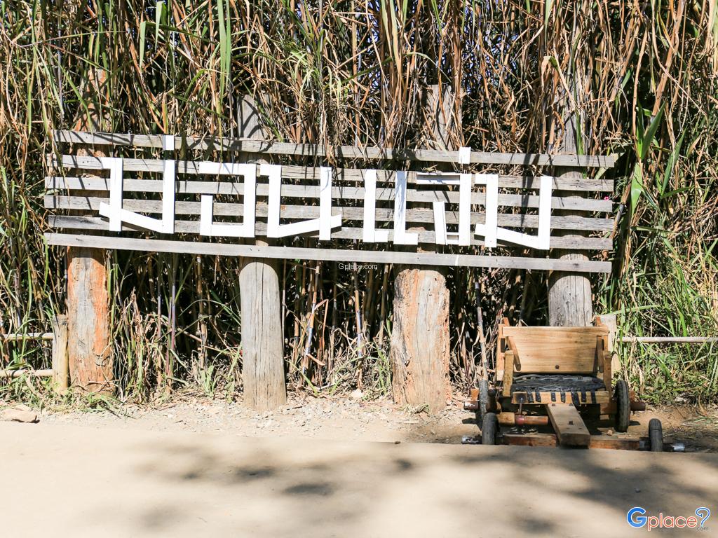
 Mon Jam is part of the Royal Project Development Center, Nong Hoi. Located in the village of Hmong Nong Hoi, Mae Rim Moom is cool all year round. Morning mist The view of the mountain to see the alternating horizons far and wide. On the other side is the plantation of the Royal Project. At the peak there is space. Not much can walk all around comfortably.
You can see both sunrise and sunset. ... read more

 Doi Angkhang, a coldest place in Thailand is a popular destination for Thai visitors in the winder season. Doi Angkhang is located in the valley, Chiang Mai province, the northernmost of Thailand. It is wellknown as Royal Agricultural Station amidst beautiful mountainous scenery, provincial capital, 163 kms north of Chiang Mai, is a demonstration site for planting and researching flowering p...
read more
Doi Angkhang, a coldest place in Thailand is a popular destination for Thai visitors in the winder season. Doi Angkhang is located in the valley, Chiang Mai province, the northernmost of Thailand. It is wellknown as Royal Agricultural Station amidst beautiful mountainous scenery, provincial capital, 163 kms north of Chiang Mai, is a demonstration site for planting and researching flowering p...
read more
 The Dok Bua Tong (may be classified as wild sunflowers) blooms during November painting the entire hilly area of Doi Mae U-kho in brilliant yellow. It draws flocks of visitors to Khun Yuam district during that 2 weeks of blooming yearly. Camping sites arranged during the Bua Tong Bloom Festival.
Doi Mae U Kho, Bua Tong Field, Doi Mae U Kho Covering an area of about 1,000 Rai of hills, it i... read more

 Phu Kha National Park is in a high mountain range in Amphoe Pua, Amphoe Bo Klua and Amphoe Mae Charim in Nan.The apex of Doi Phu Kha is 1,980 meters above sea level.The park has a lovely scenery and various trees and plants in abundance.Furthermore, there are several nice waterfalls and caves such as Ton Tong Waterfall and Pha Khong Cave, ideal for natrue lovers....
read more
Phu Kha National Park is in a high mountain range in Amphoe Pua, Amphoe Bo Klua and Amphoe Mae Charim in Nan.The apex of Doi Phu Kha is 1,980 meters above sea level.The park has a lovely scenery and various trees and plants in abundance.Furthermore, there are several nice waterfalls and caves such as Ton Tong Waterfall and Pha Khong Cave, ideal for natrue lovers....
read more
7
Pai
Huai Nam Dang National Park, Moo 5, Kuet Chang, Mae Taeng, Chiang Mai 50150 Thailand (25km East of Pai),. Huai Nam Dang National Park is positioned on top of the crest... read more
8
Khao Kho
Old town area 're along the Khong river which you can see som... read more
10
Phu Chi Fa
Tourists visit the mountain especially at dawn in order to catch a glimpse of the "sea of mist", the view of the fog-surrounded hills, with heights ranging between 1,200 and 1,600 m to the east of the mountain.
... read more
12
Pha Taem
It covers the Dipterocarp forest with Shorea obtusa, Shorea siamensis, Dipterocarpus obtusifollus are dominant specie... read more
14
Doi Tung
Khao Yai was listed as the first National Park in Thailand on September 18, 1962. The highest peak in Khao Yai is Yod Khao Lae... read more
19
Mon Jam
You can see both sunrise and sunset. ... read more
20
Doi Angkhang
Doi Mae U Kho, Bua Tong Field, Doi Mae U Kho Covering an area of about 1,000 Rai of hills, it i... read more
กำลังเป็นที่นิยม
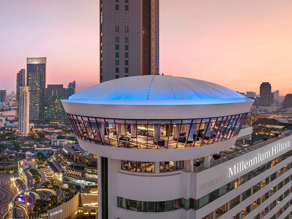 10 of the Most Luxurious Riverside Hotels in Bangk
Top 10 - The Most Luxurious Riverside Hotels in Bangkok We summarize from all m..
 0 milestone of Thailand
Do you know Km 0 of landmark attractions in Thailand? If you have one, please sh..
แนะนำทริป
- 10 of the Most Luxurious Riverside Hotels in Bangk
- 0 milestone of Thailand
- Top Interesting Castles in Ireland
- Highlighted Shopping Streets of Ireland
- Interesting Museums of Ireland
- 10 Must-See Destinations in Dublin
- Ireland's Popular Tourist Attractions
- ขอพร จากฟากฟ้า
- รวมที่เที่ยวยอดนิยม 2559
- One Day Trip Chanthaburi
- แหล่งท่องเที่ยว ที่ธรรมชาติสร้างสรรค์ ดูแปลกตา
- 12 ร้านอร่อยในเมืองกระบี่
- ชุมนุม ทะเลแหวก เมืองไทย
- หาดดัง ประจำจังหวัด
- จันทบุรี มุมนี้ ตากล้องต้องชอบ
- รวมฮิตถนนคนเดินทั่วไทย
- 4 สังเวชนียพุทธสถาน
- อยุธยา ต้องเที่ยว
- 10 หมู่บ้าน กลางหุบเขา น่าเที่ยว
- อุบลราชธานี ต้องเที่ยว