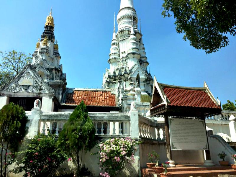
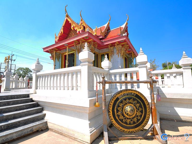
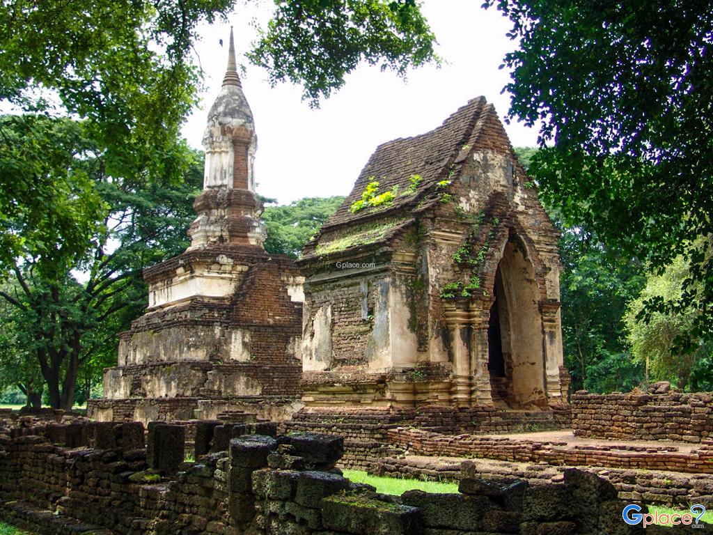
“Witness the tranquil scenery of the horseshoe-shaped lake that historically inspired the province's name and visit Wat Chanthaburi, located on the banks of the lake where the first city of Saraburi once stood.”
Bueng Ngong, also referred to in some historical texts as “Bueng Nong Ngong,” is a large natural freshwater wetland covering an area of approximately 90 rai. It is located in Mueang Kao Subdistrict, Sao Hai District, Saraburi Province. This wetland is historically significant as it is believed to be the origin of the name “Saraburi Province,” which is still in use today.
Historical evidence suggests that during the founding of Saraburi in the Ayutthaya period, under the reign of King Maha Chakkraphat, the city was established near this large natural water source. The word “Sara” refers to the wetland itself, which served as a vital water reservoir for the community, while “Buri” means city. Combined, the name “Saraburi” clearly reflects the close relationship between the ancient settlement and its surrounding water resources.
The physical characteristics of Bueng Ngong are particularly distinctive. It is shaped like a semi-circular curve resembling a horseshoe, formed by a historical change in the course of the Pa Sak River. In geographical terms, this type of landform is known as an oxbow lake. The original name of the wetland was “Bueng Khong,” meaning a curved wetland, which later evolved into “Bueng Ngong” due to local pronunciation over time.
In the past, the area surrounding Bueng Ngong served as the administrative and settlement center of early Saraburi. The city center was later relocated to Phai Lom Subdistrict and subsequently to Pak Phriao Subdistrict, which constitutes the present-day downtown area of Saraburi. Despite these changes, the old city area around Bueng Ngong still preserves clear traces of its historical importance.
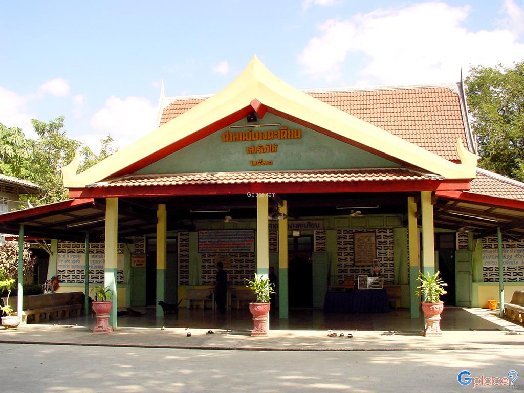
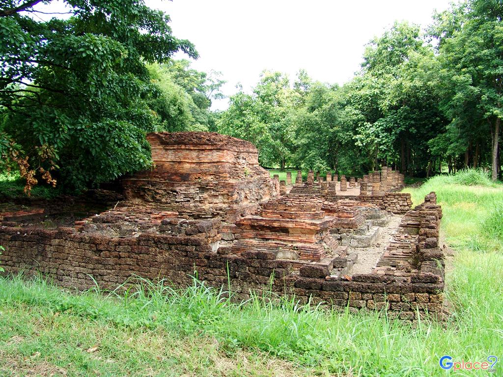
Today, Bueng Ngong is not only a water source for local residents of Sao Hai District, but also a recreational and historical attraction offering scenic views throughout the year. Along the edge of the wetland stands Wat Chanthaburi, an ancient temple renowned for its old ordination hall and valuable mural paintings.
A visit to Bueng Ngong is therefore akin to traveling back in time to the birthplace of Saraburi. Visitors can experience the serene riverside atmosphere of a traditional community, where simplicity, tranquility, and the historical essence of the Pa Sak River basin remain beautifully preserved.
How to Get There
Private Car:
- From Saraburi town, take Highway 3041 (Phichai Ronnarong Songkhram Road) toward Sao Hai. After passing the district center, look for signs directing to "Mueang Kao" or "Wat Chanthaburi." The lake surrounds the old city area and the temple.
Public Transport:
- Take a local minibus (Saraburi-Sao Hai) to Sao Hai district, then take a short motorbike taxi ride to Bueng Ngong.
Travel Tips
Best Viewpoint:
- The most scenic spot to view the lake is from the waterside area next to Wat Chanthaburi, where the curve of the water is clearly visible and refreshed by a constant breeze.
Recommended Activities:
- Perfect for a leisurely stroll, landscape photography, or relaxing while watching the sunset over the water.
Trip Combination:
- It is highly recommended to follow the "Sao Hai Old City Trail" by visiting Wat Chanthaburi, viewing Bueng Ngong, and then heading to nearby Wat Ban Yang or Wat Phayao.
Best Time to Visit:
- Late rainy season to early winter (October - December) provides the fullest water levels and the most pleasant weather.
Admission Fee
-
Free entry (Public site)
Opening Hours
-
Accessible all day (06:00 – 18:30 is recommended for safety and better lighting)
Bueng Ngong
![]() Moo 6, Mueang Kao, Sao Hai, Saraburi 18160, Thailand
Map
Moo 6, Mueang Kao, Sao Hai, Saraburi 18160, Thailand
Map
![]() Open now
Open now
![]()
 2290
2290