“A tranquil coconut island shaped like a star, featuring diverse bays from swimmable white-sand beaches to scenic red-sand coasts and peaceful local fishing communities.”
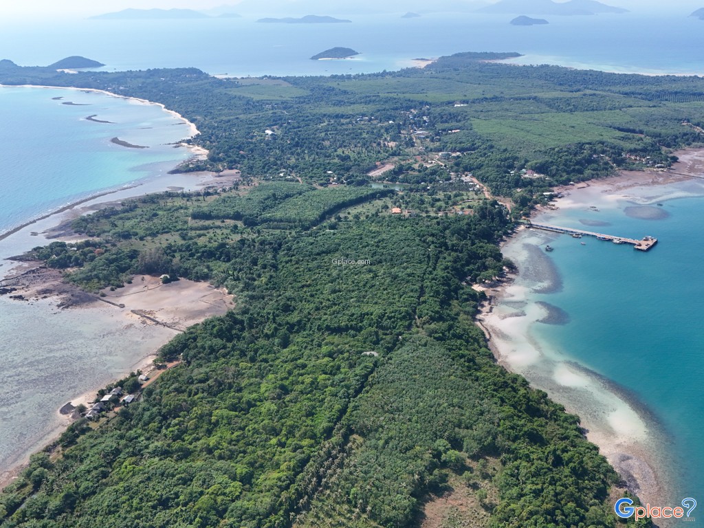
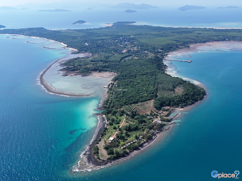
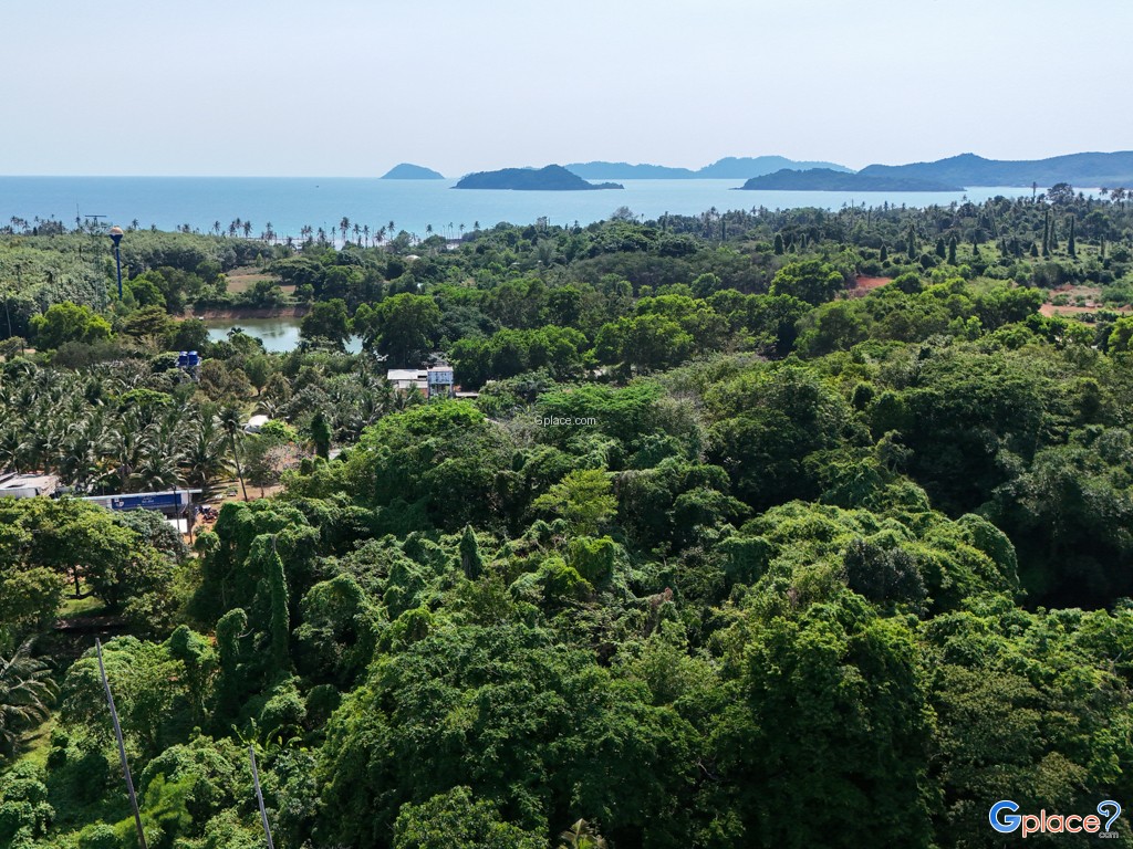
Koh Mak is one of the largest islands in Trat Province, covering approximately 9,000 rai between Koh Chang and Koh Kut. The island is well known for its distinctive star-like shape and flat terrain, largely covered by coconut and rubber plantations. Unlike many busy tourist destinations, Koh Mak follows a “Low Carbon” concept, preserving its quiet atmosphere, clean environment, and strong local community identity.
The island’s history dates back to 1904 during the French Indochina period, when Khmer Thais and Chinese families migrated from Koh Kong under the leadership of Luang Phromphakdi. Today, their descendants continue traditional agricultural practices, especially coconut and rubber farming. A 27-kilometer ring road circles the island, making it easy to explore by motorbike or bicycle—one of the few Thai islands suitable for cycling due to its flat terrain.
Beach & Bay Breakdown:
- Ao Suan Yai (Northwest):
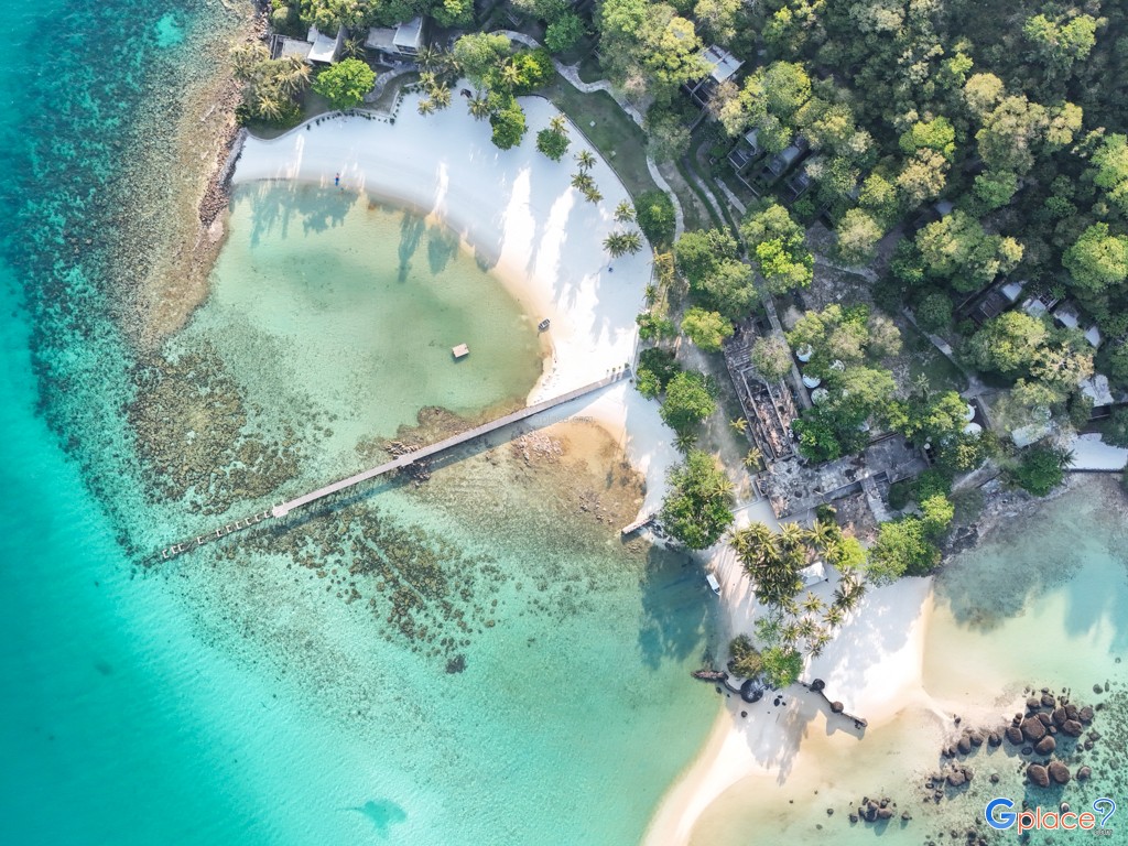
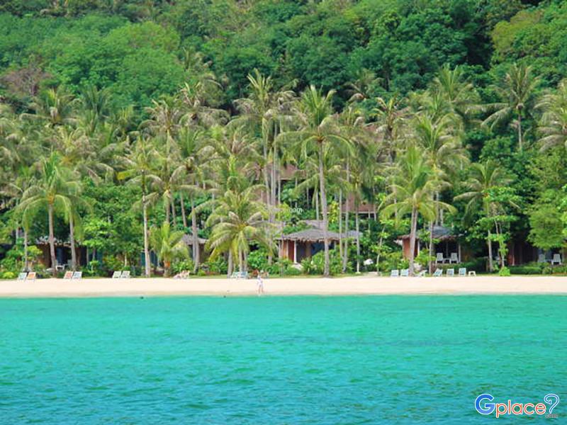
- The longest and most beautiful white-sand beach on the island, featuring clear shallow waters ideal for swimming, with scenic views of nearby Koh Kham.
- Ao Pra (West Coast):
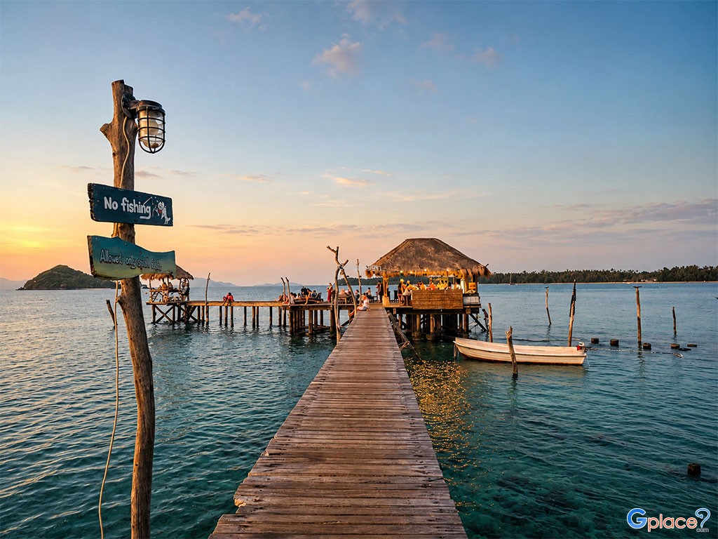
A peaceful and relaxed bay with several beachfront resorts. The sea is generally calm, making it suitable for leisure stays and enjoying peaceful ocean views. - Ao Khao (Southwest):
A quiet beach known for its beautiful sunsets. The shoreline features a mix of sand and rocky areas, with views toward Koh Kut and the Rayang islands. - Laem Tukata (Southwest):
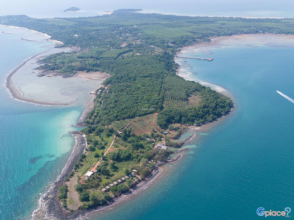
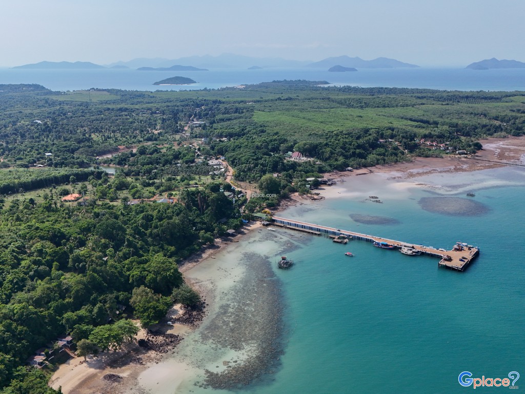
A small cape extending into the sea, located between bays on the southwest coast. Ideal for walking, photography, and enjoying open sea views. - Ao Nid (Southeast):
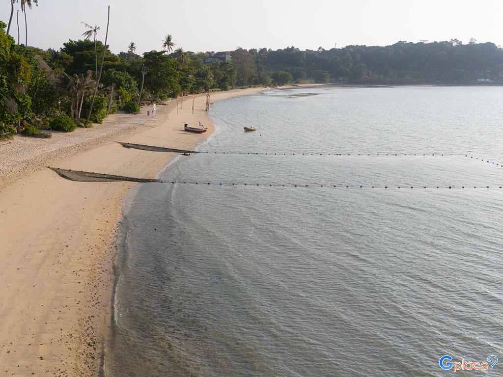
The island’s main pier and transportation hub, offering insight into local life with small shops and fishing activity. Also a great spot for sunrise views. - Ao Tan Beach (Northeast):
A quiet coastal area near local communities, surrounded by coconut plantations and natural scenery. Suitable for walking and experiencing the island’s traditional lifestyle. - Laem Kadun (East Coast):
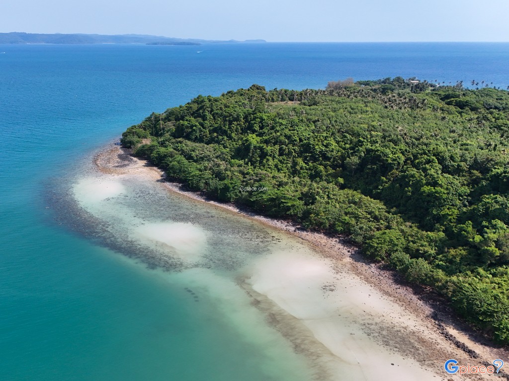
A scenic viewpoint known for panoramic sunrise views, often compared to a smaller version of Promthep Cape in Phuket. - East Coast (Natural Shoreline):
A largely undeveloped coastline with a mix of sandy, muddy, and rocky areas, lined with coconut groves. Not suitable for swimming but ideal for scenic walks and observing local island life.
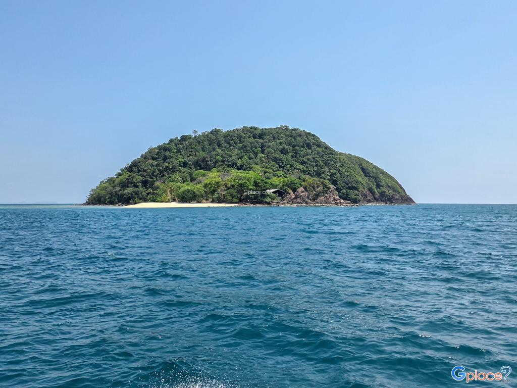
Koh Mak is also surrounded by nearby islets and coral reefs, making it an excellent base for snorkeling and short boat trips. Popular nearby destinations include Koh Kham and Koh Rayang Nai, which can be reached within minutes by longtail boat. The island’s balance of natural beauty, sustainability, and simplicity makes it a standout destination for travelers seeking a more authentic Thai island experience.
How to Get There
Step 1: Travel from Bangkok to Trat / Laem Ngop
- By Bus: Depart from Ekkamai Bus Terminal to Trat or Laem Ngop (~5 hours)
- By Car: Drive approximately 320 km (4.5–5 hours)
- By Flight: Fly from Suvarnabhumi Airport to Trat Airport (~1 hour), then transfer 30–40 minutes to Laem Ngop pier area
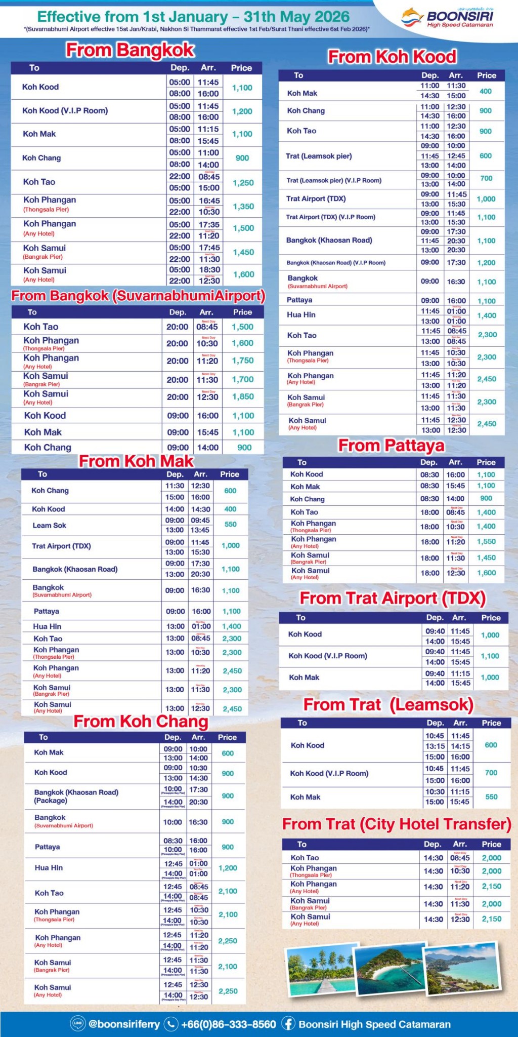
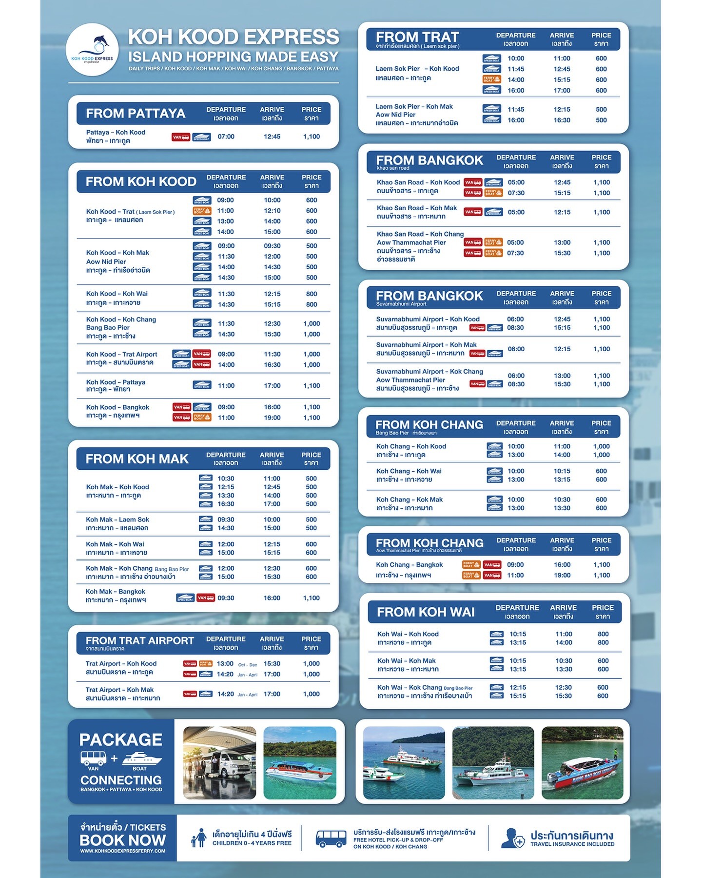
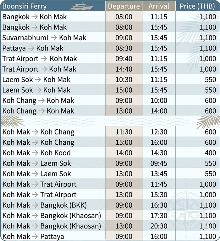
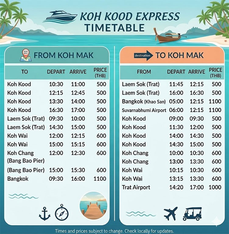
Step 2: Ferry & Speedboat to Koh Mak (Key Transport Stage)
Boats to Koh Mak depart from the Laem Ngop area, mainly from piers such as Krom Luang Chumphon Pier.
Speedboat Operators (Recommended)
- Route: Laem Ngop → Koh Mak (Ao Nid Pier / resort beaches)
- Travel time: ~50–60 minutes
- Typical schedule:
- Departure from mainland: ~10:00, ~13:00
- Return from Koh Mak: ~09:00, ~12:00
- Highlights: Reliable, widely used, connects multiple islands (Koh Chang / Koh Kood)
Boonsiri Ferry (Speedboat + Bus Combo)
- Route: Bangkok → Laem Ngop → Koh Mak (combined ticket)
- Travel time: ~7–8 hours total
- Typical schedule:
- Departure from Bangkok (Khao San / office): ~05:00–06:00
- Boat departure from Laem Ngop: ~10:30–11:00
- Return:
- Koh Mak → Mainland: ~12:00–13:00
- Highlights: Seamless transfer (bus + boat), popular with international travelers
Slow Ferry (Limited Option)
- Travel time: ~2.5–3 hours
- Frequency: Usually 1 trip per day or less
- Arrival point: Ao Nid Pier
- Note: Less commonly used by tourists; mainly for cargo and local transport
Step 3: Arrival on Koh Mak
- Main arrival point: Ao Nid Pier (Southeast coast)
- Many resorts offer pickup service (free or small fee)
- Motorbike and bicycle rentals available near the pier and resorts
From Nearby Islands
- Koh Chang → Koh Mak: ~50–60 minutes by speedboat
- Koh Kut → Koh Mak: ~30–60 minutes
- Operates mainly during high season (Oct–May)
- Boats may stop at Ao Nid or directly at resort beaches
Important Travel Notes
- Last boats from mainland usually depart around 13:00–14:00 — plan arrival carefully
- Schedules vary by season and weather, especially during monsoon (Jun–Sep)
- Advance booking is recommended in peak season
- Sea conditions can affect travel time and comfort
Travel Tips
- Best time to visit: October to May for calm seas and clear skies
- Getting around: Rent a motorbike or bicycle to explore the 27-km ring road
- Atmosphere: Very peaceful with limited nightlife—ideal for relaxation and slow travel
- Must-do: Take a short boat trip to Koh Kham or Koh Rayang for snorkeling
- Enjoy fresh seafood and tropical fruits at local beachfront restaurants
Admission Fee:
- No island entrance fee (transport and activity costs vary)
Opening Time:
- Open daily (boat schedules and services vary by season)
Koh Mak
![]() Koh Mak, Ko Mak Subdistrict, Ko Kut District, Trat
Map
Koh Mak, Ko Mak Subdistrict, Ko Kut District, Trat
Map
![]() Open now
Open now
![]() https://www.thai-tour.com/thai-tour/east/trad/data/place/kohmak/index.html
https://www.thai-tour.com/thai-tour/east/trad/data/place/kohmak/index.html
![]()
 7108
7108