


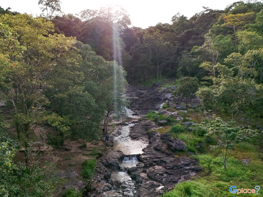


“Lan Hin Sai Waterfall, a beautiful waterfall in the Phu Phan mountain range, is notable for its three-tiered entrance amidst a pristine dry evergreen forest. Located near the Snake Bend, it's easily accessible and serves as a top recreational area and an important water source for Sakon Nakhon province.”
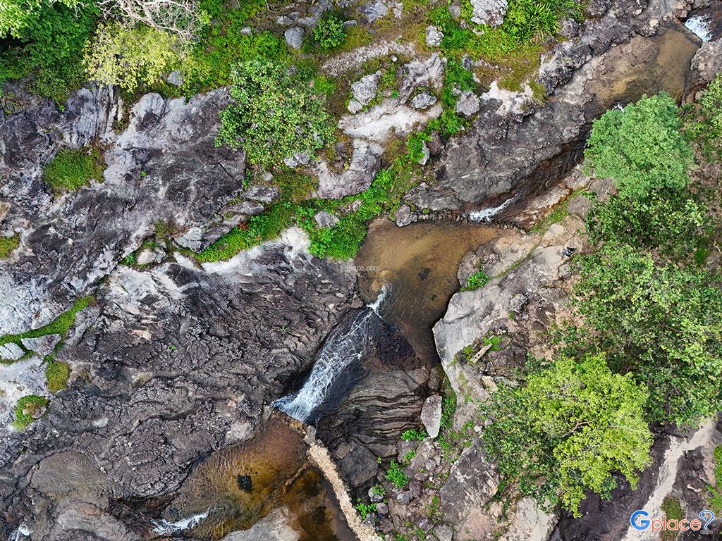
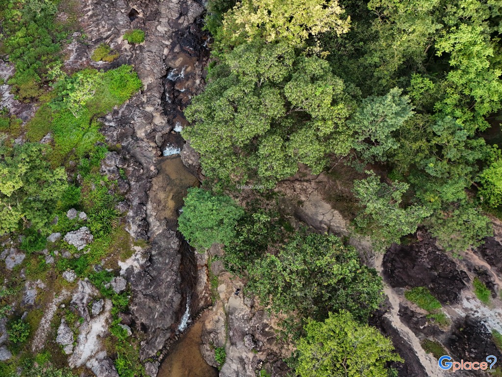
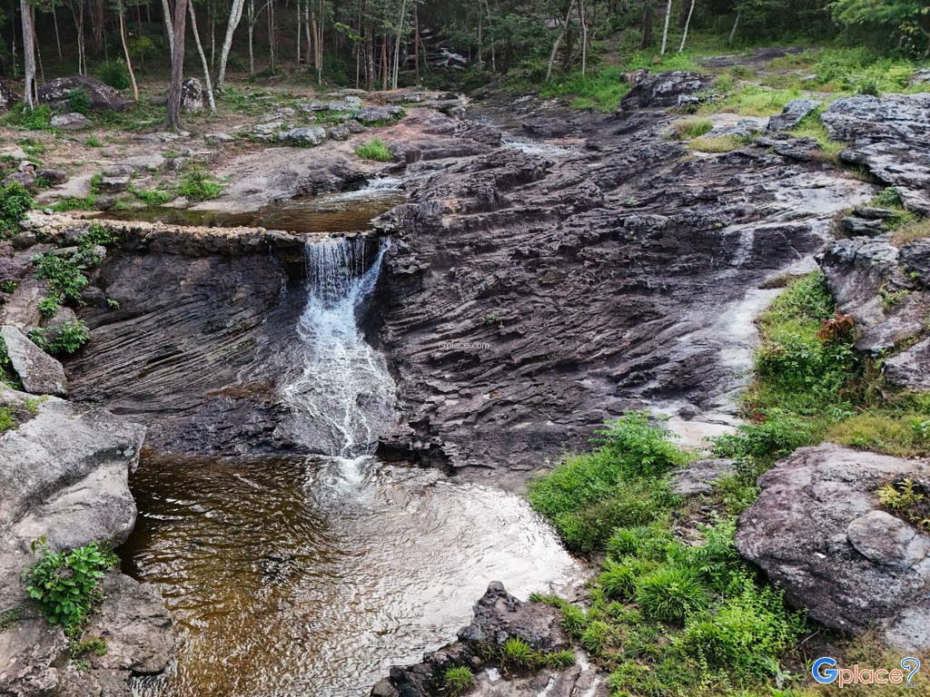
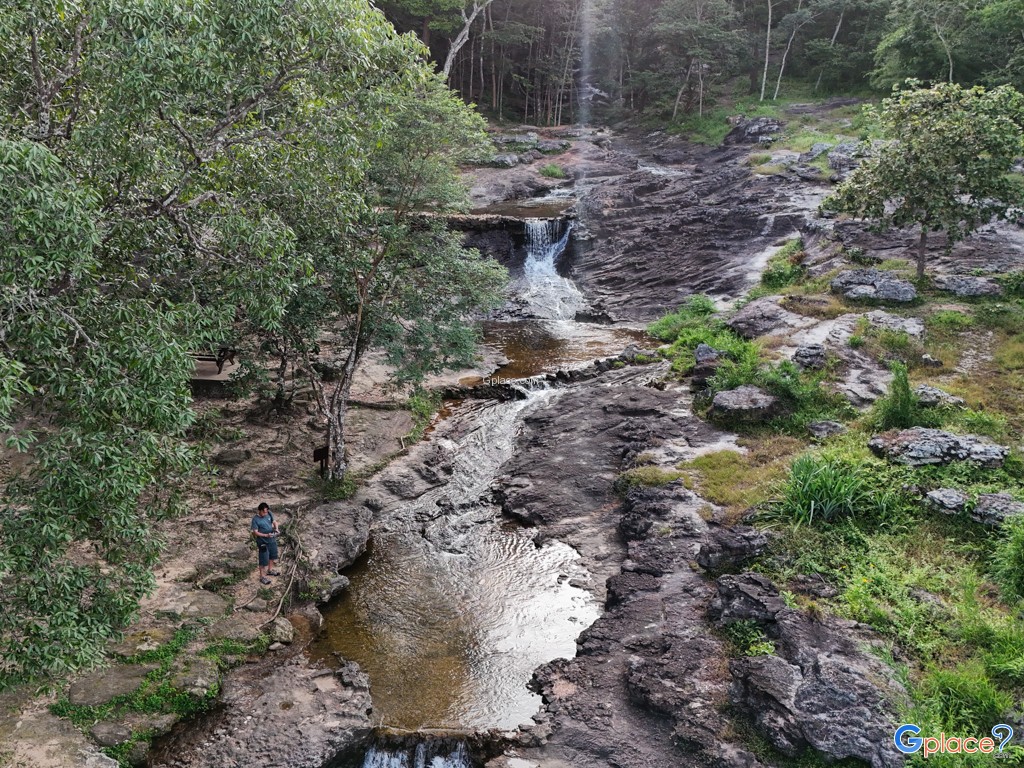
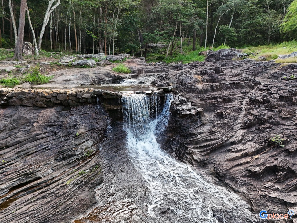
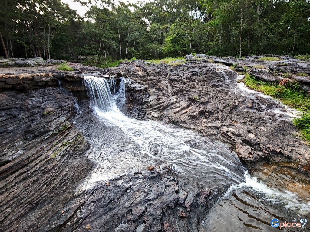
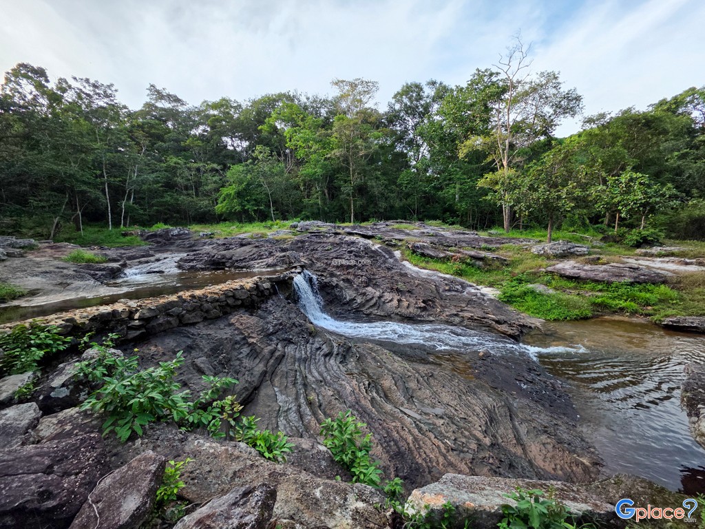
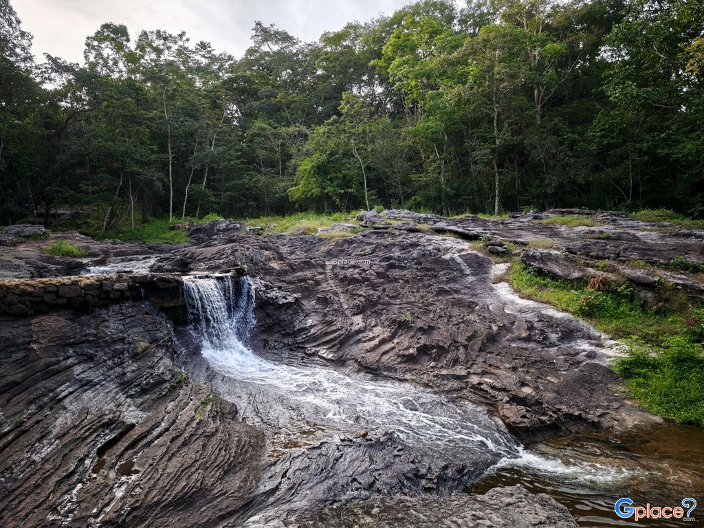
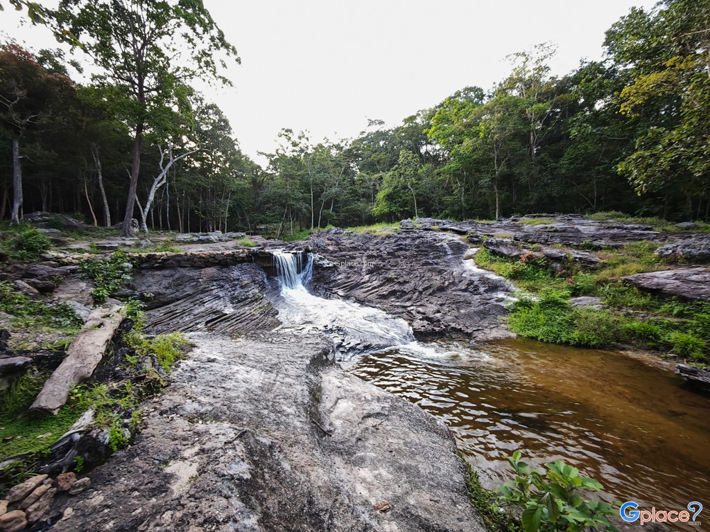
Kam Hom Waterfall serves as a vital ecological and recreational gateway to the Phu Phan National Park, specifically situated near the 14th kilometer marker on Highway 213. Unlike the high-drop waterfalls found in Southern Thailand, Kam Hom is a distinct plateau-style cascade characterized by its expansive Jurassic-period sandstone foundations. The water originates from the high ridges of the Phu Phan Mountain Range, gathering in small forest rivulets before converging and spilling over three primary levels of rocky terraces. The geological layout creates a series of shallow, clear natural basins that are safely accessible for wading, making it a preferred destination for local families and ecology students studying the sedimentary rock layers of the Khorat Plateau.
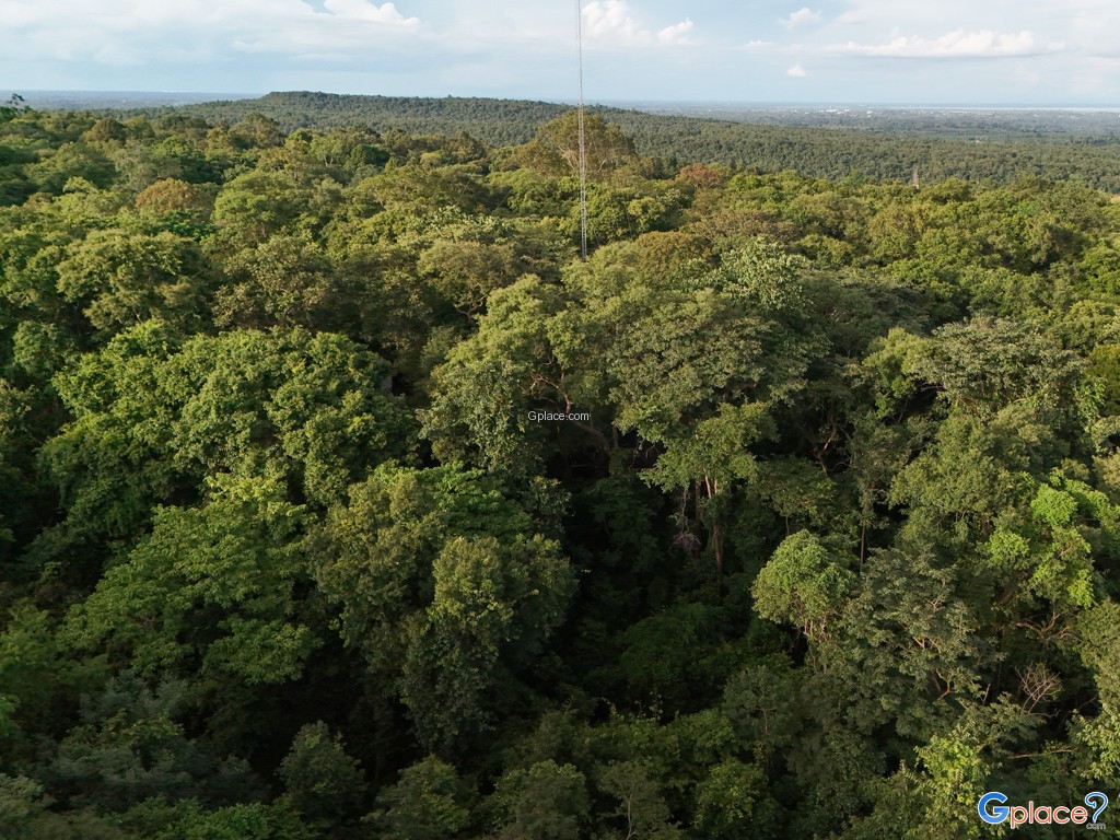
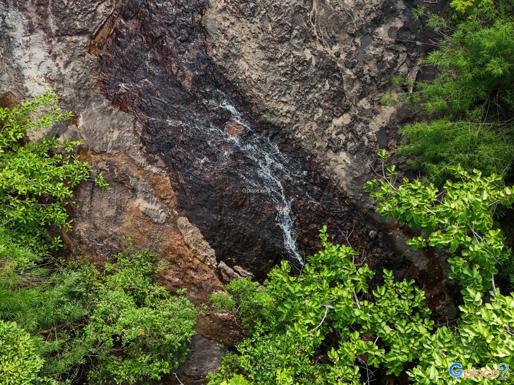
The surrounding vegetation is classified as a mixed deciduous and dry evergreen forest, featuring an impressive density of indigenous flora such as Dipterocarpus alatus and various wild orchids. This dense canopy acts as a thermal buffer, maintaining a microclimate that is consistently 3 to 5 degrees Celsius cooler than the nearby Sakon Nakhon city center. During the peak monsoon months from August to October, the waterfall reaches its full hydraulic potential, transforming into a broad, foaming white curtain that stretches across the entire rock face. The site is also historically significant as part of the Strategic Route developed during the mid-20th century, and it remains a testament to the coexistence of modern infrastructure—the famous Ping Ngu Curve—and preserved forest ecosystems.
Visitor amenities have been systematically improved to include a reinforced stone staircase system that circumvents the slippery moss-covered areas, ensuring a secure descent for tourists of all ages. The soundscape of the area is dominated by the constant rhythm of falling water and the calls of the Great Hornbill or the Blue-winged Pitta, both of which have been sighted in the deeper corridors of the park near the falls. The waterfall is not merely a scenic vista but serves as the headwaters for the Huai Yang Reservoir, meaning its preservation is crucial for the agricultural stability of the surrounding plains. To visit Kam Hom is to witness a delicate balance where water, ancient stone, and rare biodiversity intersect in a secluded mountain sanctuary.
How to Get There
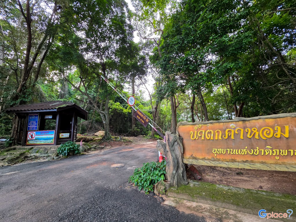
- From Sakon Nakhon city, take Highway 213 (the route to Kalasin province) and drive up the Phu Phan mountain range for approximately 14 kilometers. The waterfall will be on the right-hand side, near the "Snake Curve" (Khao Ping Ngou). There are clear signs indicating the way.
Travel Tips
-
Best time to visit: It's recommended to go during the late rainy season to early winter (August - November) when the water volume is just right.
-
Preparation: The path down to the waterfall is a stone staircase that may be slippery in some places. Wear shoes with good grip.
-
Must-see spot: Don't forget to stop and take photos at the Snake Curve viewpoint, which is only a short distance from the waterfall entrance.
Admission Fees:
- Free Admission
Opening Hours:
- Open daily from 8:00 AM to 4:30 PM. (Visiting during daylight hours is highly recommended for safety due to its mountainous location.)
Kam Hom Waterfall
![]() Ban Huai Yang, Huai Yang, Mueang Sakon Nakhon, Sakon Nakhon 47000
Map
Ban Huai Yang, Huai Yang, Mueang Sakon Nakhon, Sakon Nakhon 47000
Map
![]() Closed today
Closed today![]()
Mon8.00 - 16.30
Tue8.00 - 16.30
Wed8.00 - 16.30
Thu8.00 - 16.30
Fri8.00 - 16.30
Sat8.00 - 16.30
Sun8.00 - 16.30
![]()
 144
144