“Study the geographical importance of the northern strait and experience the pristine shallow-water coral reefs, among the healthiest in the Mu Ko Chang archipelago.”
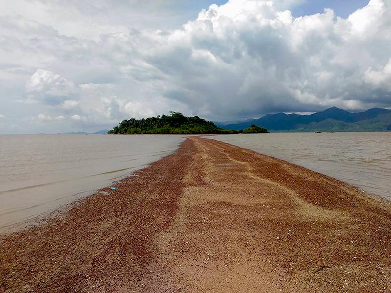
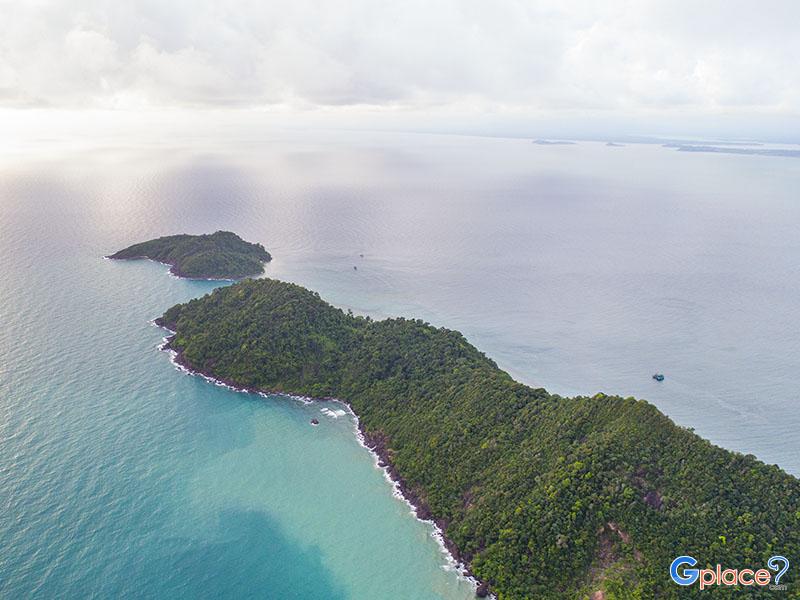
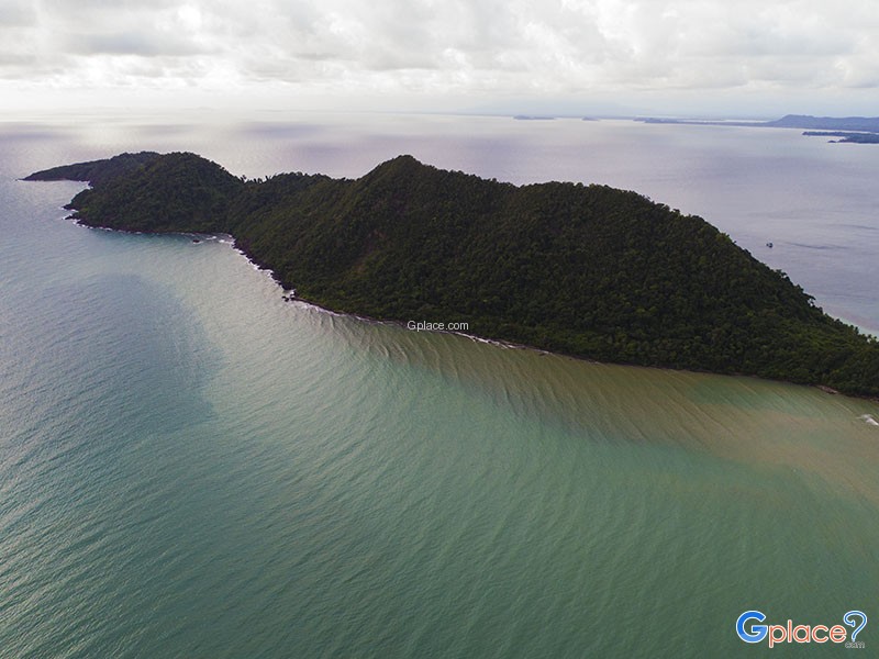
Koh Chang Noi & Laem Chang Noi are situated at the northernmost tip of Koh Chang, serving as significant strategic and geographical landmarks. Laem Chang Noi is a cape that juts out into the Gulf of Thailand toward mainland Trat, while Koh Chang Noi is a small, uninhabited islet located just a few hundred meters off the cape's tip. This area is distinguished by its extreme privacy and tranquility, as it is separated from the main tourist hubs, acting as a sanctuary for those wishing to experience Koh Chang's undisturbed natural state.
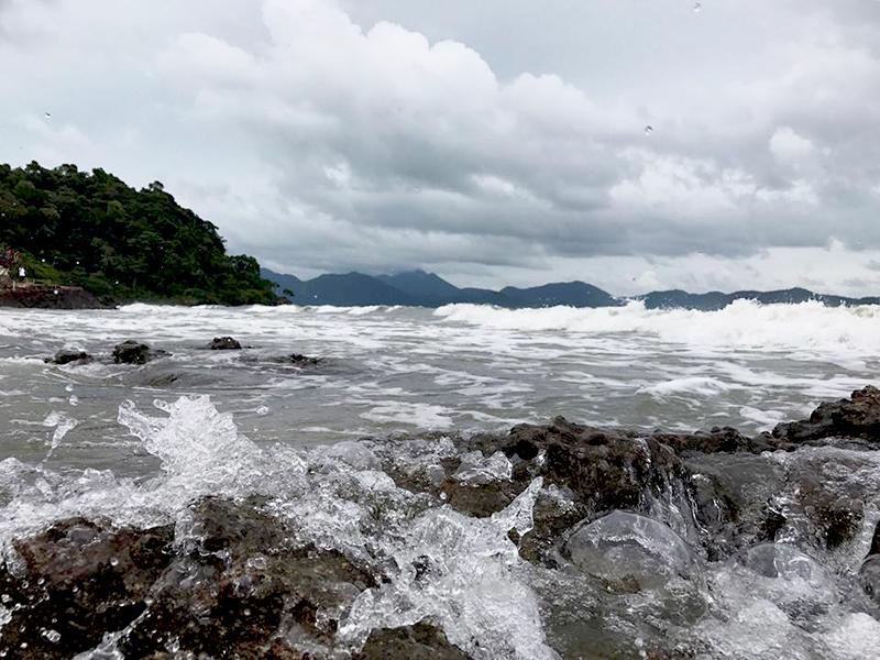
The highlight of this area is the rich coastal biodiversity. The shores around Laem Chang Noi consist of rocky outcrops interspersed with pebble beaches, home to various crab species and marine life. It is also a renowned fishing spot for locals and slow-travel enthusiasts, as the currents between the cape and the islet attract various fish species. Koh Chang Noi itself is surrounded by crystal-clear waters and vibrant shallow-water coral reefs, which remain healthy due to minimal disturbance from large tour boats.
In terms of geology and aquatic ecosystems, the strait between Laem Chang Noi and Koh Chang Noi is a point where water currents circulate constantly. This results in clean sea water with high oxygen aeration, which is a vital factor allowing sea fans and shallow-water corals to thrive better than in stagnant areas. This landscape also functions as a "natural wall" that helps reduce the impact of wind and waves blowing from the outer Gulf of Thailand before they enter the Klong Son Bay area, making it an essential nursery for young marine life for the North Koh Chang community.
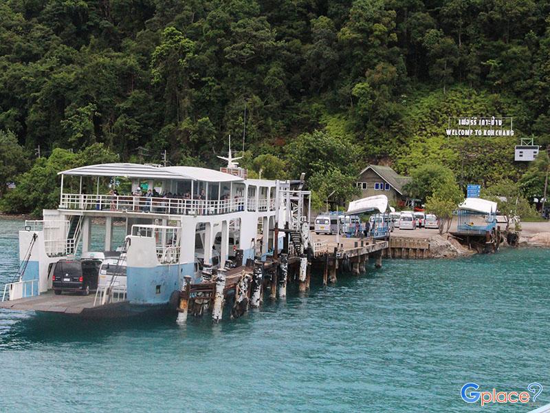
The provincial significance of this site is its role as a key Navigation Point for vessels traveling between Laem Ngop Pier and Koh Chang. Laem Chang Noi is utilized as a natural boundary to identify the northernmost latitude of the island. Visiting this location is therefore not just a leisure trip, but an opportunity to experience the most important physical connection point between the island and mainland Trat, which strictly maintains a balance between community utility and its status as a National Park zone.
We invite you to experience the geographical heart of the great island's northern tip, where Koh Chang Noi and Laem Chang Noi continue to serve as a strong and beautiful natural fortress. It is a place where beauty harmoniously intertwines with ecological significance.
How to Get There
-
By Kayak: The most popular method. Paddle north from Klong Son Bay along the coastline; it takes about 20–30 minutes.
-
On Foot: During low tide, it is possible to walk along the shoreline and over the rocks from Klong Son Bay to the tip of Laem Chang Noi.
-
Local Boat: Hire a small fishing boat from Klong Son village for fishing or private snorkeling trips around the islet.
Travel Tips
-
Best Visiting Season: November to May, when the water is at its clearest and calmest, making it safe to paddle across to the islet.
-
Footwear and Gear: Water shoes are highly recommended as the cape area is rocky and has sharp shells.
-
Photography: The view looking back from Koh Chang Noi toward the cape offers the most majestic backdrop of Koh Chang’s mountains.
-
Culture and Environment: As a quiet area within the National Park, please keep the area clean and strictly refrain from littering.
-
Planning: Check tide tables before heading out; low tide can make paddling difficult due to exposed rocks
Admission Fee:
-
Local visitors: Adult 40 THB, Child 20 THB
-
Foreign visitors: Adult 200 THB, Child 100 THB
Opening Hours:
-
Daily hours: 08:30 – 16:30
-
note: Returning before dusk is advised as there is no artificial lighting and rocks can be hazardous in the dark.
Koh Chang Noi Laem Chang Noi
![]() Mu Ko Chang National Park, Koh Chang Nuea Subdistrict, Koh Chang District, Trat Province
Map
Mu Ko Chang National Park, Koh Chang Nuea Subdistrict, Koh Chang District, Trat Province
Map
![]() Open now : 8.30 - 16.30
Open now : 8.30 - 16.30![]()
Mon8.30 - 16.30
Tue8.30 - 16.30
Wed8.30 - 16.30
Thu8.30 - 16.30
Fri8.30 - 16.30
Sat8.30 - 16.30
Sun8.30 - 16.30
![]()
 117
117