


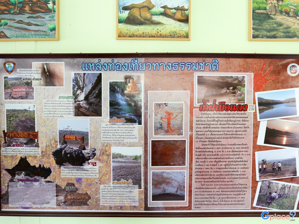


“Unique sandstone formations with unusual shapes, Mukda Field with wildflowers blooming during Oct–Nov, and Phu Uat–Phu Manao viewpoints offering panoramic views of the Mekong River.”
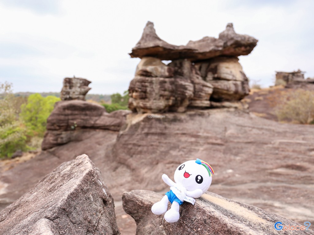
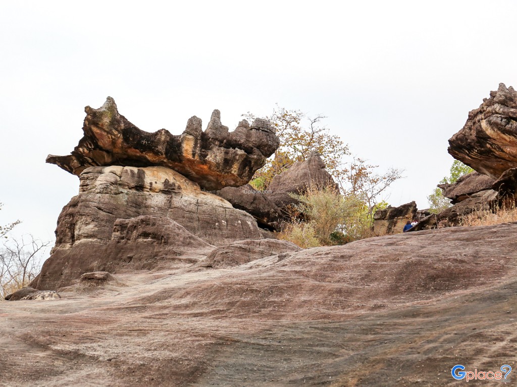
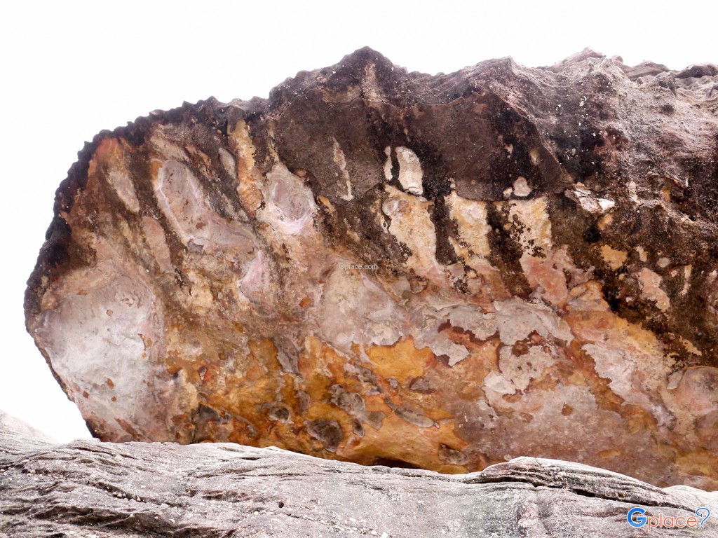
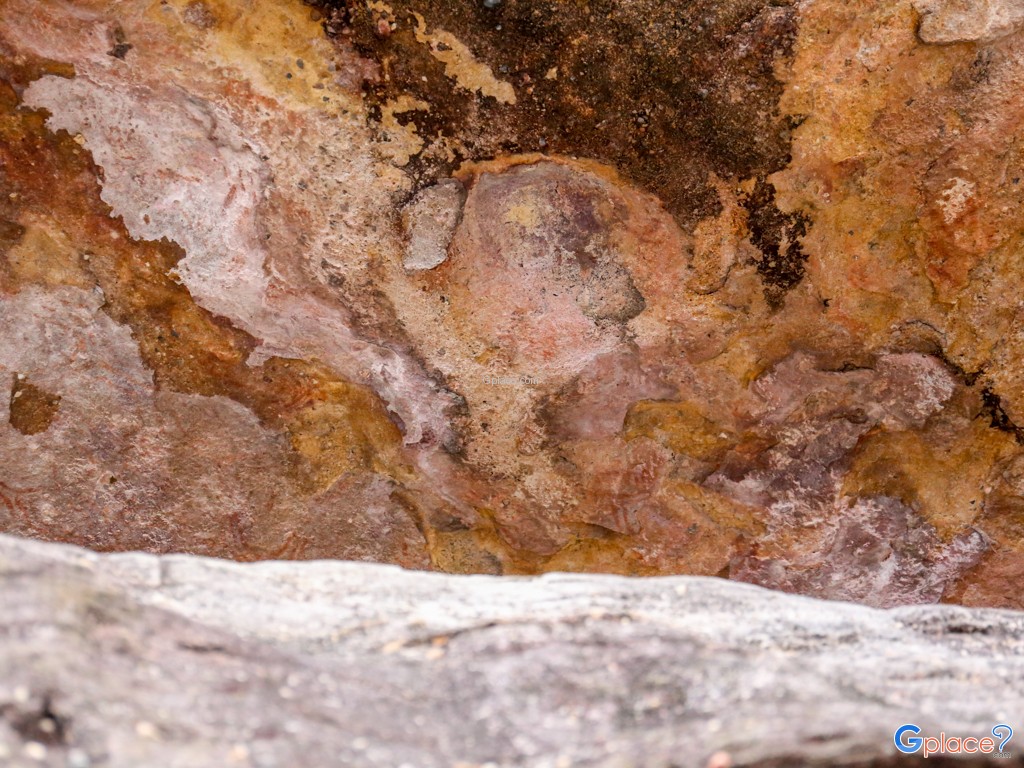
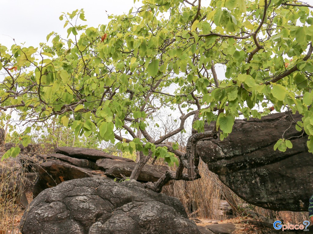
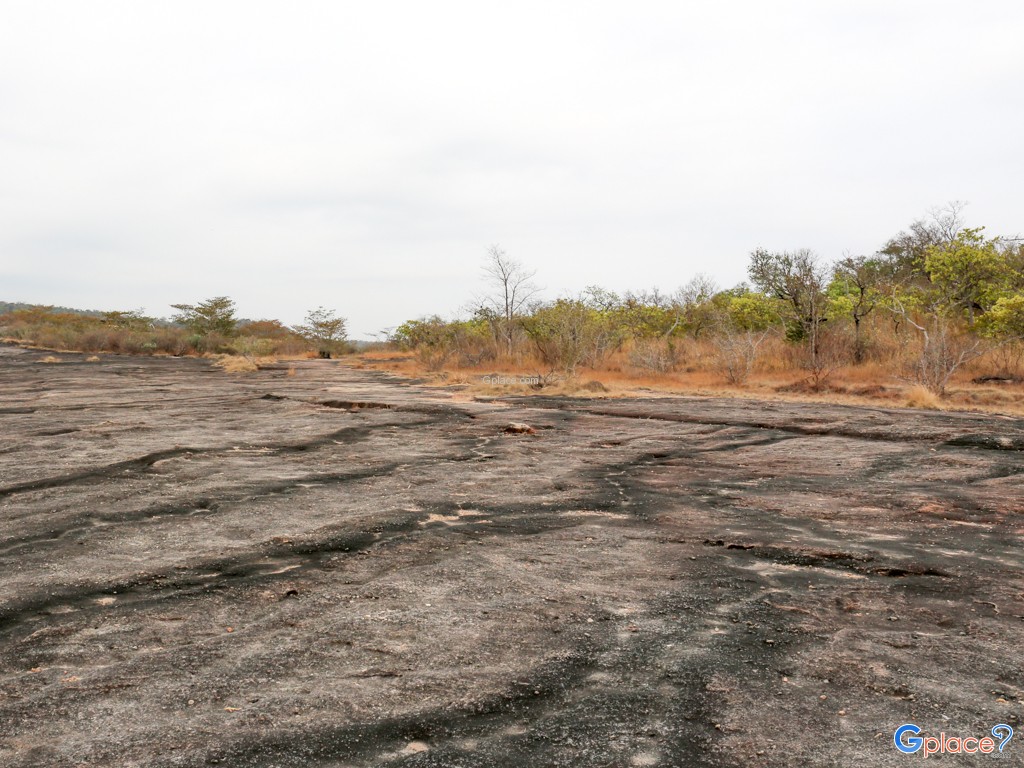
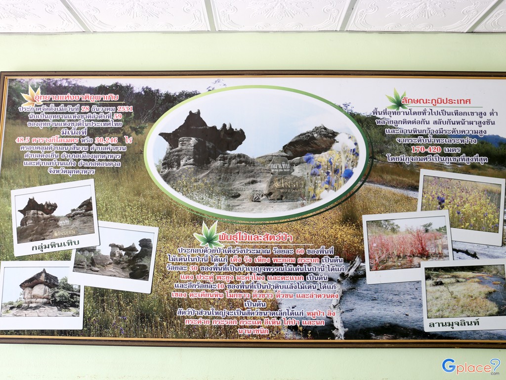
Phu Pha Thoep National Park is a highly distinctive national park in northeastern Thailand, known for its exceptional geology, landscape, and ecosystems. It is located in Mukdahan Province near the Mekong River basin, which has played an important role in shaping its long-standing natural environment and biodiversity.The park consists of ancient sandstone mountains estimated to be around 90–100 million years old, dating back to the Cretaceous period. In the past, this area was formed from sediment deposits of ancient rivers and seas before being uplifted by tectonic movements and gradually shaped by long-term weathering and erosion.
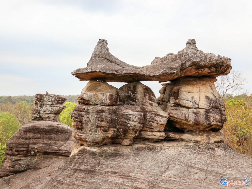
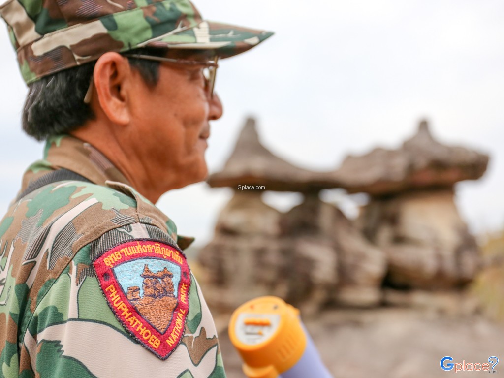
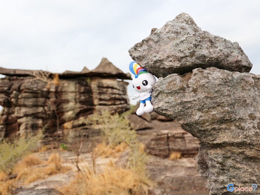
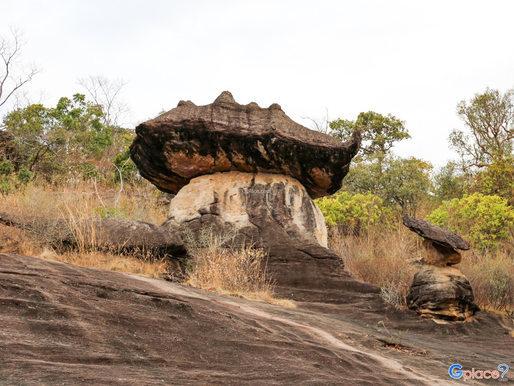
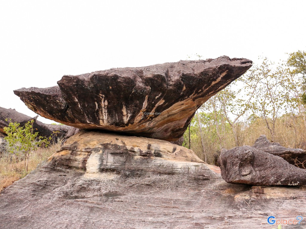
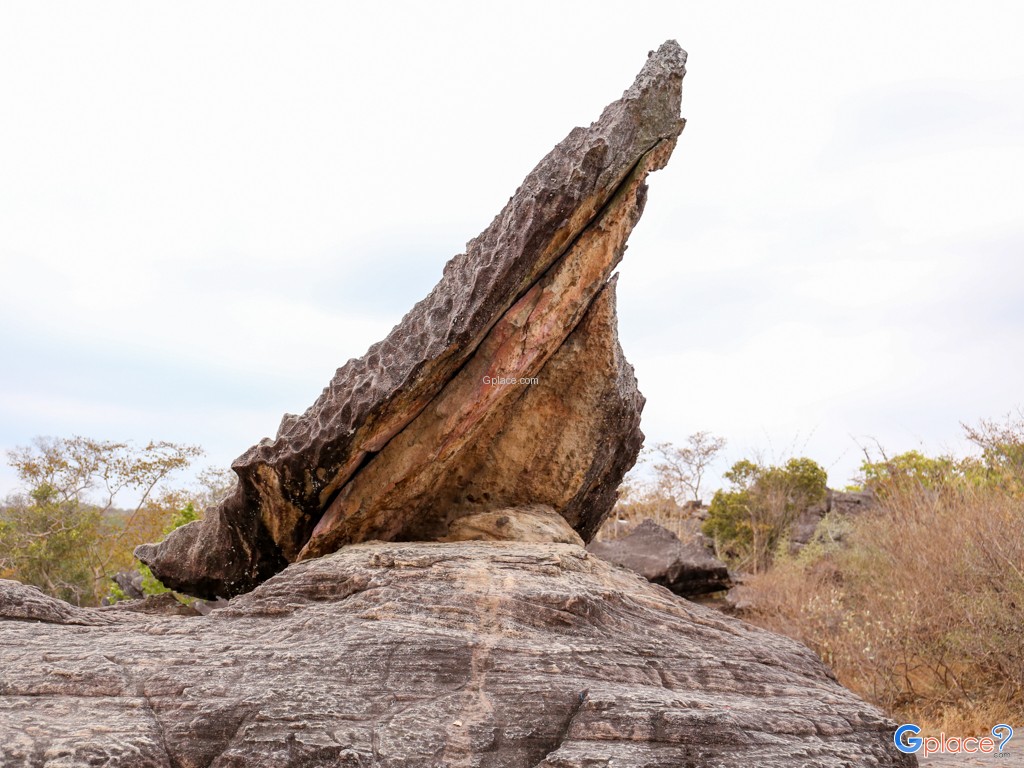
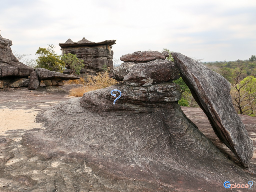
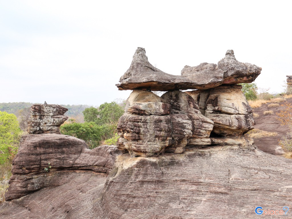
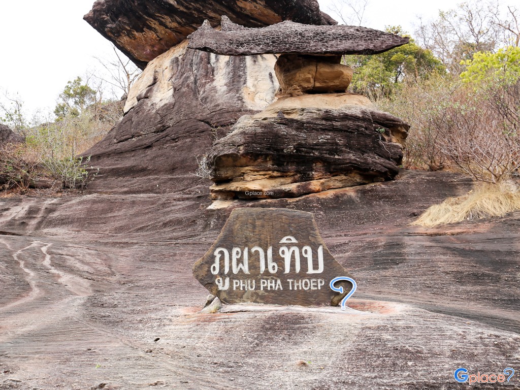
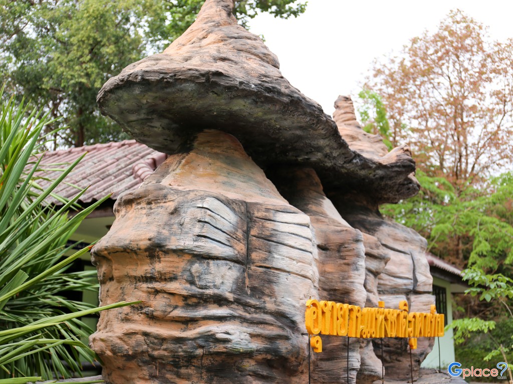
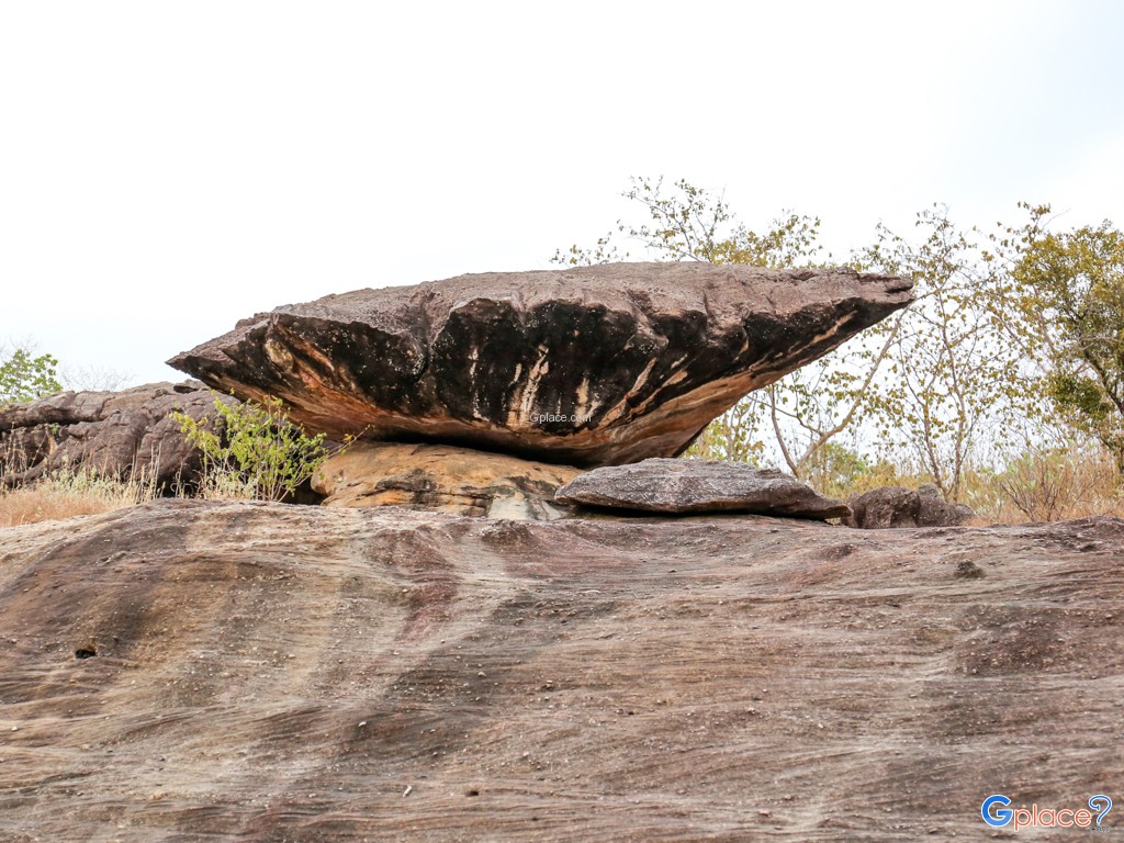
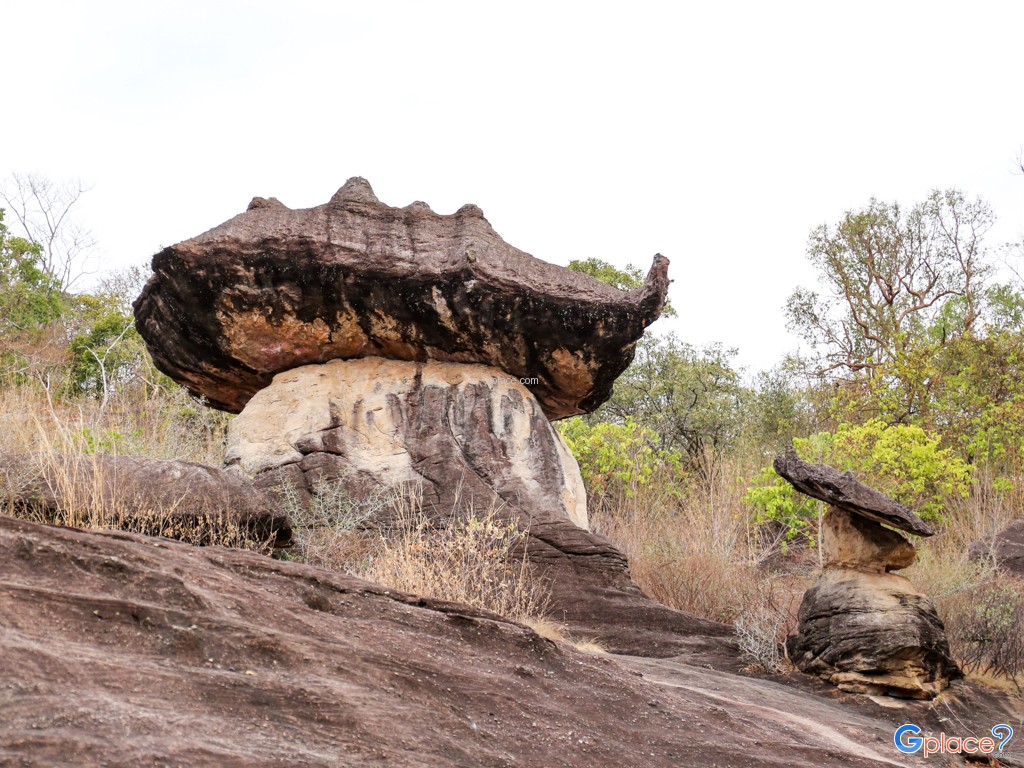
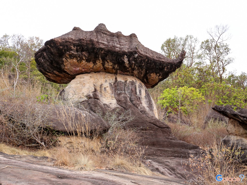
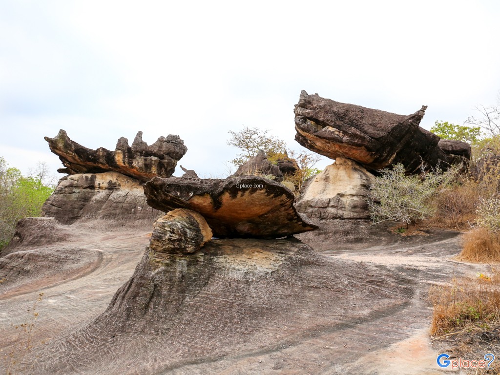
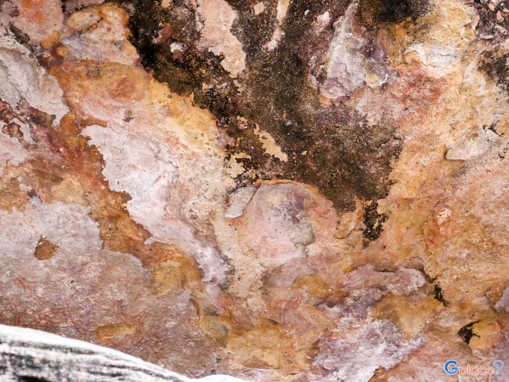
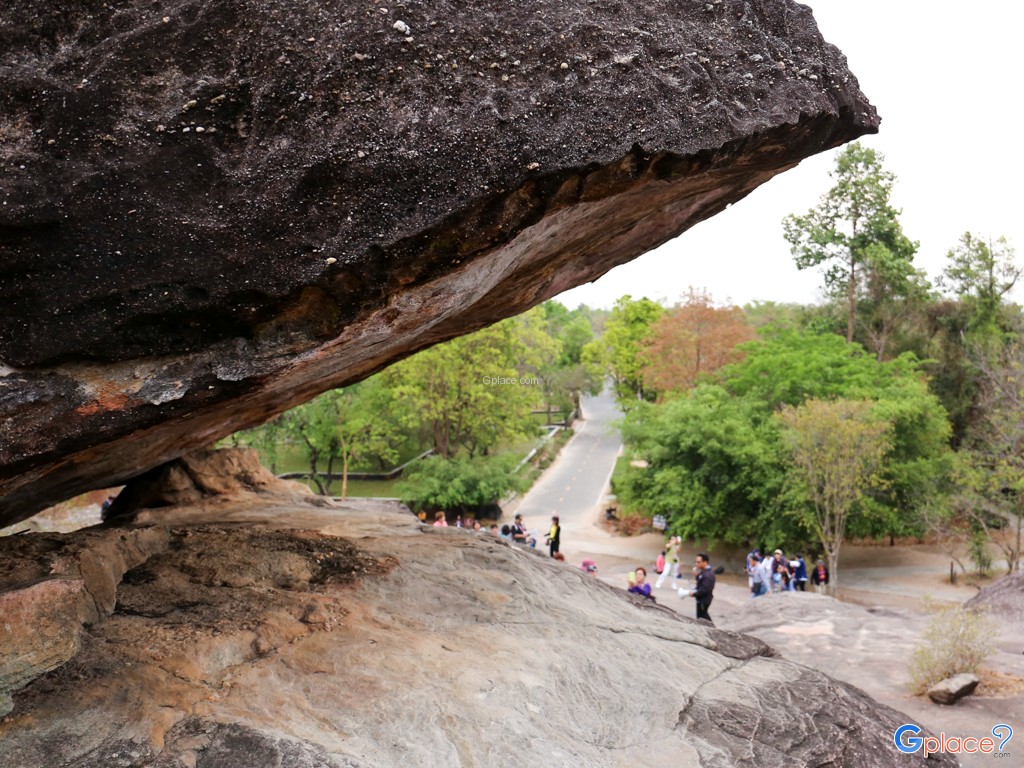
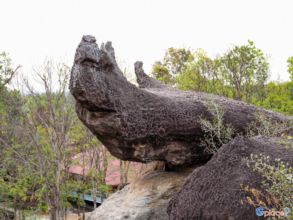
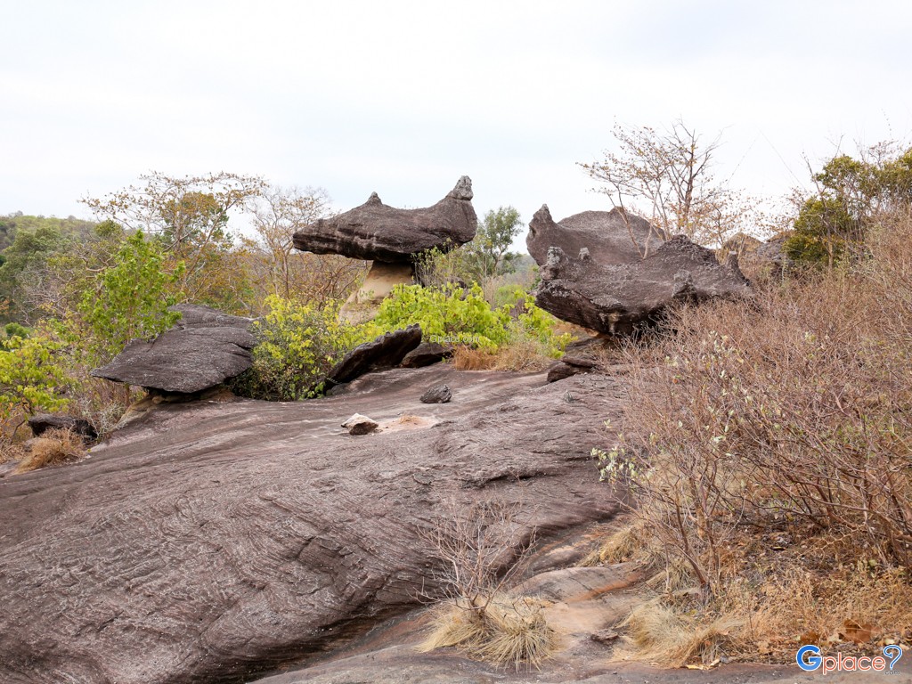
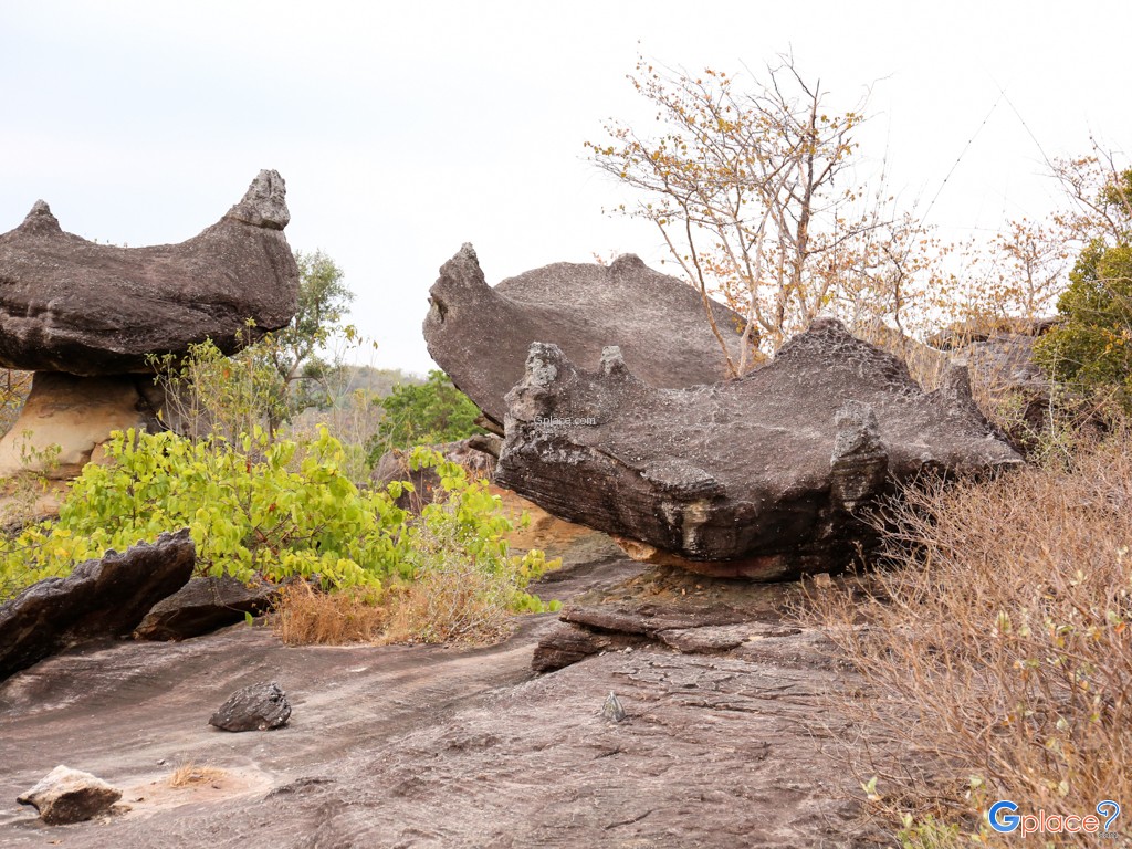
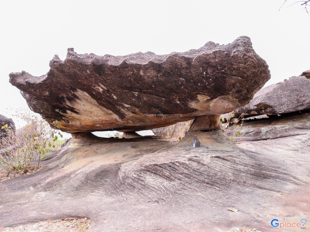
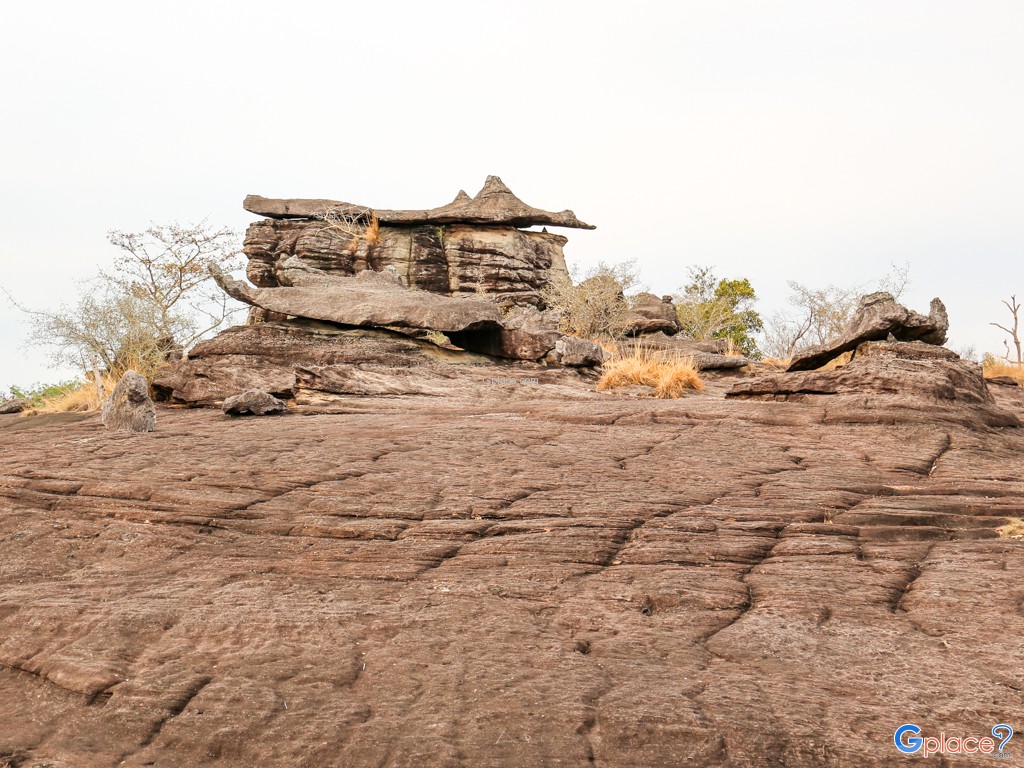
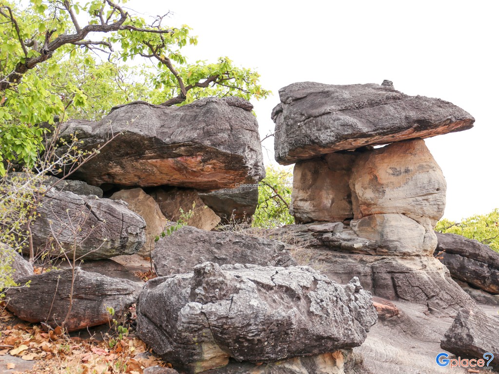
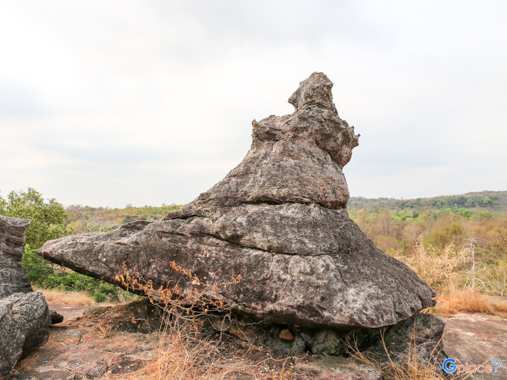
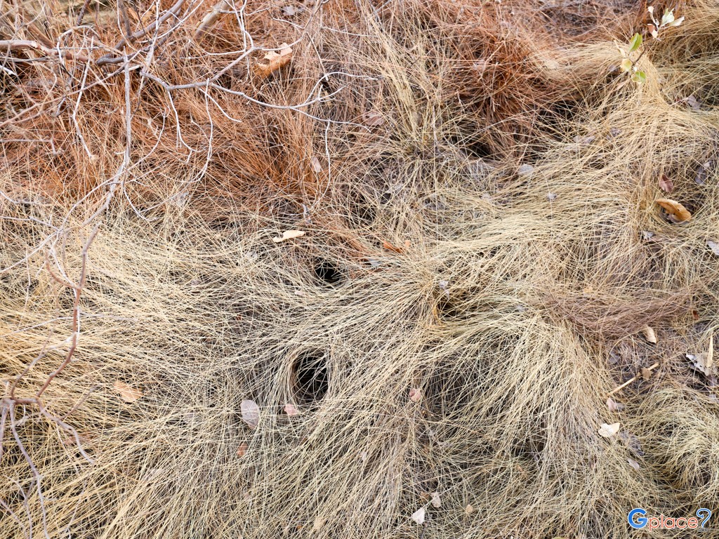
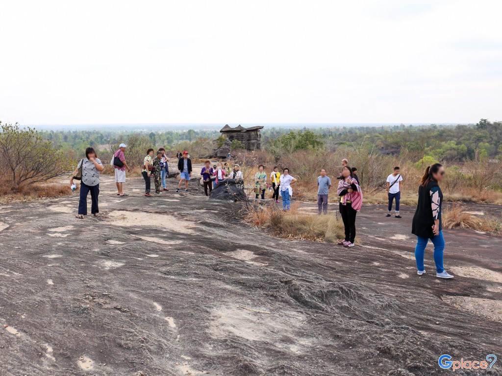
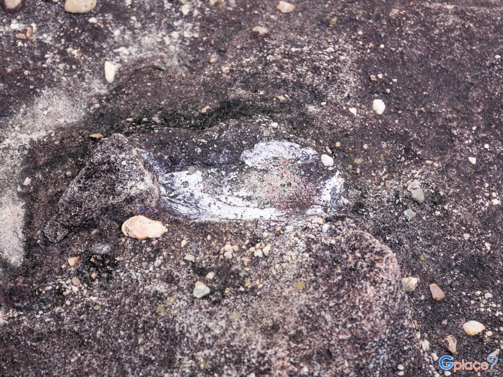
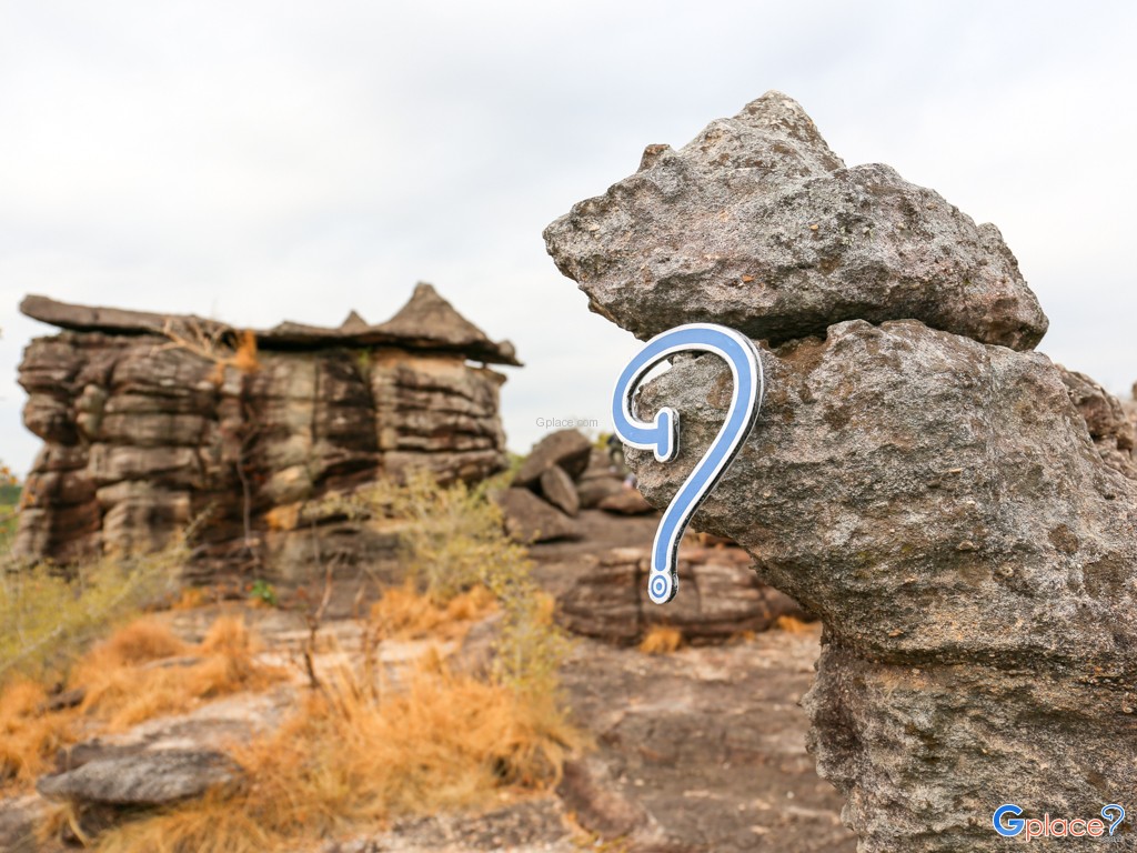
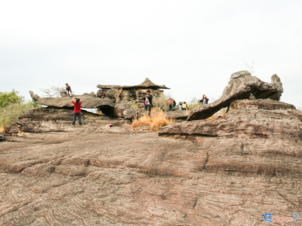
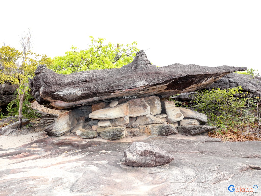
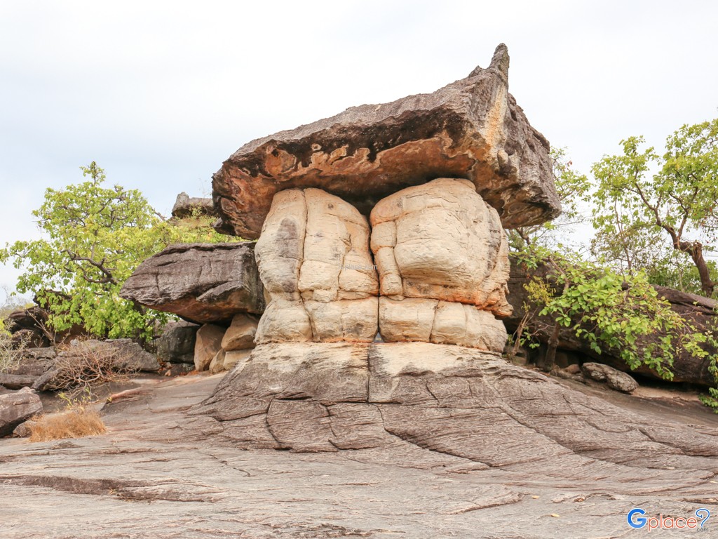
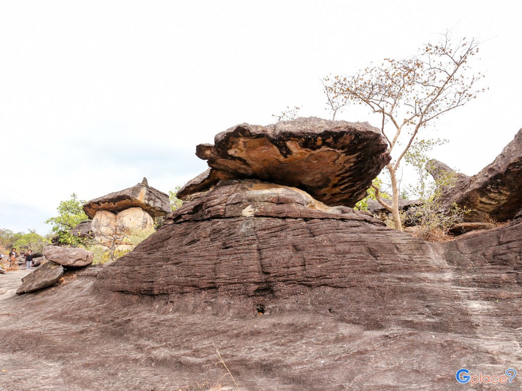
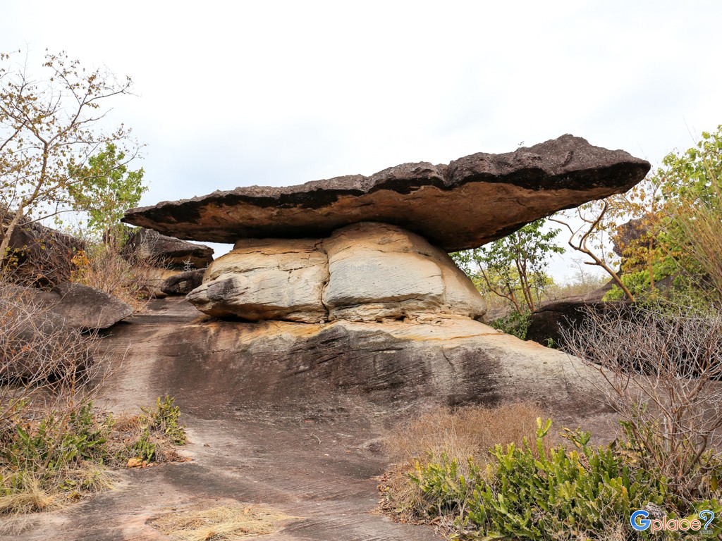
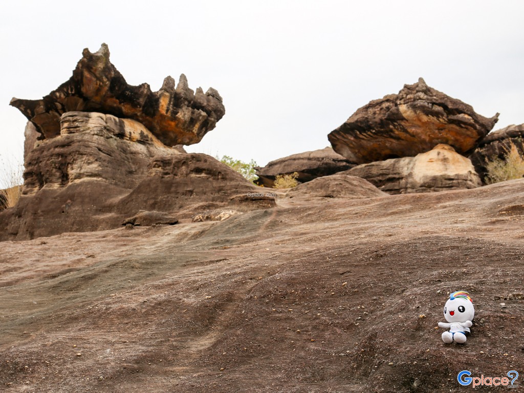
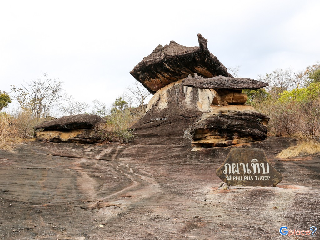
The highlight of the park is the “Phu Pha Thoep rock formations,” created through differential erosion processes. Each sandstone formation has a unique shape, with some resembling mushrooms, pillars, altars, or abstract sculptures. All of these unusual formations are naturally created without human intervention.The landscape is shaped by three main natural processes: weathering from temperature and humidity changes, erosion caused by wind and rain, and differences in rock hardness that cause softer layers to erode faster while harder sections remain as prominent structures.In addition to its geological significance, the park is home to dry dipterocarp forest and mixed deciduous forest ecosystems. These environments are relatively open and dry, supporting plant species such as dipterocarp trees, teak, and seasonal ground vegetation. During the rainy season through early winter, the rocky plains transform into seasonal wildflower fields.
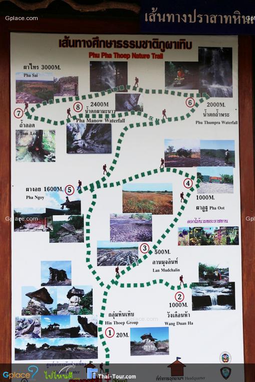
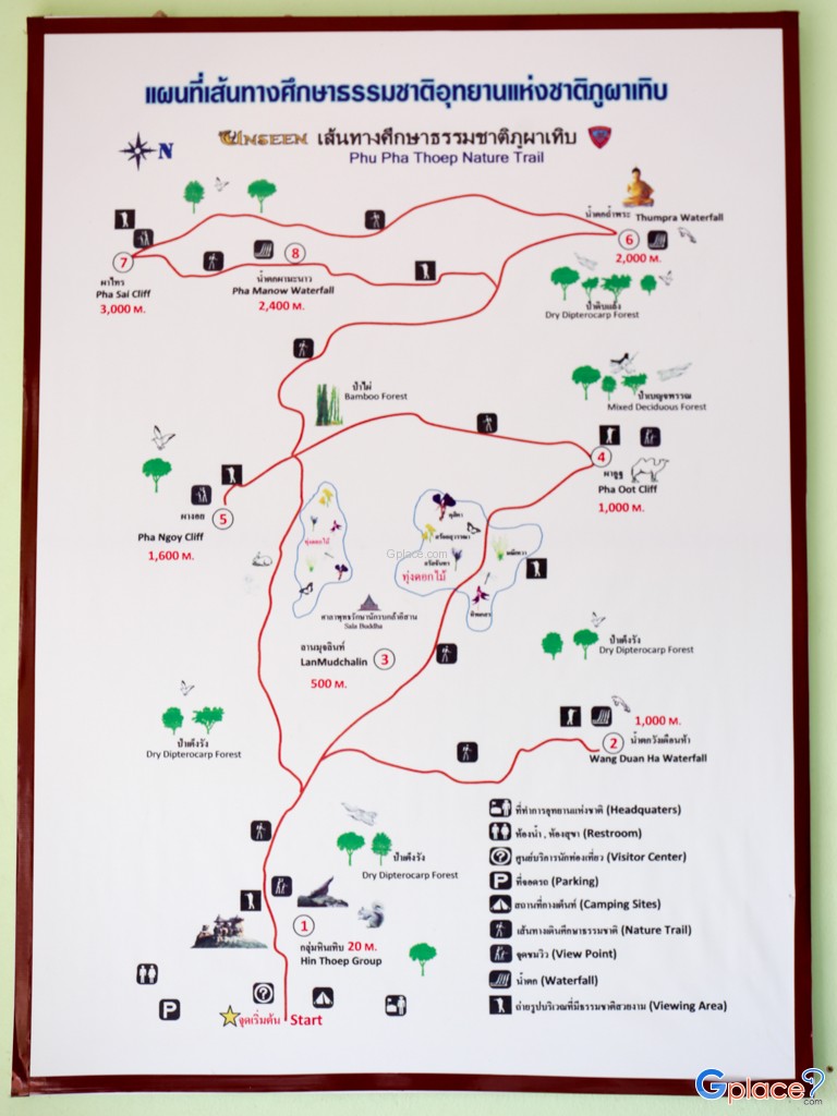
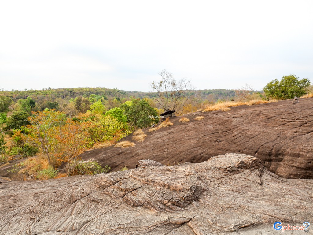
Wildflowers such as Dusita flowers and other small native species bloom depending on moisture conditions, creating a changing natural landscape throughout the year. The park also supports small wildlife including forest birds, squirrels, lizards, reptiles, and various insects that play important ecological roles.The park features nature trails connecting key attractions such as the main rock formations, Mukda Field (Lan Mukda), Phu Uat Cliff, and Phu Manao Viewpoint. These viewpoints offer panoramic scenery of forests and the Mekong River, with clear views of Laos on the opposite bank on clear days.
The atmosphere changes throughout the day: mornings are cool with occasional mist over the forest, daytime brings strong sunlight that enhances the contrast of the rock formations, and evenings feature golden sunset light that creates stunning photographic scenery.Overall, the park offers a combination of geological wonders, biodiversity, and scenic landscapes, making it suitable for hiking, photography, nature study, stargazing, and eco-tourism experiences.
How to Get There
- By car: From Mukdahan city, take Highway 2034 (Mukdahan–Don Tan) for about 11 km, then turn into the park entrance. Continue another 2 km to reach the visitor center.
- By public transport: You can take a local songthaew (shared pickup truck) or hire a “skylab” (motor tricycle taxi) from Mukdahan Bus Terminal to the national park.
Travel Tips
- Recommended visiting period is October–January when the weather is cool and wildflowers are in bloom.
- It is best to visit in the early morning or late afternoon for pleasant weather and beautiful lighting.
- Bring a hat, sunscreen, and drinking water as the rocky terrain is exposed and can be hot during midday.
- The rock surface can also be slippery in some areas, so caution is advised.
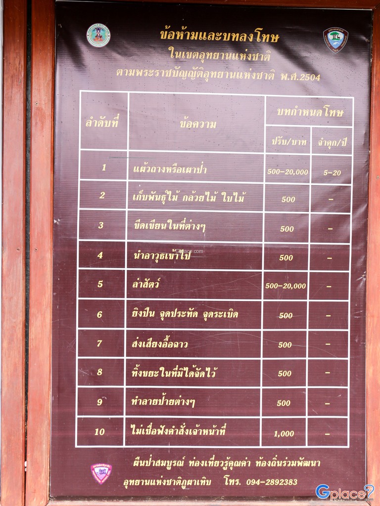
- Do not climb or damage the rock formations in order to ensure safety and help preserve the natural environment.
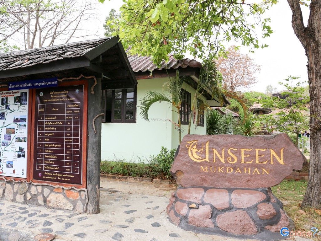
Admission Fee:
- Thai visitors: Adults 20 THB / Children 10 THB
- Foreign visitors: Adults 100 THB / Children 50 THB
- Additional vehicle entry fees may apply depending on vehicle type
Opening Hours:
- Open daily from 08:00 AM – 04:30 PM
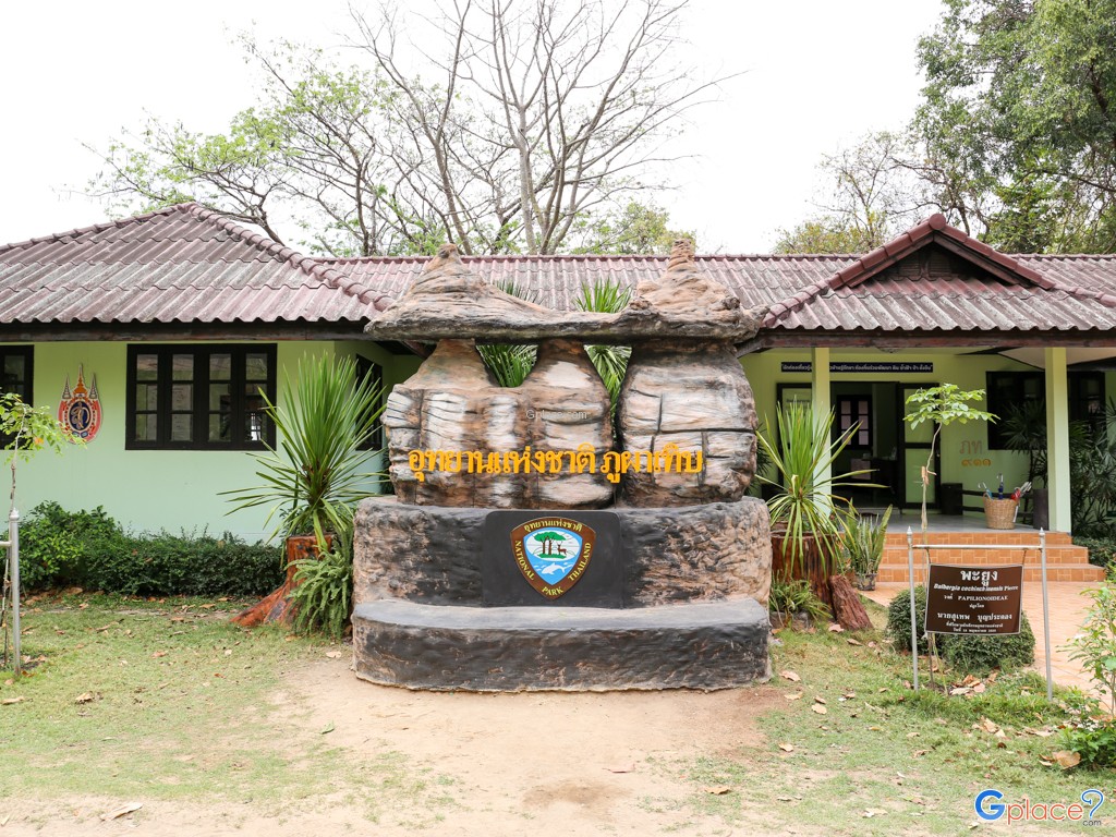
Phu Pha Thoep National Park
![]() 25 Moo 5, Ban Khon Sai, Na Si Nuan, Mueang, Mukdahan 49000
Map
25 Moo 5, Ban Khon Sai, Na Si Nuan, Mueang, Mukdahan 49000
Map
![]() Closed today
Closed today![]()
Mon8.00 - 16.30
Tue8.00 - 16.30
Wed8.00 - 16.30
Thu8.00 - 16.30
Fri8.00 - 16.30
Sat8.00 - 16.30
Sun8.00 - 16.30
![]()
 2919
2919