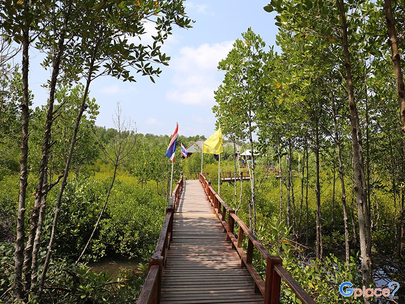

“The park is home to a rich mangrove ecosystem and a diverse marine environment, especially known for black corals. On land, key attractions include hanging bridges and mangrove nature trails at Thung Kha-Sawi Bay, which has been registered as a Ramsar wetland site.”
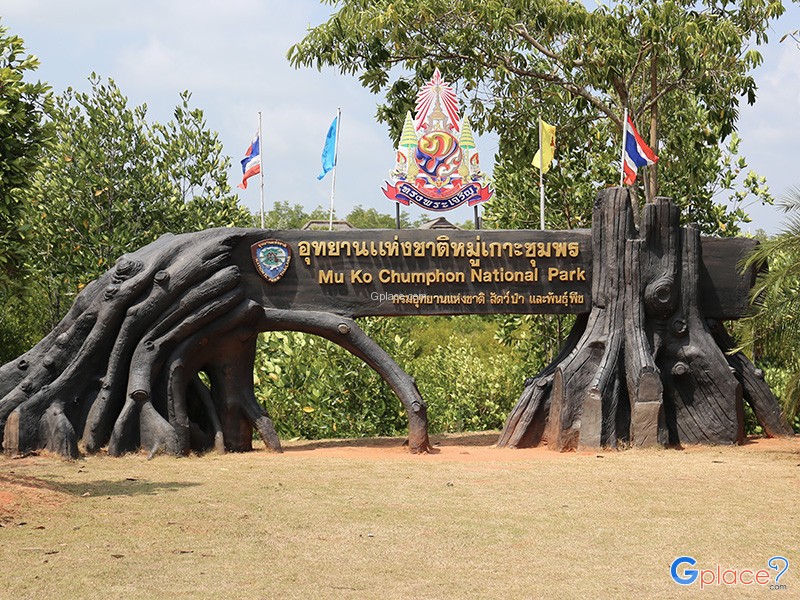
Mu Ko Chumphon National Park was officially established on February 24, 1999, covering a total area of 198,125 rai (approximately 324.42 square kilometers), with more than 80% of the area being marine.
Originally proposed as "Hat Sai Ri National Park," it was renamed to reflect the geographical features that include numerous small and large islands—over 40 in total.
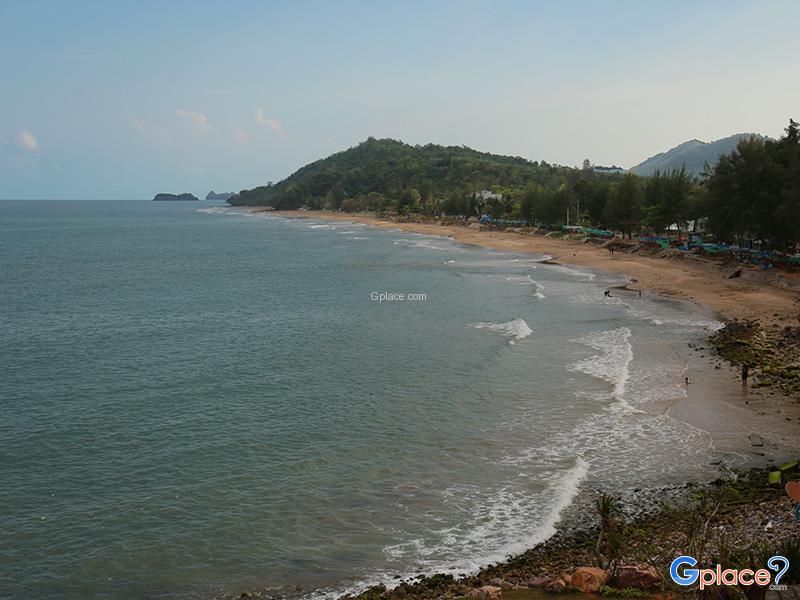
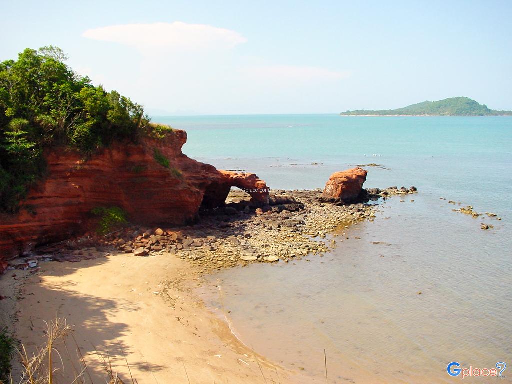
The park features a variety of ecosystems and landscapes across five districts of Chumphon Province: Mueang, Pathiu, Sawi, Thung Tako, and Lang Suan. The main landforms include coastal areas, bays and estuaries, islands (limestone islands), and mountains with tropical forests.
Attractions and Important Sites
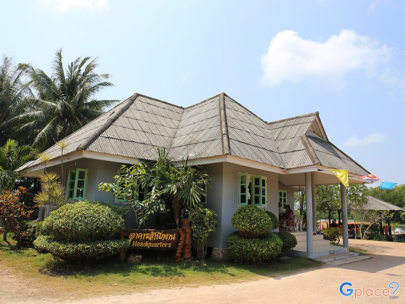
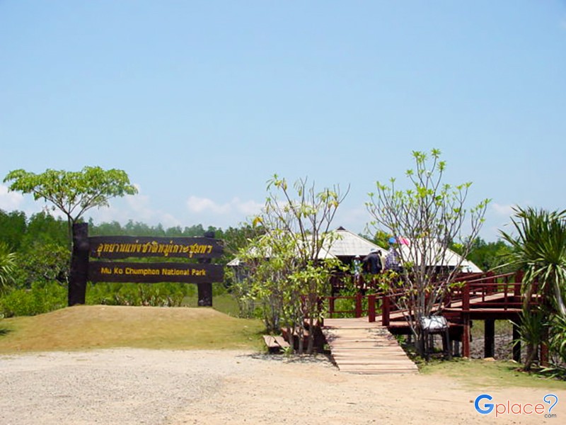
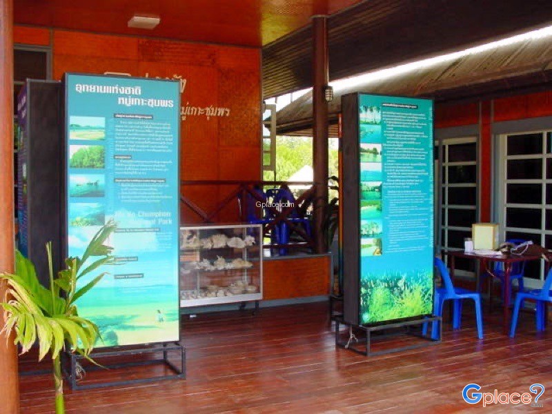
On Land (Park Headquarters)
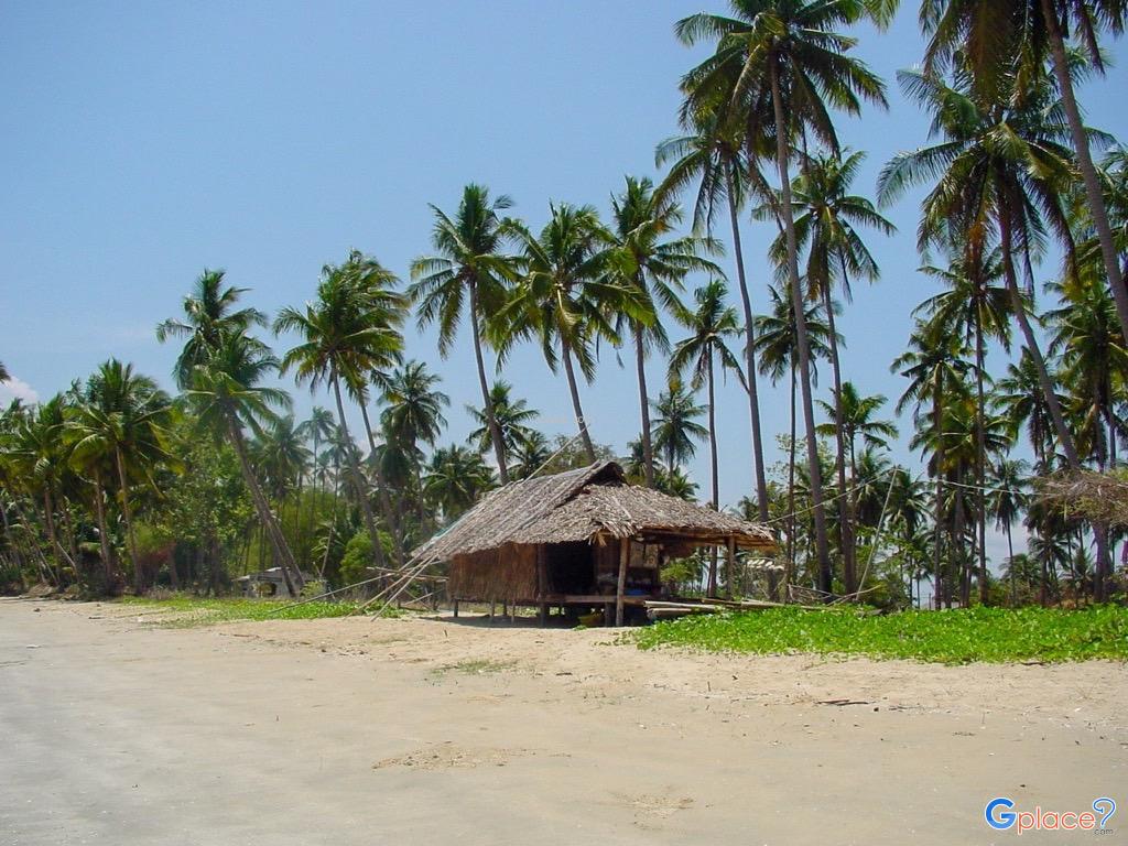
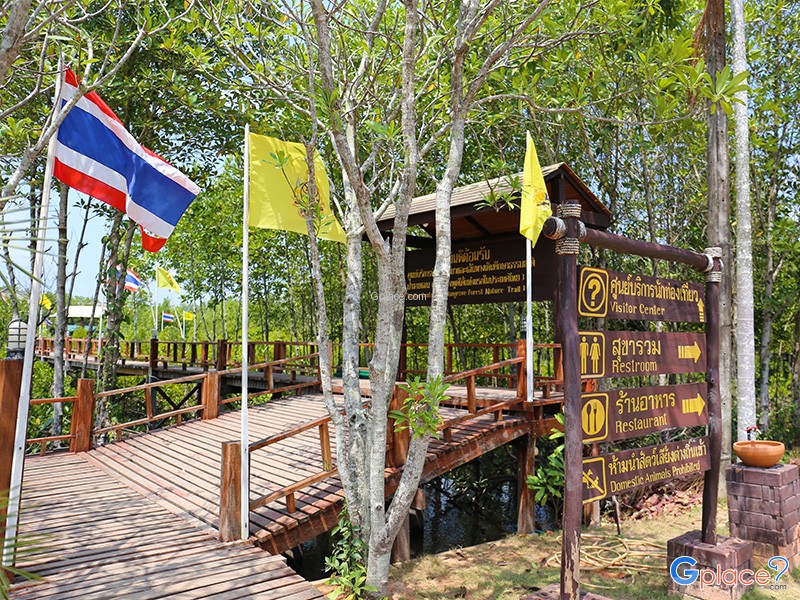
The park headquarters is located at Tha Chorakhe Canal, Hat Sai Ri Subdistrict. It serves as the gateway to the mangrove forest of Thung Kha-Sawi Bay, one of the most pristine mangrove areas registered under the Ramsar Convention.
Nature Trails
Wooden bridges and hanging bridges have been built for visitors to explore the mangrove ecosystem up close. Key plant species include the black mangrove and white mangrove, while wildlife includes various species inhabiting the mangrove forest.
Visitors can also enjoy kayaking or SUP (stand-up paddleboarding) through the mangrove tunnels, a popular ecotourism activity.
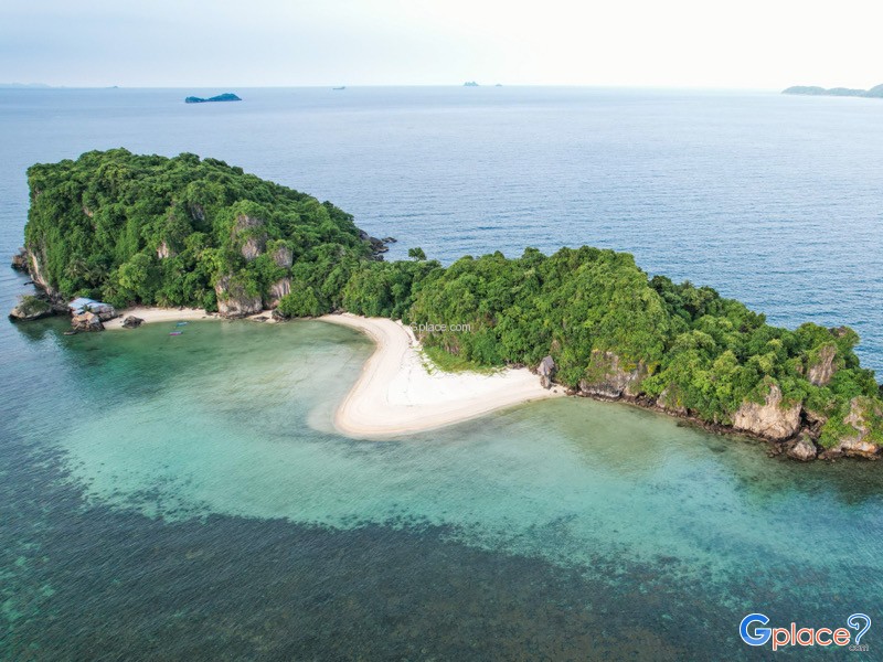
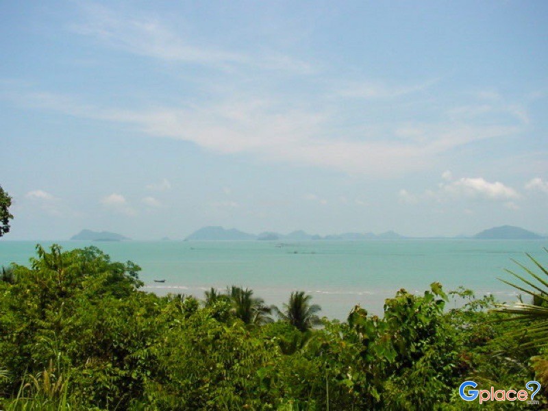
Islands and Marine Life
The park consists of several important islands that play a vital role in marine ecosystems:
-
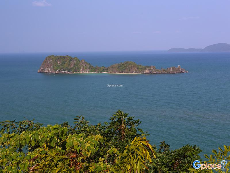
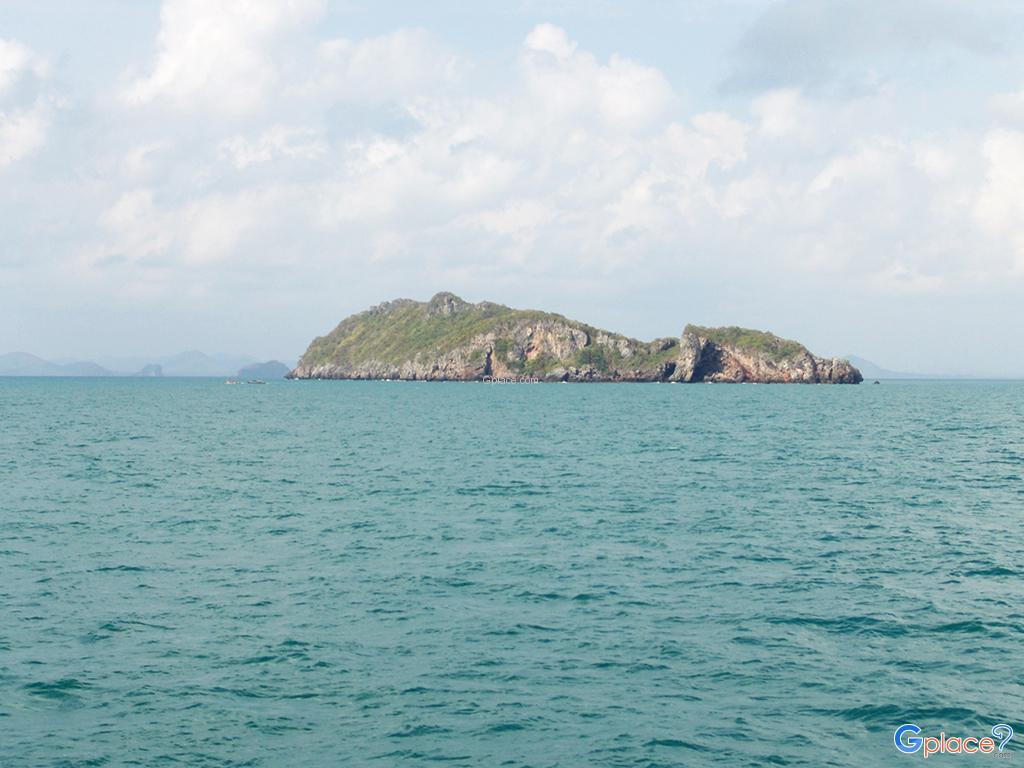
Koh Ngam Yai and Koh Ngam Noi: Limestone islands that are prime diving sites. Coral reefs are highly diverse, and geological features include underwater caves over 15 meters long, inhabited by sponges, corals, and various marine species. These islands are also prime locations for spotting whale sharks and blacktip reef sharks.
-
Koh Rangka Jiw (or Koh Lang Jiw): A bird’s nest concession island with historical importance, featuring inscriptions of King Rama V’s royal monogram carved into the cliffs.
-
Koh Thalu: Features a large natural rock tunnel forming a unique gateway, with coral reefs surrounding the island hosting diverse marine life including staghorn corals.
-
Koh Matra (or Koh Tang Kui) and Koh Thong Lang: Islands with surrounding coral reefs suitable for snorkeling and home to numerous fish species.
Biodiversity and Wildlife
The park is rich in biodiversity.
Marine diversity includes black coral, soft corals, sea fans, sea carpets, and large sea anemones. The reefs host the highest abundance and variety of fish and mollusks in the Gulf of Thailand.
Terrestrial and avian species include various seabirds such as herons, shorebirds, gulls, and swifts. Several islands serve as breeding grounds for swifts. Monkeys can also be found near the mangrove areas around the park headquarters.
How to Get There
- To reach the park headquarters: From Chumphon city, take Highway 4001 (Chumphon–Pak Nam), then continue on Highway 4119 to the Pak Nam Subdistrict junction. Turn right onto Highway 4098 for about 100 meters, then turn right onto Highway 4017 and continue 9 km to reach the park headquarters. The total distance from Chumphon city is approximately 23 km.
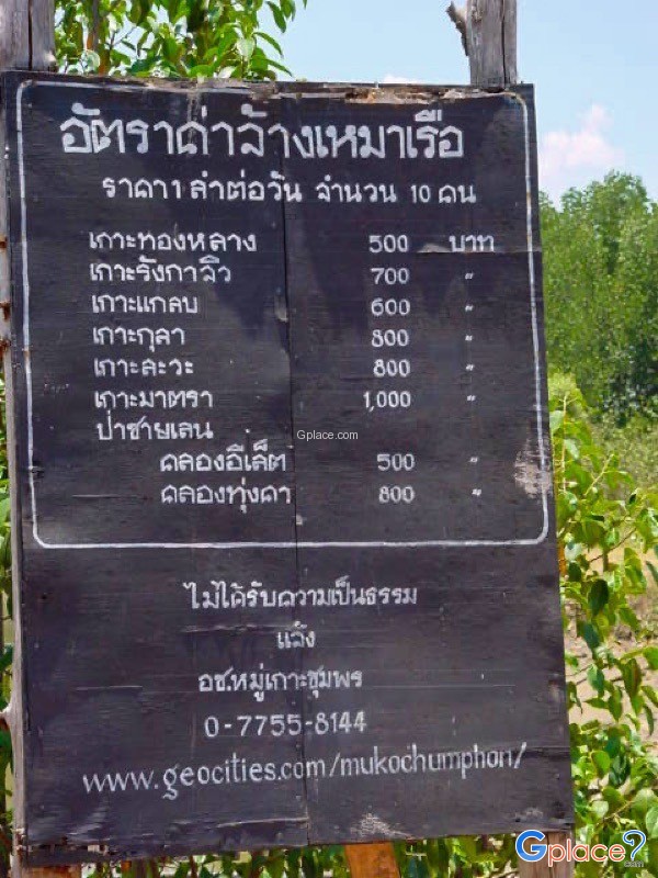
- To visit the islands: Visitors must rent a long-tail boat or speedboat from operators at Hat Sai Ri or contact the park’s tourist service center.
Travel Tips
- The best time for marine activities and diving is between February–April and October–November, when seas are calm, water clarity is excellent, and underwater visibility is high. Avoid the northeast monsoon season.
- The park provides accommodations and camping sites at the headquarters area.
- Key activities include snorkeling and diving, kayaking in the mangrove forest, nature trails, and island tours.
Admission Fee:
Entrance fees differ between Thai and foreign visitors as follows:
-
Thai: Adults 40 Baht / Children 20 Baht
-
Foreign: Adults 200 Baht / Children 100 Baht
Additional costs include renting boats to visit the islands (prices vary depending on the number of islands and type of boat such as long-tail or speedboat) and accommodation or camping fees if staying overnight within the park.
Opening Hours:
-
Park Headquarters and Tourist Service Center: Open daily 08:30 – 16:30
-
Marine Attractions and Islands: Open daily 08:00 – 18:00 (may adjust depending on weather conditions)
Mu Ko Chumphon National Park
![]() 1/4 Moo 5, Hat Sai Ri Subdistrict, Mueang District, Chumphon 86120 (National Park Headquarters)
Map
1/4 Moo 5, Hat Sai Ri Subdistrict, Mueang District, Chumphon 86120 (National Park Headquarters)
Map
![]() Closed today
Closed today![]()
Mon8.30 - 16.30
Tue8.30 - 16.30
Wed8.30 - 16.30
Thu8.30 - 16.30
Fri8.30 - 16.30
Sat8.30 - 16.30
Sun8.30 - 16.30
![]() https://www.facebook.com/Mukochumphonnationalpark?mibextid=ZbWKwL
https://www.facebook.com/Mukochumphonnationalpark?mibextid=ZbWKwL
![]() mukochumphon@hotmail.com
mukochumphon@hotmail.com
 5319
5319