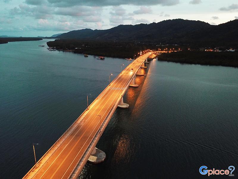


“A beautiful sea bridge connecting Koh Lanta Noi and Koh Lanta Yai, offering panoramic Andaman Sea views and stunning sunsets.”
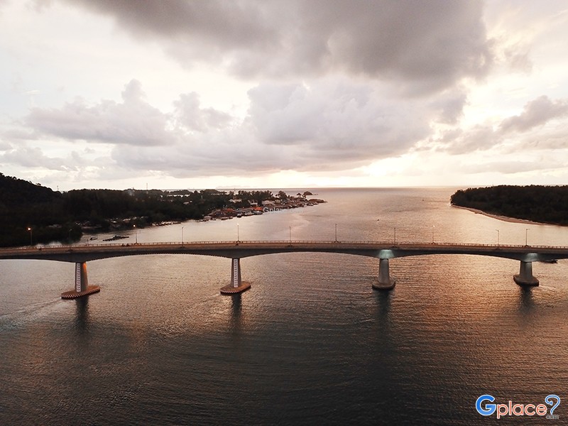
Siri Lanta Bridge is a sea bridge connecting Koh Lanta Noi and Koh Lanta Yai in Krabi Province. It is considered an important infrastructure project that has significantly improved transportation and tourism accessibility on Koh Lanta. The bridge was graciously named by Her Royal Highness Princess Maha Chakri Sirindhorn and was officially opened in 2016.
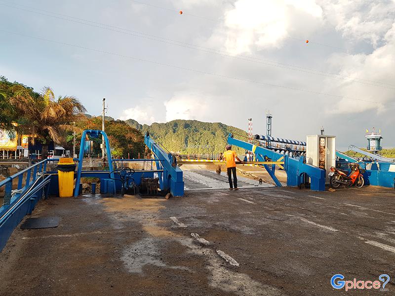
Before the bridge existed, tourists and local residents had to rely on car ferries to travel between the islands. The journey often took a long time and depended heavily on weather conditions, especially during the monsoon season when strong winds and waves could disrupt transportation. After Siri Lanta Bridge was opened, travel became faster, safer, and far more convenient for both residents and visitors.
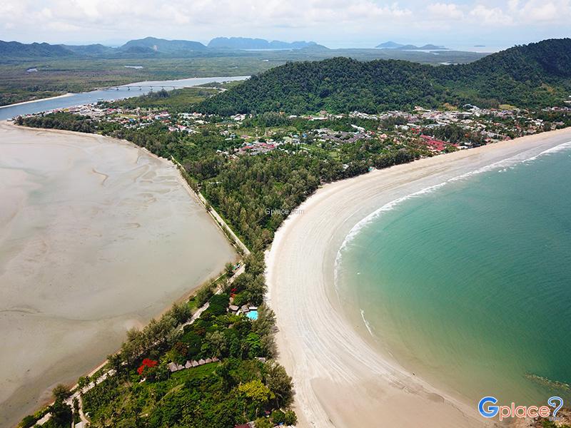
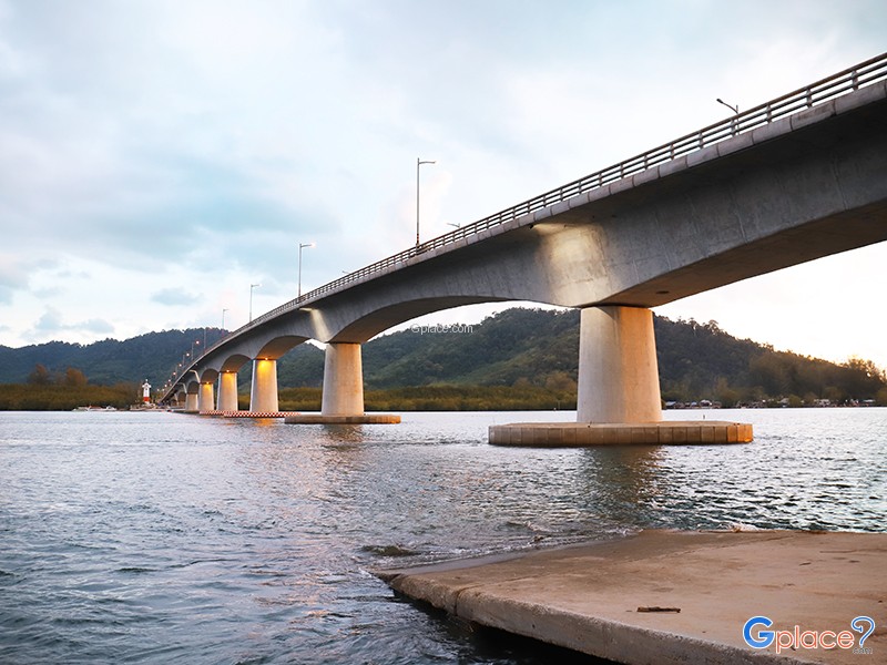
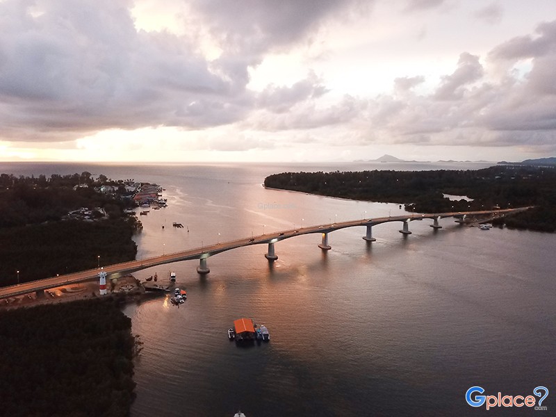
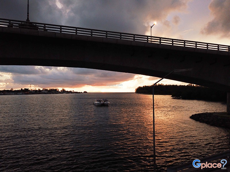
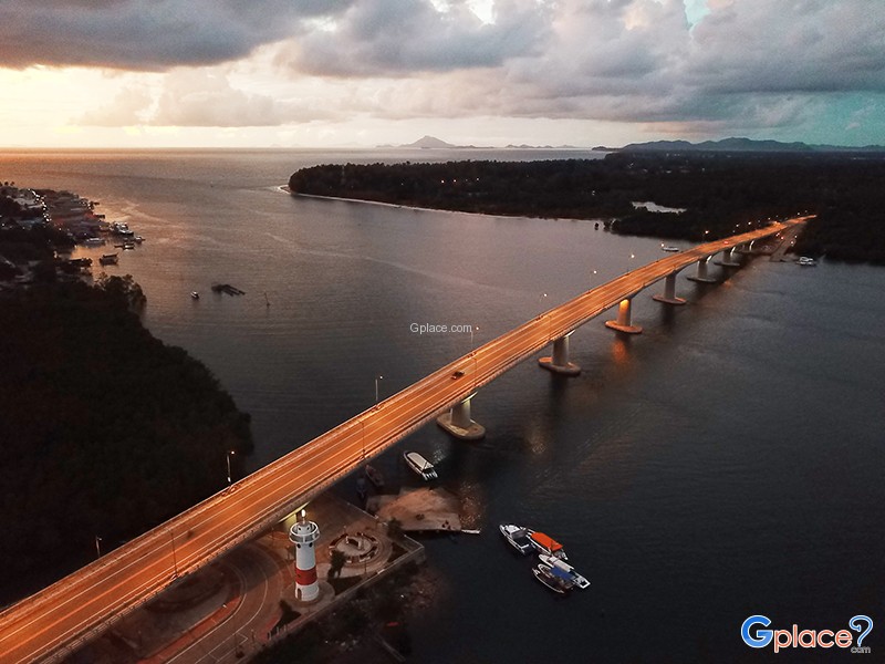
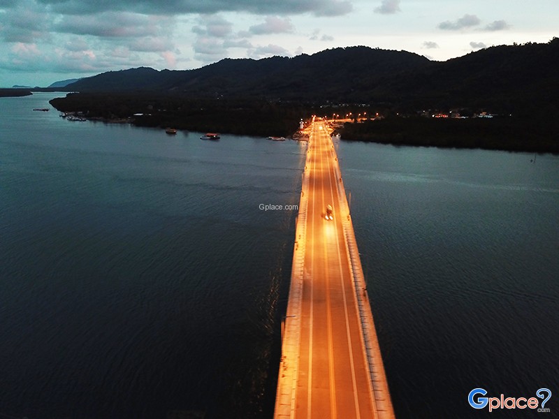
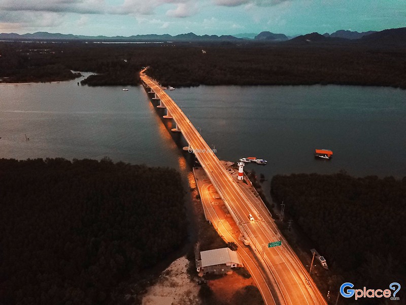
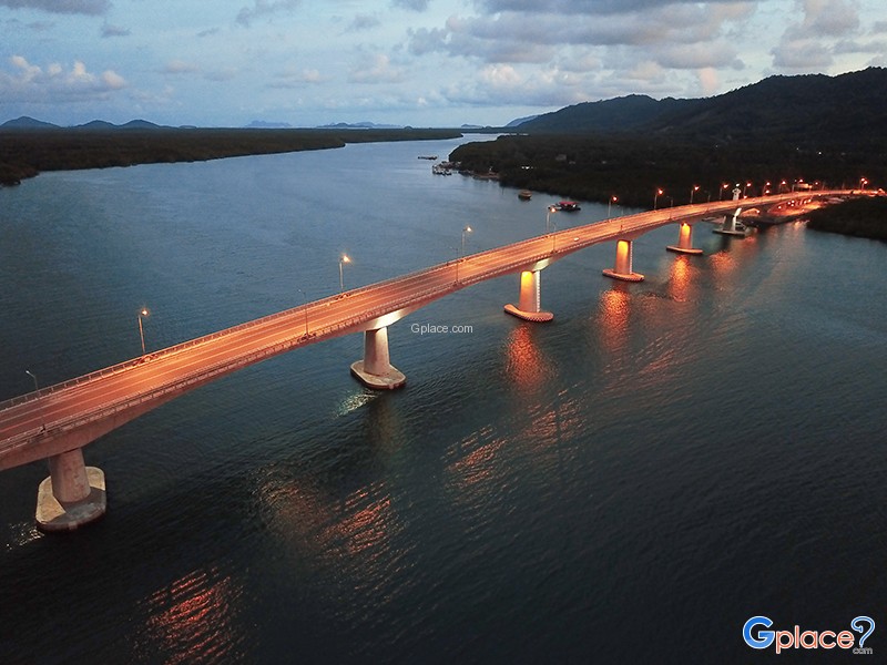
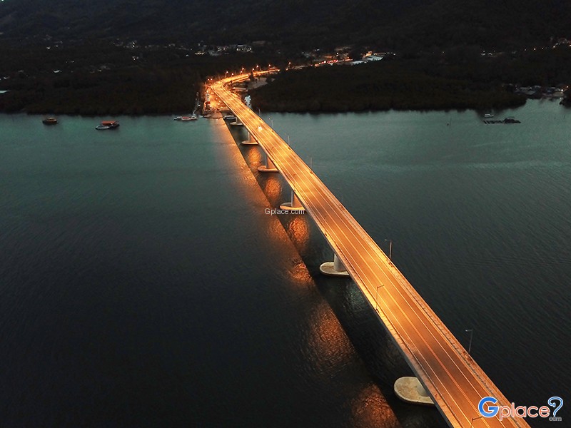
The bridge stretches approximately 650 meters across the Lao Osom Channel, linking the main roads of both islands. Its reinforced concrete structure features an elegant curved design that blends beautifully with the surrounding Andaman Sea landscape. The bridge accommodates cars, motorcycles, and pedestrians, with walkways on both sides for visitors who wish to enjoy the sea views up close.
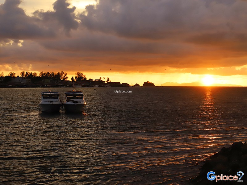
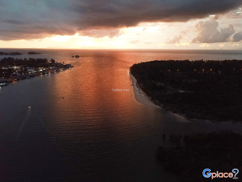
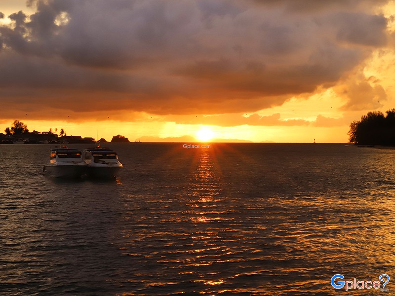
The center of the bridge is regarded as one of the most popular viewpoints on Koh Lanta, offering panoramic views of the sea, mangrove forests, fishing villages, and traditional long-tail boats traveling through the channel. During sunset, golden sunlight reflects across the ocean surface, creating a peaceful and picturesque atmosphere ideal for photography and relaxation.
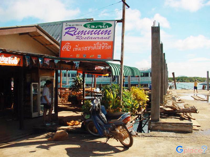
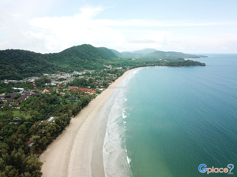
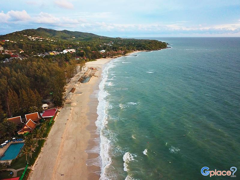
In addition to its transportation role, Siri Lanta Bridge has greatly supported the local economy and tourism industry. The improved accessibility allows travelers to reach major attractions more conveniently, including Klong Dao Beach, Phra Ae Beach (Long Beach), Klong Nin Beach, Mu Ko Lanta National Park, and Lanta Old Town. This has encouraged continuous growth in hotels, restaurants, local shops, and tourism-related businesses throughout the island.
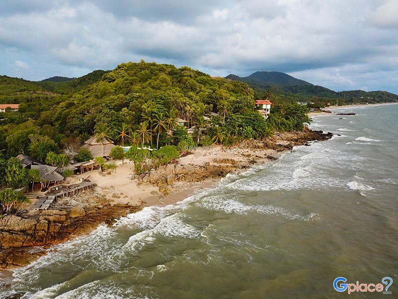
The surrounding area is also rich in coastal ecosystems and mangrove forests, which serve as important breeding grounds for marine life in the Andaman region. Visitors may occasionally spot seabirds, floating fish farms, and local fishing boats operating during the early morning and evening, reflecting the island’s traditional maritime lifestyle that remains closely connected to the sea.
At night, the bridge is illuminated with lights along its entire length, creating a peaceful and romantic atmosphere. Many travelers enjoy driving across the bridge after sunset or stopping briefly to admire the reflections of lights shimmering on the water.
Today, Siri Lanta Bridge is more than just a transportation route; it has become an important landmark of Krabi Province, symbolizing modern development while preserving the charm of nature, local culture, and the tranquil atmosphere of southern Thailand’s coastal communities. It remains a must-visit destination for travelers exploring Koh Lanta.
How to Get There
- From Krabi Town, take Highway No. 4 toward Khlong Thom District, then turn onto Highway No. 4206 heading toward Hua Hin Pier. Take the car ferry to Koh Lanta Noi, then continue along the island’s main road until reaching Siri Lanta Bridge, which connects to Koh Lanta Yai in the Sala Dan area.
Travel Tips
- The best visiting time is between 5:00 PM – 6:30 PM, when the sunset is most beautiful and the weather is cooler.
- Bring a camera or smartphone, as the bridge offers excellent photo opportunities during both daytime and sunset hours.
- Visitors can walk or cycle across the bridge while enjoying the scenery of the Andaman Sea.
- Park your vehicle in a safe area before stopping to walk or take photos on the bridge.
- On clear days, you can enjoy unobstructed views of the sea, fishing communities, and nearby coastal landscapes.
Admission Fee:
- Free of charge (no fee for vehicles or pedestrians)
Opening Hours:
- Open 24 hours daily (visiting during daylight or sunset hours is recommended for safety and the best scenery)
Siri Lanta Bridge
![]() Sala Dan, Ko Lanta, Krabi 81150
Map
Sala Dan, Ko Lanta, Krabi 81150
Map
![]() Open now
Open now
![]()
 86
86