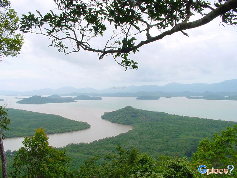
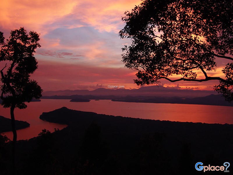

“Sunset viewpoint overlooking the Kraburi–La-un rivers and Myanmar, with traces of World War II history.”
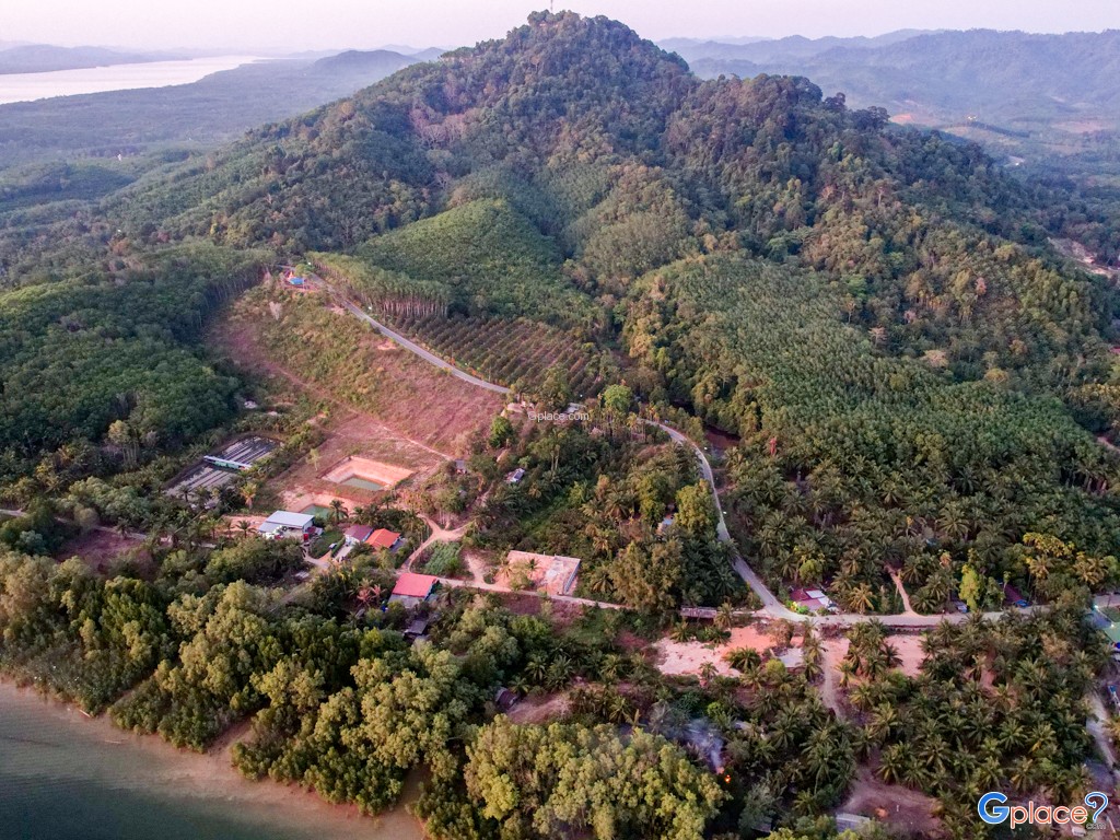
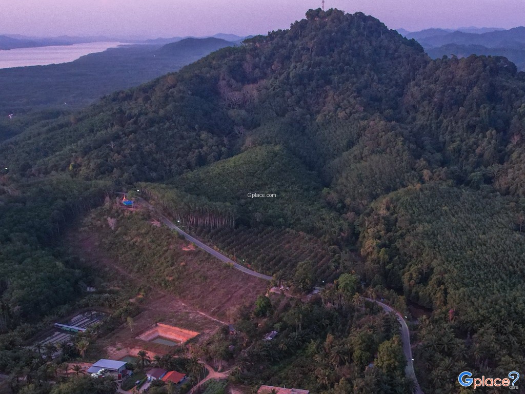
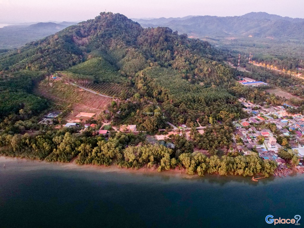
Khao Fachi is located in La-un Nuea Subdistrict, La-un District, Ranong Province, with an elevation of approximately 259 meters above sea level. The mountain’s distinctive rounded shape resembles an upside-down traditional food cover (“fachi”), which is the origin of its name.
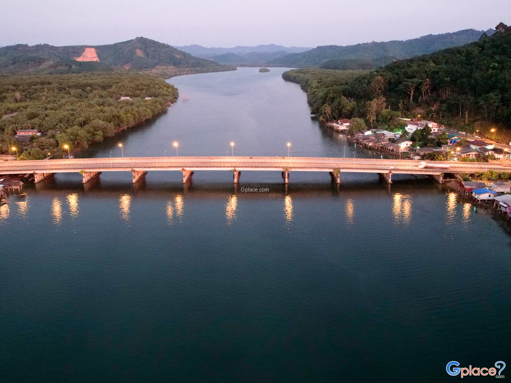
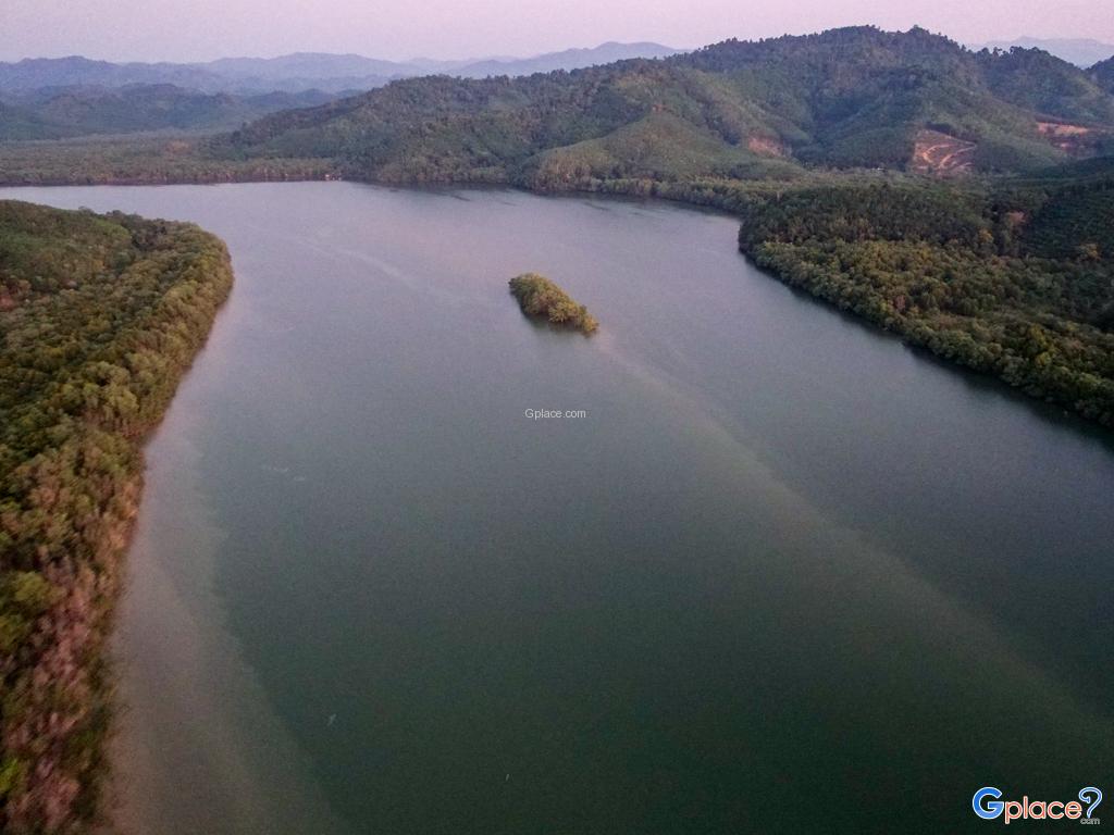
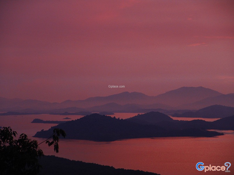
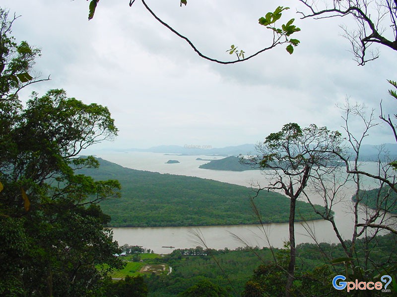
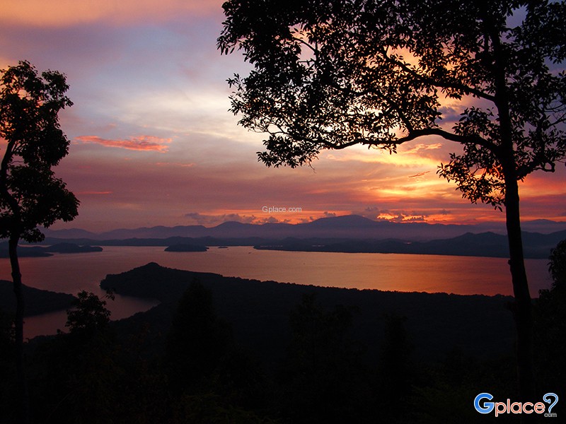
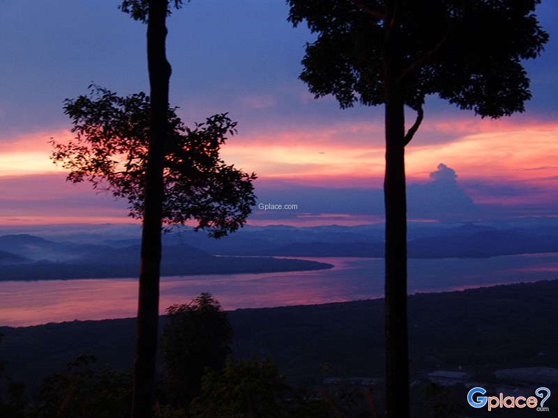
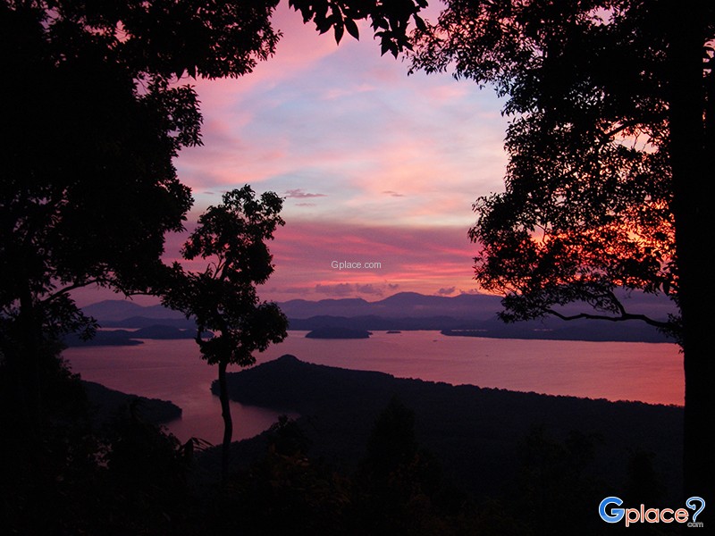
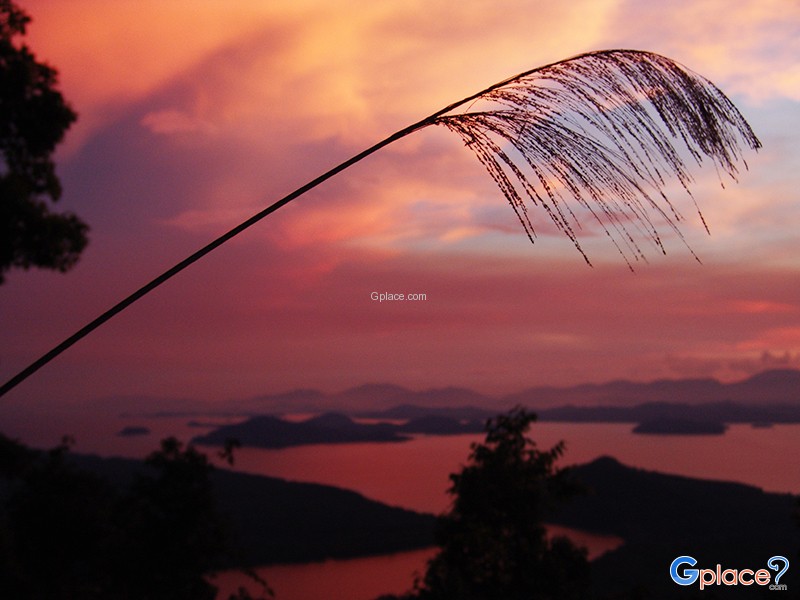
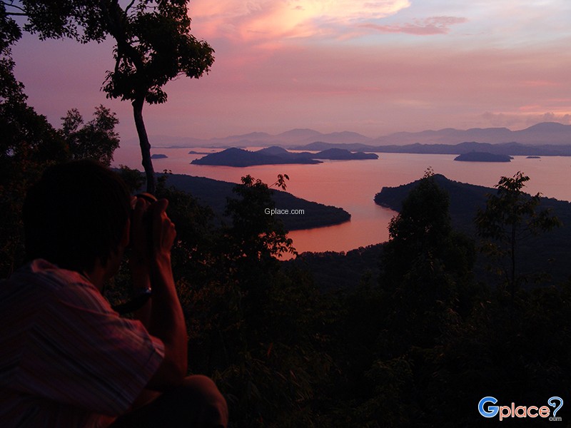
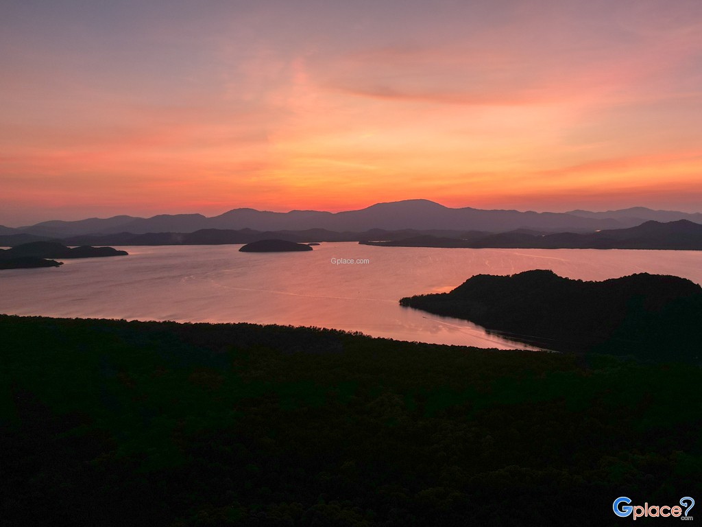
The summit serves as a prominent viewpoint in the province, offering clear views of an estuary landscape. This is where the Kraburi River meets the La-un River before flowing into the Andaman Sea. During low tide, sandbars emerge, forming intricate natural patterns along the winding waterways that change over time.
The Kraburi River plays an important role as a natural border between Thailand and Myanmar. From the viewpoint, visitors can enjoy panoramic scenery of both countries, including mangrove forests, mountain ranges, and riverside communities on the Myanmar side—making this location uniquely distinctive.
Ecologically, the surrounding area is part of a rich mangrove forest ecosystem, which serves as a nursery for marine life and plays a vital role in coastal protection and carbon absorption. Visitors can experience both natural beauty and environmental significance in one place.
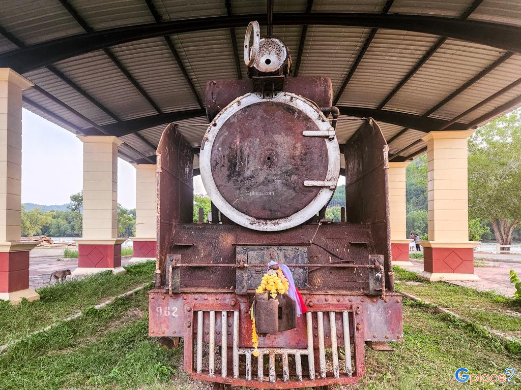
Historically, Khao Fachi is linked to World War II, when the area was used as a strategic route and base by Japanese forces. Remnants such as shelters, old transport routes, and connections to the unfinished Kra Isthmus Railway project can still be found nearby, reflecting the area's historical importance.
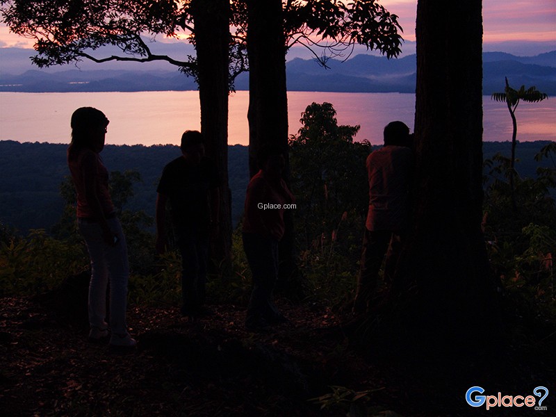
The atmosphere at the summit is peaceful, with cool breezes throughout the day. It is especially popular for sunset viewing, as the sunlight reflects beautifully over the rivers and mangrove forests. In certain seasons—particularly after rainfall or during the late rainy to early cool season—mist may form over the water, adding a soft and scenic dimension to the landscape.
Although a telecommunications relay station is located at the top, most of the area remains natural and accessible. A paved road leads to the summit, making it suitable for all types of visitors, including photographers, nature lovers, and those seeking a quiet retreat.
How to Get There
Travel Tips
Admission Fee:
- Free
Opening Hours:
- Open daily from 06:00 AM – 07:00 PM
Khao Fa Chi
![]() La-un, Ranong 85110
Map
La-un, Ranong 85110
Map
![]() Closed today
Closed today![]()
Mon6.00 - 19.00
Tue6.00 - 19.00
Wed6.00 - 19.00
Thu6.00 - 19.00
Fri6.00 - 19.00
Sat6.00 - 19.00
Sun6.00 - 19.00
![]() https://www.thai-tour.com/thai-tour/south/ranong/data/place/pic_kao-fa-chee.htm
https://www.thai-tour.com/thai-tour/south/ranong/data/place/pic_kao-fa-chee.htm
![]()
 8800
8800