


สถานที่ท่องเทียว รูปหัวใจ เมืองไทย
 1514
1514
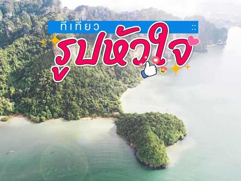 พอจะเก็บได้เท่านี้ไปก่อน 3 สถานที่ท่องเทียว รูปหัวใจ เมืองไทย
แล้วแอดฯสัญญาว่าจะไปเก็บภาพจุดอื่นๆมาให้เพิ่ม....
พอจะเก็บได้เท่านี้ไปก่อน 3 สถานที่ท่องเทียว รูปหัวใจ เมืองไทย
แล้วแอดฯสัญญาว่าจะไปเก็บภาพจุดอื่นๆมาให้เพิ่ม....

Phu Kradueng National Park is a sandstone table-top mountain shaped like an inverted bell, covering approximately 348 square kilometers (217,575 rai). It was declared Thailand’s second national park in 1959 (B.E. 2502).
The summit plateau is about 60 square kilometers, serving as the main area for overnight stays and nature exploration. The Wang Kwang Visitor Center provides accommodation, c...
read more

Bang Boet Beach is a hidden gem located in the southern part of Prachuap Khiri Khan, within the Bang Saphan Noi District. It is well-known among travelers who cherish tranquility and wish to escape the crowds of more commercial beaches. This beach gracefully curves along the sea, distinguished by its clean, off-white sand and clear seawater during certain periods of the year. The overall atmo...
read more

Kaeo Yai Island is a small island located off the coast of Phuket province, near Laem Phromthep in the Rawai area of Phuket Town. Separated from the main Laem Phromthep viewpoint, it's a charming rocky island with a small area surrounded by the azure Andaman Sea. Although not yet considered a top destination, the island remains highly significant, ideal for beginners and offering a clear, r...
read more

Railay East is a geographically distinct part of the Railay peninsula, characterized by its towering limestone karsts that isolate it from mainland Krabi, making it accessible solely by boat. Unlike its western counterpart, Railay East features a muddy coastline influenced by sedimentary deposits, which has fostered a flourishing mangrove ecosystem. During low tide, the receding waters reveal expa...
read more
5
Ko Ma

Ko Ma (Koh Ma) is one of the prominent natural destinations of Koh Phangan, especially the “Separated Sea” phenomenon that reveals a long sandbar connecting from Mae Haad Beach to the island during low tide. Tourists can walk across it closely, which is a rare experience to find in Thailand.
Unique Topography The sandbar of Ko Ma is over 300 meters long and slightly curved. The changing water leve...
read more
กำลังเป็นที่นิยม
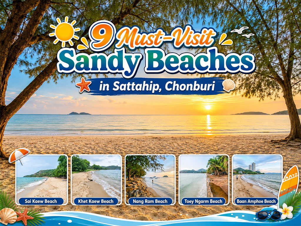
Attractive Beaches in Sattahip, Chonburi
For those looking to escape the hustle and bustle of Pattaya and experience calm..
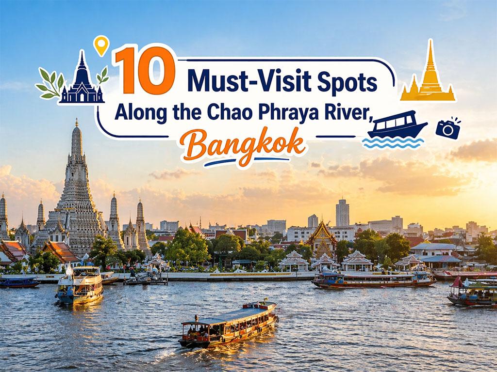
10 Must-Visit Spots Along the Chao Phraya River, B
Exploring the Chao Phraya River offers one of the most complete experiences of B..

8 World Heritage Sites of Thailand
Tracing Ancient Civilizations and Invaluable Forests Recognized by UNESCO Thaila..
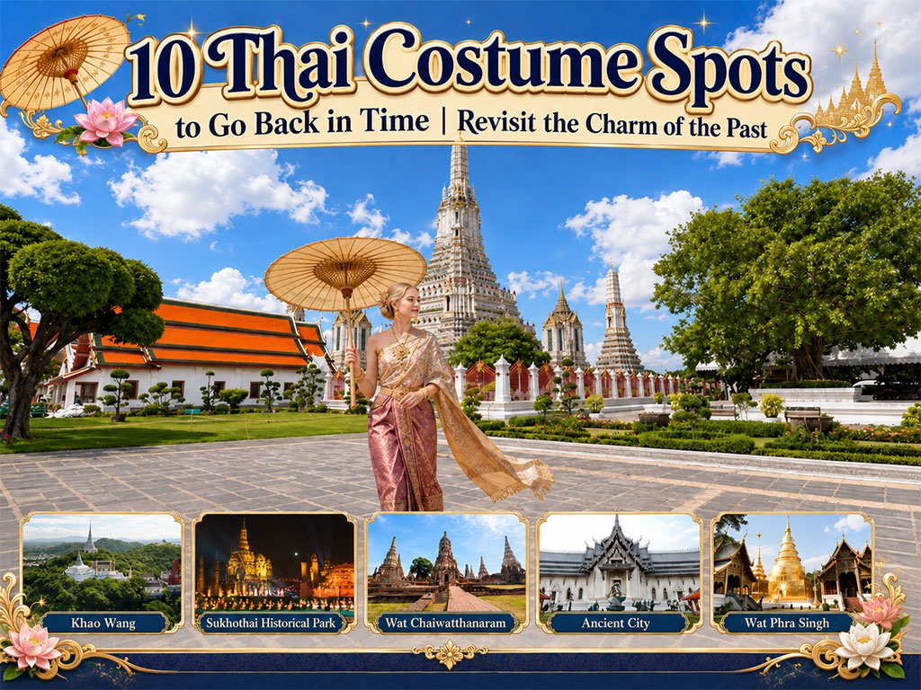
10 Thai Costume Spots to Go Back in Time
Wearing traditional Thai costume and taking photos at beautiful places is more t..
Recommend trips
- 10 Sacred Buddhist Sites Thai Temples in India–Nep
- The Four Holy Pilgrimage Sites
- Dream Destinations in Switzerland
- Pilgrimage to the Sacred Sites
- Trip to Bhutan
- Must-Visit Check-in Spots in London
- Attractive Beaches in Sattahip, Chonburi
- Top Paris Check-in Spots
- 10 Thai Costume Spots to Go Back in Time
- 10 Must-Visit Spots Along the Chao Phraya River, B
- 8 World Heritage Sites of Thailand
- The Ultimate Ancient Villages in Japan
- Watsons Bay Half-Day Trip
- 10 Must-Visit Places in Waterford
- 10 Best Shopping Destinations in Bangkok
- EBC - World-Class Trekking Route
- 10 Must-Visit Check-ins in Uthai Thani
- Giant Buddha Landmarks in Thailand
- 10 Must-Check-In Spots in Ireland
- Top 10 Must-Visit Spots in Pattaya