10 ที่สุดยอดที่เที่ยว หน้าฝน ประจำเดือนกรกฏาคม
 8499
8499
 10 ที่เที่ยว ช่วงหน้าฝน ประจำเดือน กรกฎาคม ชมธรรมชาติ ตามกระเเสโลกออนไลน์
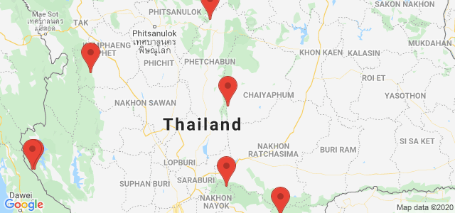
Phu Tubberk The highest peak in Phetchabun. Just opened for tourists to explore the area soon. But it can be amazing to those who visit so much that they become one in UNSEEN THAILAND you should not miss visiting. At an elevation of 1,768 meters above sea level Cold temperatures all year on the peak. And cabbage farm The vast eye. Eat at the top of the mountain. Phu Kradueng is considered one...
read more
Pang Sida National Park is part of the Dong Phayayen–Khao Yai Forest Complex, a natural World Heritage Site internationally recognized for its outstanding biodiversity and ecological importance. The park is characterized by vast and fertile forest areas that serve as important watershed sources for eastern Thailand.
One of the park’s most iconic attractions is Pang Sida Waterfall, a la... read more
One of the park’s most iconic attractions is Pang Sida Waterfall, a la... read more
Khao Yai National Park is Thailand’s first national park, established on September 18, 1962, covering an area of over 2,168 square kilometers across four provinces: Nakhon Ratchasima, Prachinburi, Nakhon Nayok, and Saraburi. In 2005, it was declared a UNESCO World Heritage Site as part of the Dong Phayayen–Khao Yai Forest Complex.
The park features a mix of evergreen forests, grassland... read more
The park features a mix of evergreen forests, grassland... read more
Kaeng Krachan National Park is one of Thailand’s most significant natural World Heritage sites, recognized for its outstanding ecological value in Southeast Asia. Covering more than 2,900 square kilometers across Phetchaburi and Prachuap Khiri Khan provinces, the park serves as a major watershed that feeds the Phetchaburi and Pranburi rivers, playing a crucial role in sustaining agriculture,...
read more
Noen Nangphaya Viewpoint is situated on a seaside hill in the Na Yai Am district of Chanthaburi Province. It is considered a major landmark and the most beautiful viewpoint in the Eastern region. Noen Nangphaya is part of the Chalerm Burapha Chonlathit Road, which has been selected by the Tourism Authority of Thailand as one of the Dream Destinations that must be visited at least once.
The definin... read more
The definin... read more
Khlong Lan National Park covers approximately 187,500 rai in Tambon Khlong Lan Phatthana, Tambon Khlong Nam Lai, and Tambon Pong Nam Ron, Khlong Lan District, Kamphaeng Phet, about 58 km from the provincial town. Established as Thailand’s 44th national park on December 25, 1982, it is an important natural area in western Thailand with mountainous terrain and serves as the source of several r...
read more


