


ปากน้ำ เมืองไทย
 6071
6071
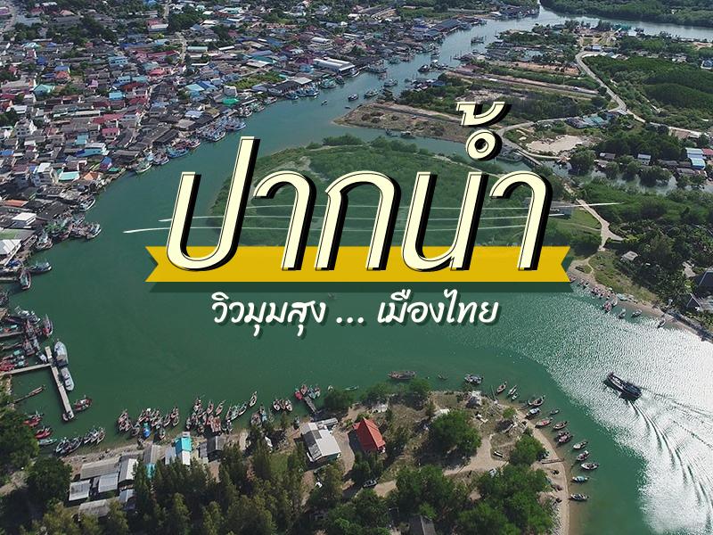 วิวมุมสุง ปากน้ำ เมืองไทย


Pranburi River Mouth is the area where the Pranburi River flows into the Gulf of Thailand, creating a rich coastal area that hosts an historic fishing community which still largely maintains its traditional way of life. This area is not only the livelihood source for the locals but also a central point for selling fresh seafood brought ashore by fishing boats daily. Visitors can experience the bus...
read more

Tha Chalom Fishing Village is a historic community of great national significance, as it was the site of Thailand’s first sanitary district established during the reign of King Rama V (King Chulalongkorn). This marked an important beginning in the country’s modern urban development. Today, the area continues to preserve the classic atmosphere of traditional fishing life. Rows of colorf...
read more


The City Observatory is a modern landmark located along the Chao Phraya River. It is designed as both an observation point and a vertical museum that presents the history of Pak Nam (Samut Prakan) through an immersive learning experience.The concept of this place is to tell the story of Samut Prakan from the past to the future through interactive experiences, allowing visitors to learn about the c...
read more


Pak Nam Prasae (Pak Nam Prasae) is a historic riverside community located at the mouth of the Prasae River, flowing into the Gulf of Thailand. The area has long been an important maritime trading and fishing settlement since the Ayutthaya era. It once served as a key coastal trade route on Thailand’s eastern seaboard, forming a unique riverside community characterized by traditional wooden h...
read more


Chaloem Phra Kiat Pak Nam Khaem Nu Bridge is a vital structure that spans the mouth of the Khaem Nu River just before it flows into the Gulf of Thailand. The bridge is part of the "Chaloem Burapha Chonlathit Road," a coastal route in Eastern Thailand highly popular among tourists. The bridge connects the area of Chao Lao Beach with nearby attractions like Laem Sing. Driving along this route, visit...
read more


Taksin Maharat Bridge It is a bridge that spans the mouth of the Chanthaburi River in Laem Sing District, connecting Pak Nam Laem Sing Sub-district and Bang Kachai Sub-district on the opposite bank. It is the longest bridge in the Eastern region, with a length of 1,060 meters.
The Taksin Maharat Bridge is considered part of the "Chaloem Burapha Chonlathit Road," which is the longest and most ...
read more


Wat Satthatham is located in Bang Chao Khang Subdistrict, Mueang Samut Songkhram District. It is an ancient temple of the Mon community who migrated and settled in the area near the mouth of the Mae Klong River around 1883. The temple has long served as the spiritual center of the local community, playing an important role in religious practices, cultural traditions, and daily life up to the prese...
read more

Bang Tabun Estuary is a strategically significant ecological junction where freshwater rivers meet the Gulf of Thailand, weaving a complex and magnificent tapestry of biological diversity. It is a crown jewel of the Scenic Route (SS.2021), recognized as one of Thailand's most breathtaking coastal drives. Visitors are immediately captivated by the sight of ancient wooden houses lining the waterfron...
read more

Thawan Chai Beach is located in Village No. 3, Ban Tha Phae, Lamae Subdistrict, Lamae District, Chumphon Province. It is the last beach of Chumphon Province before entering Surat Thani Province. The beach is wide and stretches for a long distance, with smooth white sand, clean water, and suitable for swimming.
The overall atmosphere of Thawan Chai Beach is quiet, ideal for visitors who want to esc...
read more


Phum Riang Community & Laem Pho Beach is a destination that beautifully blends history, culture, and coastal lifestyle in Chaiya, Surat Thani. Located about 6 kilometers from Chaiya town, this historic community dates back to the Srivijaya era and still preserves its traditional charm.
A Heritage of Silk Weaving Phum Riang is renowned for its traditional silk weaving, especially the intricate ...
read more
11
Pak Nam Tapi

Pak Nam Tapi (Tapi River Estuary) is the important meeting point between the Tapi River and the Gulf of Thailand. It is considered a highly fertile estuary ecosystem, making this area an important breeding ground for coastal aquatic animals in the South.
A key feature of this area is that it is a source of "Surat Thani Oysters" which are famous nationwide. Due to the nature of brackish water (a mi...
read more
12
Koh Kho Khao


Koh Kho Khao is one of the most unique destinations in Phang Nga Province, distinguished by its unusually flat landscape—unlike the mountainous islands typically found in the Andaman region. The island features expansive grasslands, mangrove forests, and coconut plantations, creating a tranquil and open atmosphere.
The western coastline stretches for several kilometers along the Andaman Sea,...
read more


Samed Nang Chee Viewpoint is one of the most awe-inspiring sunrise viewpoints in southern Thailand, located in Ban Khlong Kian, Phang-nga. Perched above Phang-nga Bay, the viewpoint provides a panoramic 180-degree vista of limestone karsts and scattered islands across the calm sea. As the sun rises from behind the cliffs, the golden light dances on the misty bay, offering an unforgettable spectacl...
read more


Klong Jilad Pier is the primary commercial passenger terminal managed by the Krabi Provincial Administrative Organization. Acting as the most significant "Gateway to the Andaman Sea," it serves as the essential link between the Thai mainland and the world-renowned Phi Phi Islands. Designed to meet international maritime standards, the pier accommodates a massive volume of global travelers an...
read more


Laem Kruat Pier, situated in Khlong Khanan Sub-district of Nuea Khlong District, Krabi, serves as a critical strategic and logistical hub for the coastal communities. It is recognized as the primary and most convenient gateway to the island clusters of Nuea Khlong, specifically Koh Jum and Koh Pu—which are technically two parts of the same island. Located approximately 45 kilometers from Kra...
read more


Klong Pak Pra is one of the most distinctive natural landscapes in Phatthalung Province, characterized by a wide water basin formed by the convergence of several canals before flowing into Thale Noi, part of the greater Songkhla Lake system. This area is exceptionally rich in natural resources and biodiversity, forming an important wetland ecosystem at both national and international levels. Thale...
read more
17
Pakbara Pier


Pakbara Pier is the most important maritime transport hub in Satun Province and serves as the main gateway to Koh Lipe, Tarutao National Park, the Adang–Rawi Islands, and nearby archipelagos. It is designed with modern management systems to efficiently support both Thai and international travelers.
Complete Convenience Facilities
Inside the passenger terminal, there is a well-organized check...
read more
กำลังเป็นที่นิยม

12 Tourist Attractions Doi Inthanon
Doi Inthanon is the highest mountain in Thailand, located within Doi Inthanon Na..

10 Must-Visit Checkpoints in Nan
This route comprehensively gathers Nan's important historical, religious, artist..

Chiang Mai's Ultimate National Parks
Chiang Mai is not just about temples and Lanna culture; it also boasts vast fore..
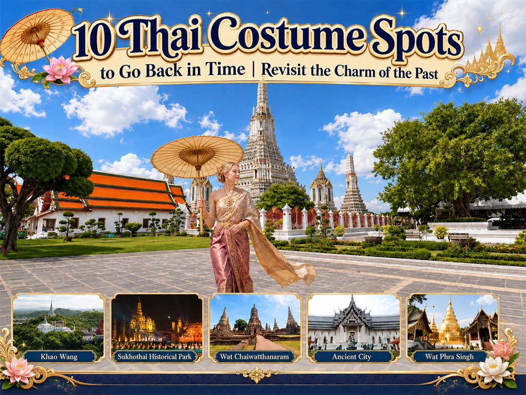
10 Thai Costume Spots to Go Back in Time
Wearing traditional Thai costume and taking photos at beautiful places is more t..
Recommend trips
- 10 Thai Costume Spots to Go Back in Time
- The Four Holy Pilgrimage Sites
- 10 Must-Visit Checkpoints in Nan
- Dream Destinations in Switzerland
- 12 Tourist Attractions Doi Inthanon
- Pilgrimage to the Sacred Sites
- Trip to Bhutan
- 10 Sacred Buddhist Sites Thai Temples in India–Nep
- Top Paris Check-in Spots
- Must-Visit Check-in Spots in London
- The Ultimate Ancient Villages in Japan
- 10 Must-Visit Spots Along the Chao Phraya River, B
- 8 World Heritage Sites of Thailand
- Chiang Mai's Ultimate National Parks
- Watsons Bay Half-Day Trip
- 10 Must-Visit Places in Waterford
- 10 Best Shopping Destinations in Bangkok
- 10 Must-Check-In Spots in Ireland
- Top 10 Must-Visit Spots in Pattaya
- Japan Bucket List: 20 Places You Must Visit Once i