


แลนด์มาร์คท่องเที่ยว ภาคตะวันออก ทะเลไทย มุมสูง
 4206
4206
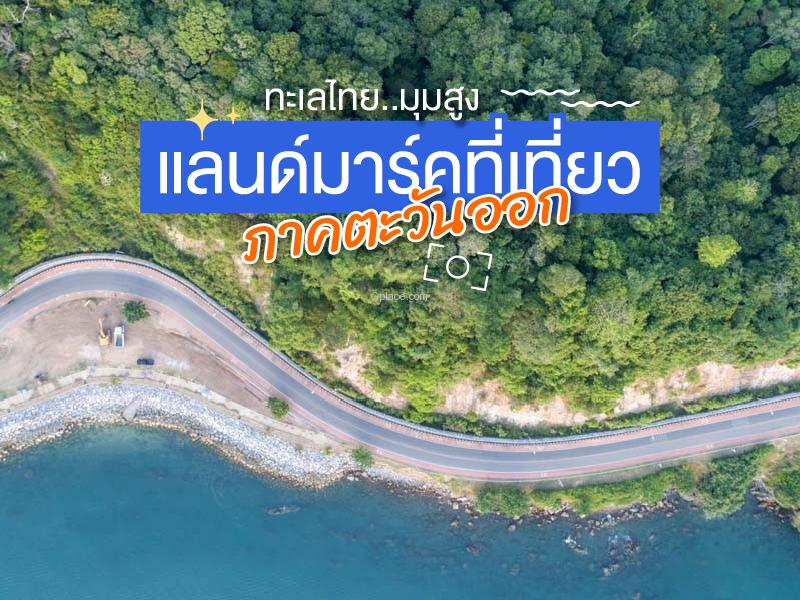 แหล่งท่องเที่ยวสำคัญ ภาพมุมสูง ภาคตะวันออก หาดูได้ยาก


Chanthaboon Waterfront Community is an old community more than 300 years old, dating back to the reign of King Narai the Great. With its suitable location and convenient transportation, many Thai–Chinese and Vietnamese people settled here, including government officials, merchants, and wealthy families, leading to a cultural blend of people of different ethnicities and religions.
The Ban Lum...
read more


Noen Nangphaya Viewpoint is situated on a seaside hill in the Na Yai Am district of Chanthaburi Province. It is considered a major landmark and the most beautiful viewpoint in the Eastern region. Noen Nangphaya is part of the Chalerm Burapha Chonlathit Road, which has been selected by the Tourism Authority of Thailand as one of the Dream Destinations that must be visited at least once.
The definin...
read more


Perid Island an island with a fishing village community, located southeast of Chanthaburi, in Ko Predit Subdistrict, Laem Singh District. It is a small island connected to the mainland. Most of the area is surrounded by the sea, with Chaloem Burapha Chonlathit Road serving as the connecting route. The terrain consists of hills, cliffs, and rocky areas. To the north and east, there is a fishing com...
read more

Nang Rum Island is a small island located in the waters off Chanthaburi Province. It is well-known among travelers who seek tranquility and highly preserved natural environments. The island's beaches feature spotlessly clean and exceptionally fine white sand, which sharply contrasts with the crystal-clear, turquoise sea water the clarity often allows visibility down to the seabed. This m...
read more
5
Pattaya


Pattaya was once just a small fishing village before undergoing rapid development to become the world-renowned special local administrative zone it is today. Pattaya possesses dual economic potential outstanding tourism sector and being part of the Eastern Economic Corridor (EEC), making it a crucial center for both relaxation and investment.
The area of Pattaya City can be divided into four ...
read more


Chonlamarkwithi 84th Anniversary Bridge locally known as the Seaside Road, was initially developed to alleviate traffic congestion in Chonburi city. However, due to its breathtaking scenery, it quickly transformed into a major tourist destination. The bridge is designed to stand high above the shoreline, stretching parallel to Chonburi’s municipal boundaries toward Bang Saen. Along the ...
read more

Koh Kram Noi Island is a small island located near Koh Kram Yai, under the supervision of the Royal Thai Navy. The distinctive charm of this island lies in its undisturbed natural state; as it is not a primary stop for large tour boats, Koh Kram Noi maintains an exceptionally quiet and private atmosphere. The beaches boast fine, creamy white sand that contrasts beautifully with the gradient shades...
read more

White Sand Beach is located on the western coast of Koh Chang, Trat Province. It is a coastal area where the shoreline extends parallel to mountainous terrain, reflecting the overall geographical characteristics of Koh Chang. The beach lies at the interface between the sea and tropical rainforest, which is a dominant natural feature of the island. The area behind the beach consists of steep ...
read more


Klong Prao Beach is a large, continuous beach stretching for several kilometers, located in the central part of Koh Chang's west coast. The standout geography of this beach is its vast width_ and very gentle slope. During low tide, a massive sand-flat emerges, providing ample space for walking or recreational activities. Another natural highlight is Klong Prao, the main canal that flows f...
read more

Kai Bae Beach is located on the western coast of Koh Chang. It is an area with a unique character and a fascinating historical background. The name Kai Bae sounds unusual even to Thais. According to local folklore, Kai means wild chicken, which used to be abundant in this area. Bae is a local dialect or an old accent that evolved from the word Ploi, meaning to release or to let spread. T...
read more
11
Koh Yuak

Koh Yuak is a small islet located west of Koh Chang, directly across from Kai Bae and Klong Prao beaches. Despite being uninhabited and having no major facilities, Koh Yuak is highly regarded as one of the best snorkeling spots near the Koh Chang shore. Characterized by rocky outcrops and small white sand patches, the surrounding waters are exceptionally clear and shallow, making it a favorit...
read more


Bang Bao Fishing Village is located at the southernmost tip of Koh Chang. It is a fishing community with a long history and one of the most interesting architectural styles on the island. The village is nestled within Bang Bao Bay, which is shaped like a circular bowl, providing an excellent natural shelter from wind and waves. Because of this, villagers built their homes on wooden stilts driven i...
read more


Tung Prong Thong (Tung Prong Thong) is part of the Prasae River Basin Mangrove Forest Natural Resources and Environment Restoration Project, covering an area of over 6,000 rai. Formerly a degraded area due to shrimp farming and unsustainable resource use, it has been continuously rehabilitated through the cooperation of the community, government agencies, and private sector, returning it to a...
read more


Pak Nam Prasae (Pak Nam Prasae) is a historic riverside community located at the mouth of the Prasae River, flowing into the Gulf of Thailand. The area has long been an important maritime trading and fishing settlement since the Ayutthaya era. It once served as a key coastal trade route on Thailand’s eastern seaboard, forming a unique riverside community characterized by traditional wooden h...
read more
กำลังเป็นที่นิยม

12 Tourist Attractions Doi Inthanon
Doi Inthanon is the highest mountain in Thailand, located within Doi Inthanon Na..
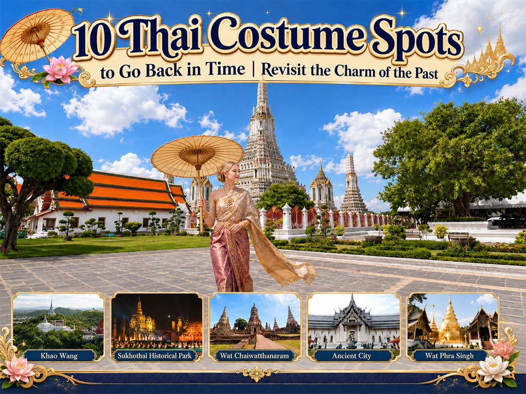
10 Thai Costume Spots to Go Back in Time
Wearing traditional Thai costume and taking photos at beautiful places is more t..

Chiang Mai's Ultimate National Parks
Chiang Mai is not just about temples and Lanna culture; it also boasts vast fore..

10 Must-Visit Checkpoints in Nan
This route comprehensively gathers Nan's important historical, religious, artist..
Recommend trips
- The Four Holy Pilgrimage Sites
- 10 Must-Visit Checkpoints in Nan
- Dream Destinations in Switzerland
- 10 Thai Costume Spots to Go Back in Time
- 12 Tourist Attractions Doi Inthanon
- Pilgrimage to the Sacred Sites
- Trip to Bhutan
- 10 Sacred Buddhist Sites Thai Temples in India–Nep
- Top Paris Check-in Spots
- Must-Visit Check-in Spots in London
- 10 Must-Visit Spots Along the Chao Phraya River, B
- 8 World Heritage Sites of Thailand
- Chiang Mai's Ultimate National Parks
- The Ultimate Ancient Villages in Japan
- 10 Must-Visit Places in Waterford
- 10 Best Shopping Destinations in Bangkok
- Watsons Bay Half-Day Trip
- EBC - World-Class Trekking Route
- 10 Must-Visit Check-ins in Uthai Thani
- Giant Buddha Landmarks in Thailand