ที่เที่ยวหน้าหนาวภาคเหนือ แบบจัดเต็ม
 17242
17242
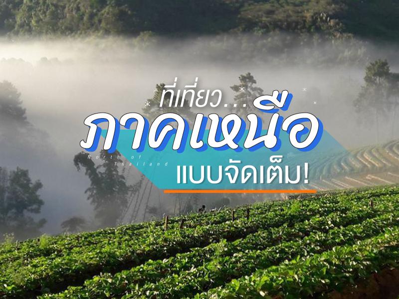 ใครกำลังมีแผนอยากขึ้นเหนือมารับลมหนาว แต่ยังไม่ได้คิดว่าจะไปไหน แอดเลยรวม ที่เที่ยวสำหรับหน้าหนาวของภาคเหนือ ทั้งจุดที่ฮิตๆ สวยๆ แม้กระทั่งจุดที่คนไปน้อยๆ แต่มีบรรยากาศที่งดงามไม่แพ้ใคร


Phu Langka Forest Park is situated on the San Pan Nam Range, also known as the Phi Pan Nam Range, which acts as a magnificent natural border between Phayao and Nan provinces. Spanning over 7,800 rai, this area is a crucial headwater for the Yom River, one of the primary lifelines of central Thailand. The forest consists mostly of dense and fertile hill evergreen trees, boasting unique biodive...
read more


Doi Tung Royal Villa began in 1988 under the royal initiative of Princess Srinagarindra (the Princess Mother). She wished for a residence to closely oversee the development of the Doi Tung area. Her famous remark, "I will plant a forest on Doi Tung," led to the construction of this simple villa as a hub for transforming bald mountains into lush forests and sustainably improving the quality of life...
read more


The Golden Triangle is a world-famous landmark located in Ban Sop Ruak, Chiang Saen District. The standout feature that draws travelers from every corner of the globe is standing on Thai soil while viewing the meeting point of three countries Thailand (right bank of the Mekong), Laos (left bank of the Mekong), and Myanmar (left bank of the Ruak River which joins the Mekong). This area is...
read more


Doi Mae Salong or Santikhiri Village, has a fascinating history filled with struggle. It began around 1961 when the 93rd Division of the Chinese Nationalist Army (Kuomintang or KMT) migrated from Burma and established a base on this mountain under the leadership of General Lee Wen-huan and General Tuan Shi-wen. Initially, Doi Mae Salong was a "red zone" troubled by political conflict and drug...
read more


Phu Chi Fa is not just an ordinary viewpoint; it is an icon that anyone visiting Chiang Rai simply cannot miss. The name of the peak is derived from its amazing physical characteristic: a stone cliff with a sharp point pointing towards the sky. The tip of this cliff protrudes into Laos, meaning that when you stand at the peak, you experience standing on the edge of the sky with a clear view o...
read more


Khun Chang Kian (Khun Chang Kian) is operated under the Faculty of Agriculture, Chiang Mai University, serving as a “highland agricultural research station” for studying, experimenting, and developing temperate crops, especially Arabica coffee, temperate fruit trees, and highland economic crops, which serve as an important agricultural knowledge base in Northern Thailand connecting res...
read more


Doi Suthep-Pui National Park covers areas in Mae Rim, Hang Dong, and Mueang Chiang Mai districts, with an area of approximately 262.50 square kilometers (163,162.50 rai). It consists of rich forests and complex mountains, including Doi Suthep (1,667 m), Doi Buak Ha, and Doi Pui (highest 1,685 m), which are the sources of important streams.
Major attractions and important sites within the park:
W...
read more


Doi Inthanon National Park, located in Chiang Mai Province, is home to the highest peak in Thailand — Doi Inthanon, standing at 2,565 meters above sea level. The park spans over 482.4 square kilometers and covers parts of Chom Thong, Mae Chaem, Mae Wang, and Doi Lo districts.
Shaped by the Himalayan mountain range, the park features a landscape of rugged high mountains running north to south...
read more


Tea Plantation 2000 (Tea Plantation 2000) is one of the most famous agro-tourism landmarks on Doi Ang Khang, Chiang Mai Province. It is located in the highlands near Ang Khang Royal Agricultural Station and was developed under the royal initiative of His Majesty King Bhumibol Adulyadej The Great (Rama IX). The project aimed to promote temperate-climate crops and create stable sources of income for...
read more

Doi Wawee Tea Plantation, located in the high mountains of Mae Suai District, Chiang Rai Province, is considered one of the most important Oolong tea growing areas in Thailand. Situated at an altitude of approximately 800–1,500 meters above sea level, the area enjoys a cool climate year-round, with morning mist and humidity ideal for tea cultivation, particularly Oolong tea and Taiwanese tea...
read more
11
Ban Nor Lae


Ban Nor Lae is a hill tribe village inhabited mainly by the Palaung people, also known locally as the Dara-ang ethnic group. The village is located at the far end of the Doi Ang Khang mountain road near the Thailand–Myanmar border in Fang District, Chiang Mai Province. Most villagers migrated from Shan State in Myanmar in 1984 and were granted settlement under the royal patronage of Thailand...
read more


The Royal Agricultural Station Angkhang was established as the first research station under the Royal Project, following the initiative of His Majesty the King. His Majesty intended for the hill tribes living in various northern mountains to stop growing opium and practicing shifting cultivation, which had been major causes of forest destruction and watershed degradation.
Originally a bald mountai...
read more
13
Mon Jam


Mon Jam is a famous getaway destination located on a mountain ridge within the Nong Hoi Hmong village area. Originally, this land was a degraded forest used for shifting cultivation. However, through the grace of King Bhumibol Adulyadej the Great, who established the Nong Hoi Royal Project Development Center, this soil was revitalized into a thriving temperate agricultural hub. Situated at an alti...
read more

Queen Sirikit Botanic Garden (Queen Sirikit Botanic Garden) is located amidst the lush natural landscapes of Mae Rim District, Chiang Mai. It is the first botanical garden in Thailand developed to international standards, covering more than 3,500 rai. The garden preserves and showcases a wide variety of Thai and international plant species, beautifully arranged according to ecological and geograph...
read more


Wat Chan Royal Project is situated at Baan Den, Chang Mai Province 3-4 drive from Chiang Mai. Can visit Karen traditional and culture places, trekking sites and more nature things to see.
The project is divided into 1,000 acres planted each year, each family 40 acres and maintained for a period of five years to today. The government subsidized the planting approximately 9,400 a...
read more


Doi Luang Chiang Dao stands as a limestone peak reaching 2,225 meters above sea level, featuring distinct geological characteristics that are rare in this region. The landscape from the summit is majestic, characterized by complex mountain ridges, particularly the Pyramid Peak and the Three Brothers Peaks, which are often enveloped in a thick sea of mist during the morning. Visitors can experience...
read more
17
Doi Mon Jong

Doi Mon Chong stands at approximately 1,929 meters above sea level, located on the border between Omkoi District in Chiang Mai and Sam Ngao District in Tak. The terrain is unique for its contrasting geography: one side features gentle, sloping meadows, while the other presents a sheer vertical cliff dropping into the valley below. The name "Mon Chong" comes from the local Lanna language, meaning a...
read more


Huai Nam Dang National Park spans across the rugged highlands of Mae Taeng District in Chiang Mai and Pai District in Mae Hong Son, serving as a vital natural corridor in Northern Thailand. Geographically, it is part of the Thanon Thong Chai Range, acting as a crucial headwater source for several major rivers, including the Mae Taeng and Pai Rivers. The geological landscape is characterized by ste...
read more


Phu Fa Development Center is one of the most important attractions in Nan province, located amidst lush mountains and unspoiled nature. The peaceful environment is perfect for visitors who wish to experience the authentic beauty of the natural landscape.
The center is special for being part of the Royal Project initiated by Princess Maha Chakri Sirindhorn, which promotes sustainability, environmen...
read more


Doi Samer Dao and Pha Hua Sing are iconic destinations in Nan province, known for their panoramic mountain scenery and enchanting morning sea of mist. This spot attracts countless nature lovers who wish to immerse themselves in the serene beauty of northern Thailand.
What makes this site truly special is its spectacular sunrise and sunset viewpoints. Visitors often camp overnight to witness the sh...
read more


Doi Phu Kha National Park is the source of numerous streams and holds an ancient history tied to the legends of Nan’s people. Situated at an altitude of 1,980 meters above sea level, it covers an area of approximately 1,050,000 rai, spanning Pua, Chiang Klang, Thung Chang, Mae Charim, Tha Wang Pha, Santi Suk, and Bo Kluea Districts.
The terrain consists of steep, rugged mountains with stunni...
read more
22
Mae Kampong


Mae Kampong Village has a long history of settlement dating back over 100 years. It was founded by a group of villagers who migrated from nearby districts to cultivate Miang (wild tea leaves), which has been the primary economic crop of the community since the past. The village's name originates from the beauty of nature; Kampong is the name of a yellow and red wild flower that commonly grows alon...
read more


Thi Lo Su Waterfall is a gigantic limestone waterfall cascading down a steep cliff over 250–300 meters high. Its powerful flow resonates throughout the valley all year long. The original Karen term “Thi Lo Chue” means “water that falls forcefully and crashes onto the ground”, but the name was later mispronounced as “Thi Lo Su,” which some mistakenly transl...
read more


Phu Hin Rong Kla National Park is a unique travel spot unlike anywhere else in Thailand. It doesn’t just have green forests, but it is also a land full of historical stories and strange-looking geological features. This area is located on the border of three provinces: Phitsanulok, Phetchabun, and Loei. This makes the weather cold almost all year, especially in winter when the temperature ca...
read more
25
Phu Tubberk


Phu Thap Boek is the highest mountain peak in Phetchabun Province and one of Thailand’s most popular destinations for nature lovers, photographers, and camping enthusiasts. Standing at approximately 1,768 meters above sea level, the mountain offers refreshing cool weather throughout the year. During winter, temperatures can drop to single digits, and frost can occasionally appear on the moun...
read more


Pa Miang Village is an ancient community nestled in the valleys of Mueang Pan District, Lampang Province, with a history spanning over 200 years. The village's name is derived from the abundant natural resource in the area Miang or wild tea trees that grow naturally under the shade of large forest trees. In the past, this area served as a rest stop for travelers and cattle traders. The signif...
read more

Chae Son National Park possesses a historical background deeply intertwined with the way of life of the Mueang Pan people since ancient times. This area has long been revered as a sacred site and a precious resource that sustains communities around the Western Phi Pan Nam Range. Originally, locals referred to the area based on the physical appearance of hot springs emerging from rock formations. I...
read more
28
Mueang Pai


Mueang Pai (Pai) is a district renowned for its nature-focused tourism and easygoing lifestyle. The town is situated in a valley surrounded by majestic mountains and forests, providing clean air and a peaceful, tranquil setting.
The town has a fascinating history, most notably the Tha Pai Memorial Bridge, which was built during World War II and remains a significant landmark telling stories of the...
read more
29
Pang Ung


Pang Ung, officially known as the Pang Tong 2 Royal Project (Pang Ung), is a large reservoir on a high mountain peak, surrounded by magnificent pine forests, earning it the nickname "Switzerland of Thailand." It is one of Mae Hong Son province's most popular tourist destinations, attracting visitors to experience its natural beauty, especially during the winter.
This place has a long history. Orig...
read more
กำลังเป็นที่นิยม
Attractive Beaches in Sattahip, Chonburi
For those looking to escape the hustle and bustle of Pattaya and experience calm..

8 World Heritage Sites of Thailand
Tracing Ancient Civilizations and Invaluable Forests Recognized by UNESCO Thaila..
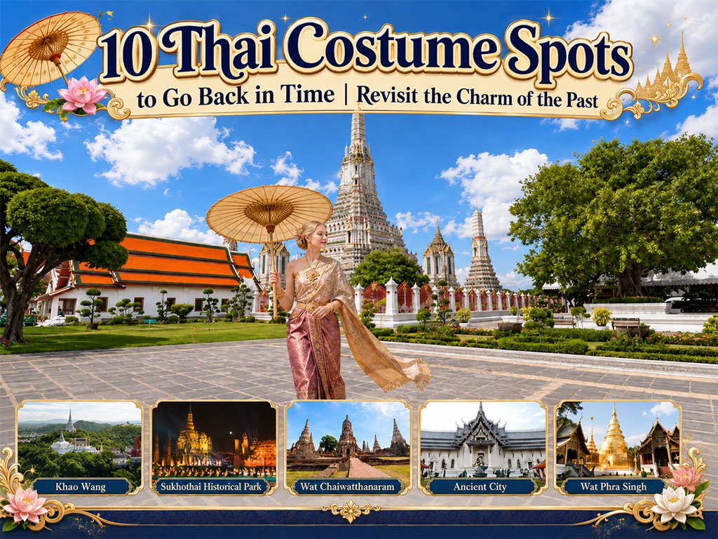
10 Thai Costume Spots to Go Back in Time
Wearing traditional Thai costume and taking photos at beautiful places is more t..
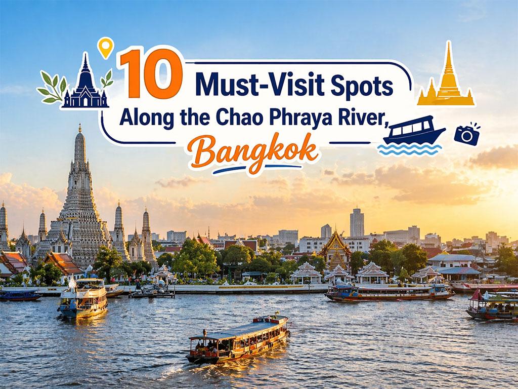
10 Must-Visit Spots Along the Chao Phraya River, B
Exploring the Chao Phraya River offers one of the most complete experiences of B..
Recommend trips
- 10 Thai Costume Spots to Go Back in Time
- The Four Holy Pilgrimage Sites
- Dream Destinations in Switzerland
- Pilgrimage to the Sacred Sites
- Trip to Bhutan
- 10 Sacred Buddhist Sites Thai Temples in India–Nep
- Attractive Beaches in Sattahip, Chonburi
- Top Paris Check-in Spots
- Must-Visit Check-in Spots in London
- 8 World Heritage Sites of Thailand
- The Ultimate Ancient Villages in Japan
- 10 Must-Visit Spots Along the Chao Phraya River, B
- Watsons Bay Half-Day Trip
- 10 Best Shopping Destinations in Bangkok
- 10 Must-Visit Places in Waterford
- Top 10 Must-Visit Spots in Pattaya
- 10 Must-Check-In Spots in Ireland
- Thailand Nature Trails
- 1-Day Kirribilli & Sydney Harbour Walking Tour
- Japan Bucket List: 20 Places You Must Visit Once i